
| Memorials | : | 10 |
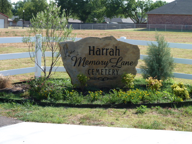
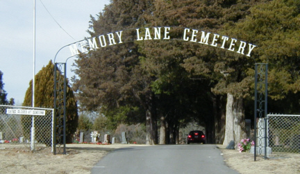
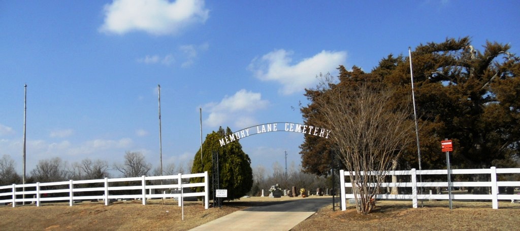
| Location | : | Harrah, Oklahoma County, USA |
| Coordinate | : | 35.4791603, -97.1691589 |
| Description | : | Memory Lane Cemetery came into being as Harrah Cemetery on March 27, 1901. This was the date of the deed which transferred one and a half acres, in the southwest corner of Section 26 in Elk Township, from C. B. Biggs and his wife, M. L. Biggs, to Dr. K. Haas, L. C. Grimes and James Beavers and their successors as trustees of Harrah Cemetery. Additional property was added to the cemetery as the need grew, including property from W. H. Johnson, Anton Owczarzak and James Allen and Vera Opal Jackson. |
frequently asked questions (FAQ):
-
Where is Memory Lane Cemetery?
Memory Lane Cemetery is located at 20451 NE 10th Street Harrah, Oklahoma County ,Oklahoma ,USA.
-
Memory Lane Cemetery cemetery's updated grave count on graveviews.com?
9 memorials
-
Where are the coordinates of the Memory Lane Cemetery?
Latitude: 35.4791603
Longitude: -97.1691589
Nearby Cemetories:
1. Evangelical Lutheran Cemetery
Harrah, Oklahoma County, USA
Coordinate: 35.4750000, -97.1681000
2. Saint Teresas Catholic Cemetery
Harrah, Oklahoma County, USA
Coordinate: 35.4851400, -97.1607200
3. Jager Cemetery
Harrah, Oklahoma County, USA
Coordinate: 35.4714000, -97.1948860
4. Mills Cemetery
Lincoln County, USA
Coordinate: 35.5071983, -97.1374969
5. Kansas Cemetery
Choctaw, Oklahoma County, USA
Coordinate: 35.4500170, -97.2148530
6. McLoud Riverside Cemetery
McLoud, Pottawatomie County, USA
Coordinate: 35.4431000, -97.1243973
7. Logan Family Cemetery
McLoud, Pottawatomie County, USA
Coordinate: 35.4493000, -97.1062000
8. Saint Mary Cemetery
Harrah, Oklahoma County, USA
Coordinate: 35.5393982, -97.1761017
9. Tom Ferrell Community Cemetery
Lincoln County, USA
Coordinate: 35.5293999, -97.1228027
10. Summit Ridge Cemetery
Harrah, Oklahoma County, USA
Coordinate: 35.5363998, -97.2022018
11. Goodman Family Cemetery
Newalla, Oklahoma County, USA
Coordinate: 35.4140300, -97.1726100
12. Kickapoo Cemetery
McLoud, Pottawatomie County, USA
Coordinate: 35.4638000, -97.0866000
13. Kickapoo Friends Church Cemetery
Lincoln County, USA
Coordinate: 35.4639015, -97.0858994
14. Saint Johns Lutheran Cemetery
McLoud, Pottawatomie County, USA
Coordinate: 35.4272995, -97.1073990
15. Elmwood Cemetery
Choctaw, Oklahoma County, USA
Coordinate: 35.4874050, -97.2649730
16. Stevens Family Cemetery
Shawnee, Pottawatomie County, USA
Coordinate: 35.4240000, -97.0999000
17. Wahpekeche Tribal Cemetery
McLoud, Pottawatomie County, USA
Coordinate: 35.4780000, -97.0676000
18. Walker Family Cemetery
McLoud, Pottawatomie County, USA
Coordinate: 35.4681000, -97.0660000
19. Southview Cemetery
Choctaw, Oklahoma County, USA
Coordinate: 35.4748978, -97.2743868
20. Frye Family Cemetery
McLoud, Pottawatomie County, USA
Coordinate: 35.4774500, -97.0535700
21. Minneha Cemetery
McLoud, Pottawatomie County, USA
Coordinate: 35.3965500, -97.1067100
22. Jent Cemetery
McLoud, Pottawatomie County, USA
Coordinate: 35.4566994, -97.0528030
23. Pilgrims Rest Cemetery
Stella, Cleveland County, USA
Coordinate: 35.3714500, -97.1593100
24. Valley Cemetery
Choctaw, Oklahoma County, USA
Coordinate: 35.4058800, -97.2731900