
| Memorials | : | 0 |
| Location | : | American Falls, Power County, USA |
| Coordinate | : | 42.8489060, -113.0614740 |
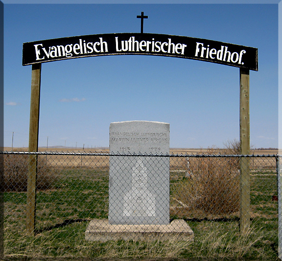
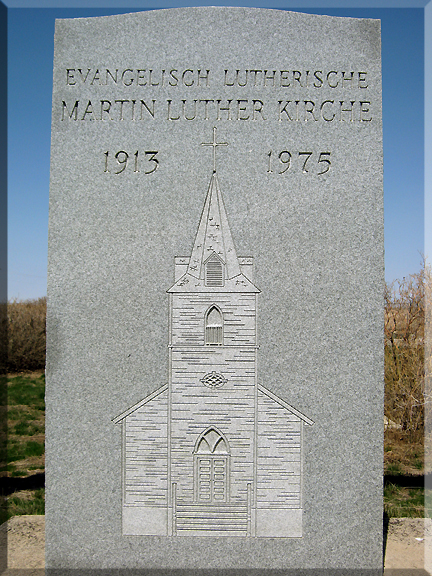
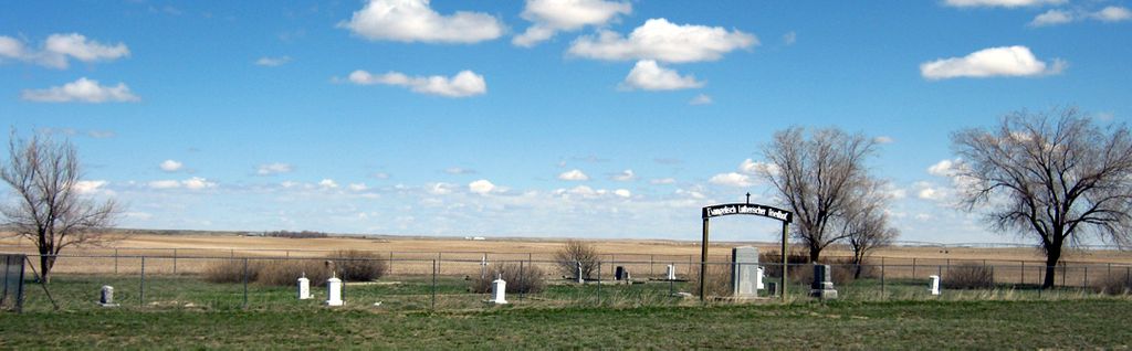
| Description | : | "Evangelisch Lutherischer Friedhof" The Evangelical Lutheran Cemetery is located at North Pleasant Valley Road and Quigley Road, Approximately 15 miles NW of American Falls, Idaho. The Cemetery was next to the Evangelical Lutheran Martin Luther Church in Pleasant Valley, both were dedicated June 27, 1915. Early German homesteaders organized the Martin Luther Church on October 31, 1909. The congregation met in member's homes and the Pleasant Valley School. Construction started for a new church in 1913 on ground donated from the Sprattler homestead. The corner stone was laid August 21, 1913. It is unclear when the first burials took place,... Read More |
frequently asked questions (FAQ):
-
Where is Evangelical Lutheran Cemetery?
Evangelical Lutheran Cemetery is located at American Falls, Power County ,Idaho ,USA.
-
Evangelical Lutheran Cemetery cemetery's updated grave count on graveviews.com?
0 memorials
-
Where are the coordinates of the Evangelical Lutheran Cemetery?
Latitude: 42.8489060
Longitude: -113.0614740
Nearby Cemetories:
1. Homestead Cemetery
Aberdeen, Bingham County, USA
Coordinate: 42.9075012, -112.8880997
2. Falls View Cemetery
American Falls, Power County, USA
Coordinate: 42.7717018, -112.8719025
3. Neeley Cemetery
American Falls, Power County, USA
Coordinate: 42.7256012, -112.9088974
4. Aberdeen Cemetery
Aberdeen, Bingham County, USA
Coordinate: 42.9423700, -112.8218800
5. Chief Pocatello Burial Site
American Falls, Power County, USA
Coordinate: 42.9177150, -112.7375790
6. Family Life Center Cemetery
Bannock County, USA
Coordinate: 42.8926100, -112.6411500
7. Valley View Cemetery
Rockland, Power County, USA
Coordinate: 42.5704000, -112.8670500
8. Bannock Creek Cemetery
Power County, USA
Coordinate: 42.8806000, -112.6316986
9. Minidoka Cemetery
Minidoka, Minidoka County, USA
Coordinate: 42.7535000, -113.4859000
10. Eldon Gerald Nelson Gravesite
Acequia, Minidoka County, USA
Coordinate: 42.6747160, -113.4782580
11. Raft River Cemetery
Raft River, Cassia County, USA
Coordinate: 42.5094300, -113.2143800
12. Springfield-Sterling Cemetery
Springfield, Bingham County, USA
Coordinate: 43.0807991, -112.6712036
13. Heglar Cemetery
Cassia County, USA
Coordinate: 42.4757800, -113.1403400
14. Cedars Cemetery
Fort Hall, Bingham County, USA
Coordinate: 42.9664800, -112.5528900
15. Cedar Cemetery
Bannock County, USA
Coordinate: 42.9675000, -112.5525000
16. Jackson Cemetery
Jackson, Cassia County, USA
Coordinate: 42.6419000, -113.5406000
17. Mountain View Cemetery
Pocatello, Bannock County, USA
Coordinate: 42.8558589, -112.4311120
18. Pauline Cemetery
Power County, USA
Coordinate: 42.5609000, -112.5605500
19. Minidoka Acequia Rupert Cemetery
Rupert, Minidoka County, USA
Coordinate: 42.6838989, -113.6639023
20. Restlawn Memorial Gardens
Pocatello, Bannock County, USA
Coordinate: 42.8460800, -112.4163600
21. Sand Hill Cemetery
Fort Hall, Bingham County, USA
Coordinate: 43.0499600, -112.4653200
22. Good Shepherd Cemetery
Fort Hall, Bingham County, USA
Coordinate: 43.0260500, -112.4269000
23. Trinity Lutheran Church Graveyard
Adelaide, Minidoka County, USA
Coordinate: 42.8060750, -113.7445090
24. Adelaide Congregational Cemetery
Adelaide, Minidoka County, USA
Coordinate: 42.8061000, -113.7446000