
| Memorials | : | 0 |
| Location | : | Bad Salzuflen, Kreis Lippe, Germany |
| Coordinate | : | 52.1035300, 8.7948720 |
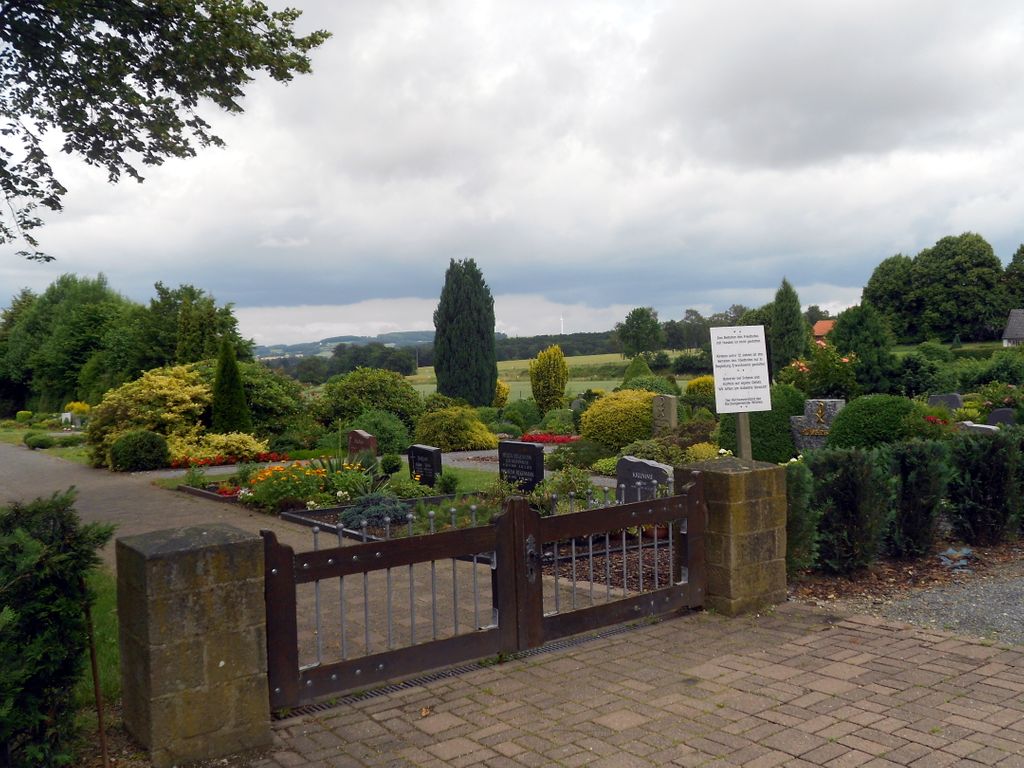
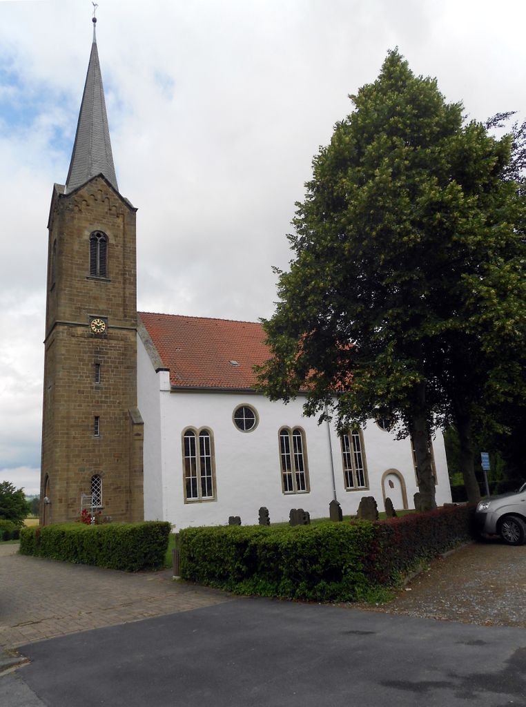
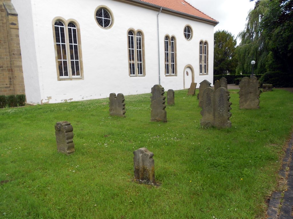
| Description | : | This Lutheran cemetery is managed by the Ev.-ref.-Kirchengemeinde Vlothoer Str. 21 32108 Bad Salzuflen Tel. 05222 9629558 Not to be confused with the municipal cemetery .5 miles away: Friedhof Wüsten This Lutheran cemetery was first opened in 1625. It's located next to the Wüsten Church and has a size of about 2 acres. The other cemeteries of the city are: Municipal Cemeteries • Friedhof Rudolph-Brandes-Allee • Friedhof Ahmsen • Friedhof Holzhausen • Friedhof Hölsen • Friedhof Lockhausen • Friedhof Retzen • Friedhof Werl-Aspe • Friedhof Wülfer-Bexten • Friedhof Wüsten • Waldfriedhof Obernberg Congregational Cemeteries • Friedhof Bergkirchen • Evangelischer Friedhof Wüsten • Evangelischer Friedhof Büxten • Funeke-Friedhof • Werrefriedhof • Friedhof Herforder Strasse Other Burial Grounds • Schloss Stietencron Former, now defunct cemeteries • Kilianskirchhof • Jüdischer Friedhof Bad... Read More |
frequently asked questions (FAQ):
-
Where is Evangelischer Friedhof Wüsten?
Evangelischer Friedhof Wüsten is located at Vlothoer Strasse Bad Salzuflen, Kreis Lippe ,Nordrhein-Westfalen , 32108Germany.
-
Evangelischer Friedhof Wüsten cemetery's updated grave count on graveviews.com?
0 memorials
-
Where are the coordinates of the Evangelischer Friedhof Wüsten?
Latitude: 52.1035300
Longitude: 8.7948720
Nearby Cemetories:
1. Friedhof Wüsten
Bad Salzuflen, Kreis Lippe, Germany
Coordinate: 52.1049200, 8.8010800
2. Friedhof Bergkirchen
Bad Salzuflen, Kreis Lippe, Germany
Coordinate: 52.0793100, 8.8183900
3. Friedhof Rudolph-Brandes-Allee
Bad Salzuflen, Kreis Lippe, Germany
Coordinate: 52.0803700, 8.7505780
4. Waldfriedhof Obernberg
Bad Salzuflen, Kreis Lippe, Germany
Coordinate: 52.0963820, 8.7350430
5. Friedhof Herforder Strasse
Bad Salzuflen, Kreis Lippe, Germany
Coordinate: 52.0865940, 8.7399350
6. Jüdischer Friedhof Werler Strasse
Bad Salzuflen, Kreis Lippe, Germany
Coordinate: 52.0847100, 8.7409100
7. Evangelischer Friedhof Exter
Vlotho, Kreis Herford, Germany
Coordinate: 52.1408032, 8.7808570
8. Schloss Stietencron
Bad Salzuflen, Kreis Lippe, Germany
Coordinate: 52.0693800, 8.7626900
9. Kilianskirchhof in Bad Salzuflen-Schötmar
Bad Salzuflen, Kreis Lippe, Germany
Coordinate: 52.0716610, 8.7569480
10. Funeke-Friedhof in Bad Salzuflen-Schötmar
Bad Salzuflen, Kreis Lippe, Germany
Coordinate: 52.0667520, 8.7645580
11. Werrefriedhof
Bad Salzuflen, Kreis Lippe, Germany
Coordinate: 52.0675830, 8.7510560
12. Jüdischer Friedhof Bad Salzuflen-Schötmar
Bad Salzuflen, Kreis Lippe, Germany
Coordinate: 52.0670390, 8.7499720
13. Friedhof Werl-Aspe
Bad Salzuflen, Kreis Lippe, Germany
Coordinate: 52.0681370, 8.7328970
14. Friedhof Retzen
Bad Salzuflen, Kreis Lippe, Germany
Coordinate: 52.0473540, 8.7989480
15. Erika Friedhof
Herford, Kreis Herford, Germany
Coordinate: 52.1158540, 8.7035591
16. Evangelischer Friedhof Vlotho-Bonneberg
Vlotho, Kreis Herford, Germany
Coordinate: 52.1640820, 8.8168283
17. Friedhof Wülfer-Bexten
Bad Salzuflen, Kreis Lippe, Germany
Coordinate: 52.0497720, 8.7376390
18. Friedhof Ahmsen
Bad Salzuflen, Kreis Lippe, Germany
Coordinate: 52.0891500, 8.6916300
19. Friedhof Hölsen
Bad Salzuflen, Kreis Lippe, Germany
Coordinate: 52.0372970, 8.7789990
20. Friedhof an der Marienkirche
Herford, Kreis Herford, Germany
Coordinate: 52.1160000, 8.6871300
21. Marienfriedhof
Herford, Kreis Herford, Germany
Coordinate: 52.1191278, 8.6819349
22. Ewiger Frieden
Herford, Kreis Herford, Germany
Coordinate: 52.1364100, 8.6872200
23. Friedhof Holzhausen
Bad Salzuflen, Kreis Lippe, Germany
Coordinate: 52.0337000, 8.7500150
24. Frauenstift Herford
Herford, Kreis Herford, Germany
Coordinate: 52.1156940, 8.6711110