
| Memorials | : | 0 |
| Location | : | Bad Salzuflen, Kreis Lippe, Germany |
| Coordinate | : | 52.0793100, 8.8183900 |
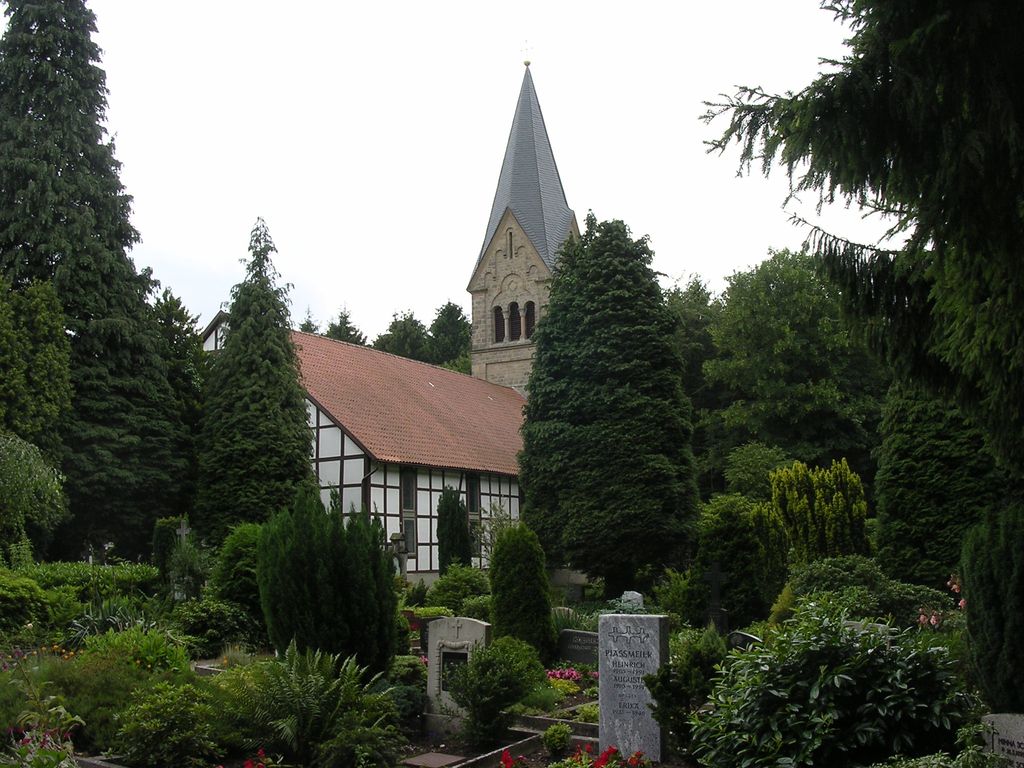
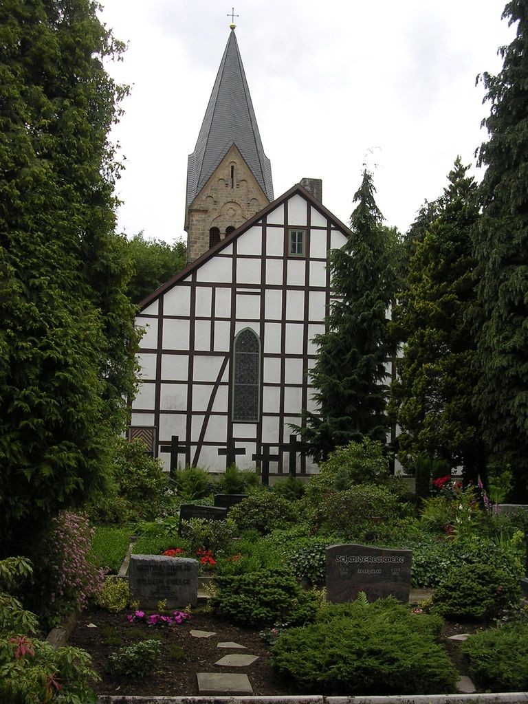
| Description | : | This cemetery is owned and managed by the Lutheran congregation of Bergkirchen. The other cemeteries of the city are: Municipal Cemeteries • Friedhof Rudolph-Brandes-Allee • Friedhof Ahmsen • Friedhof Holzhausen • Friedhof Hölsen • Friedhof Lockhausen • Friedhof Retzen • Friedhof Werl-Aspe • Friedhof Wülfer-Bexten • Friedhof Wüsten • Waldfriedhof Obernberg Congregational Cemeteries • Evangelischer Friedhof Wüsten • Evangelischer Friedhof Büxten • Funeke-Friedhof • Werrefriedhof • Friedhof Herforder Strasse • Friedhof Bergkirchen Other Burial Grounds • Schloss Stietencron Former, now defunct cemeteries • Kilianskirchhof • Jüdischer Friedhof Bad Salzuflen-Schötmar • Jüdischer Friedhof Werler Strasse Please note that the graves in Germany are not perpetual. After a certain period of repose (in Bad Salzuflen it's 30 years) the graves are being leveled and re-used. There is no... Read More |
frequently asked questions (FAQ):
-
Where is Friedhof Bergkirchen?
Friedhof Bergkirchen is located at Bergkirchen 54 Bad Salzuflen, Kreis Lippe ,Nordrhein-Westfalen , 32108Germany.
-
Friedhof Bergkirchen cemetery's updated grave count on graveviews.com?
0 memorials
-
Where are the coordinates of the Friedhof Bergkirchen?
Latitude: 52.0793100
Longitude: 8.8183900
Nearby Cemetories:
1. Friedhof Wüsten
Bad Salzuflen, Kreis Lippe, Germany
Coordinate: 52.1049200, 8.8010800
2. Evangelischer Friedhof Wüsten
Bad Salzuflen, Kreis Lippe, Germany
Coordinate: 52.1035300, 8.7948720
3. Friedhof Retzen
Bad Salzuflen, Kreis Lippe, Germany
Coordinate: 52.0473540, 8.7989480
4. Funeke-Friedhof in Bad Salzuflen-Schötmar
Bad Salzuflen, Kreis Lippe, Germany
Coordinate: 52.0667520, 8.7645580
5. Schloss Stietencron
Bad Salzuflen, Kreis Lippe, Germany
Coordinate: 52.0693800, 8.7626900
6. Kilianskirchhof in Bad Salzuflen-Schötmar
Bad Salzuflen, Kreis Lippe, Germany
Coordinate: 52.0716610, 8.7569480
7. Friedhof Rudolph-Brandes-Allee
Bad Salzuflen, Kreis Lippe, Germany
Coordinate: 52.0803700, 8.7505780
8. Werrefriedhof
Bad Salzuflen, Kreis Lippe, Germany
Coordinate: 52.0675830, 8.7510560
9. Jüdischer Friedhof Bad Salzuflen-Schötmar
Bad Salzuflen, Kreis Lippe, Germany
Coordinate: 52.0670390, 8.7499720
10. Jüdischer Friedhof Werler Strasse
Bad Salzuflen, Kreis Lippe, Germany
Coordinate: 52.0847100, 8.7409100
11. Friedhof Hölsen
Bad Salzuflen, Kreis Lippe, Germany
Coordinate: 52.0372970, 8.7789990
12. Friedhof Herforder Strasse
Bad Salzuflen, Kreis Lippe, Germany
Coordinate: 52.0865940, 8.7399350
13. Friedhof Lemgo-Lieme
Lemgo, Kreis Lippe, Germany
Coordinate: 52.0264880, 8.8334640
14. Friedhof Werl-Aspe
Bad Salzuflen, Kreis Lippe, Germany
Coordinate: 52.0681370, 8.7328970
15. Waldfriedhof Obernberg
Bad Salzuflen, Kreis Lippe, Germany
Coordinate: 52.0963820, 8.7350430
16. Friedhof Wülfer-Bexten
Bad Salzuflen, Kreis Lippe, Germany
Coordinate: 52.0497720, 8.7376390
17. Friedhof Holzhausen
Bad Salzuflen, Kreis Lippe, Germany
Coordinate: 52.0337000, 8.7500150
18. Evangelischer Friedhof Exter
Vlotho, Kreis Herford, Germany
Coordinate: 52.1408032, 8.7808570
19. Friedhof Rintelner Strasse
Lemgo, Kreis Lippe, Germany
Coordinate: 52.0378900, 8.9038600
20. Friedhof St. Johann extra muros
Lemgo, Kreis Lippe, Germany
Coordinate: 52.0278708, 8.8919307
21. Neuer Jüdischer Friedhof (New Jewish Cemetery)
Lemgo, Kreis Lippe, Germany
Coordinate: 52.0334550, 8.9043177
22. Kirchengemeinde St. Johann
Lemgo, Kreis Lippe, Germany
Coordinate: 52.0220917, 8.8867636
23. St. Marien
Lemgo, Kreis Lippe, Germany
Coordinate: 52.0254830, 8.8987500
24. Friedhof Ahmsen
Bad Salzuflen, Kreis Lippe, Germany
Coordinate: 52.0891500, 8.6916300