| Memorials | : | 13 |
| Location | : | West Lafayette, Coshocton County, USA |
| Coordinate | : | 40.2736015, -81.7253036 |
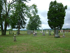
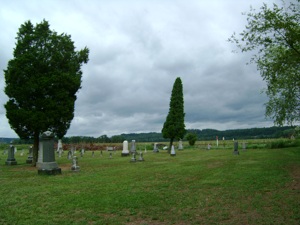
| Description | : | The cemetery is located on the west side of College Cemetery Drive at the north end of the street about 750 feet north of its intersection with Ohio State Route 751. The cemetery is located in Lafayette Township, Coshocton County, Ohio, and is # 2278 (Ferguson Cemetery / Plains Chapel Cemetery) in “Ohio Cemeteries 1803-2003”, compiled by the Ohio Genealogical Society. The U.S. Geological Survey (USGS) Geographic Names Information System (GNIS) feature ID for the cemetery is 1040420 (Ferguson Cemetery / Plains Chapel Cemetery). |
frequently asked questions (FAQ):
-
Where is Ferguson Cemetery?
Ferguson Cemetery is located at College Cemetery Drive West Lafayette, Coshocton County ,Ohio , 43845USA.
-
Ferguson Cemetery cemetery's updated grave count on graveviews.com?
11 memorials
-
Where are the coordinates of the Ferguson Cemetery?
Latitude: 40.2736015
Longitude: -81.7253036
Nearby Cemetories:
1. Fairfield Cemetery
West Lafayette, Coshocton County, USA
Coordinate: 40.2661018, -81.7463989
2. Norman Family Cemetery
West Lafayette, Coshocton County, USA
Coordinate: 40.2859570, -81.7063340
3. Claypoint Cemetery
West Lafayette, Coshocton County, USA
Coordinate: 40.2513720, -81.7292430
4. McClain Cemetery
West Lafayette, Coshocton County, USA
Coordinate: 40.2499130, -81.7251870
5. Baptist Cemetery
West Lafayette, Coshocton County, USA
Coordinate: 40.2756310, -81.7585220
6. Waggoner Cemetery
Coshocton County, USA
Coordinate: 40.2728004, -81.6900024
7. Wiggins Family Cemetery
West Lafayette, Coshocton County, USA
Coordinate: 40.2624080, -81.7585950
8. Bowman Cemetery
West Lafayette, Coshocton County, USA
Coordinate: 40.3031006, -81.7247009
9. Evansburg Cemetery
Orange, Coshocton County, USA
Coordinate: 40.2873300, -81.6771800
10. Plainfield Presbyterian Church Cemetery
Plainfield, Coshocton County, USA
Coordinate: 40.2244020, -81.7310710
11. Fairview Cemetery
Fresno, Coshocton County, USA
Coordinate: 40.3238983, -81.7328033
12. Powell's Cemetery
Coshocton, Coshocton County, USA
Coordinate: 40.3301239, -81.7438202
13. Corbit-Swigert Cemetery
Orange, Coshocton County, USA
Coordinate: 40.3107986, -81.6564026
14. Oak Grove Cemetery
Coshocton County, USA
Coordinate: 40.3032990, -81.8005981
15. Baker Cemetery
Linton Mills, Coshocton County, USA
Coordinate: 40.2090500, -81.7135230
16. Clapboard Cemetery
Coshocton County, USA
Coordinate: 40.3391991, -81.7244034
17. Plainfield Cemetery
Plainfield, Coshocton County, USA
Coordinate: 40.2070000, -81.7220000
18. West Lawn Cemetery
Shady Bend, Coshocton County, USA
Coordinate: 40.2602997, -81.6391983
19. Hill Cemetery
Coshocton County, USA
Coordinate: 40.3208008, -81.7878036
20. Coshocton County Infirmary Cemetery
Coshocton, Coshocton County, USA
Coordinate: 40.2694450, -81.8166500
21. Woods College Cemetery
Coshocton County, USA
Coordinate: 40.3405991, -81.6975021
22. Mount Zion Cemetery
Coshocton, Coshocton County, USA
Coordinate: 40.2344017, -81.8035965
23. Everal Chapel Cemetery
Coshocton County, USA
Coordinate: 40.2882110, -81.6320300
24. Taylor Cemetery
Bakersville, Coshocton County, USA
Coordinate: 40.3177986, -81.6493988


