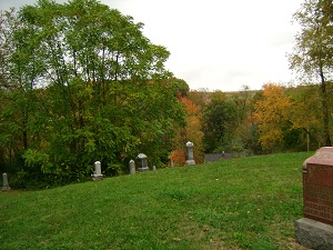
| Memorials | : | 15 |
| Location | : | Coshocton, Coshocton County, USA |
| Coordinate | : | 40.2344017, -81.8035965 |
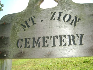
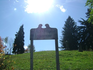
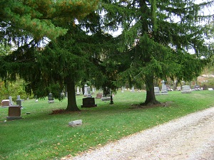
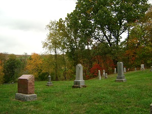
| Description | : | The cemetery is located on the south side of Ohio State Route 541 about 0.1 miles northwest of its intersection with Branch Road (Township Road 164). The cemetery is located in Lafayette Township, Coshocton County, Ohio, and is # 2280 (Mount Zion Cemetery) in “Ohio Cemeteries 1803-2003”, compiled by the Ohio Genealogical Society. The cemetery is registered with the Ohio Division of Real Estate and Professional Licensing (ODRE) as Mt. Zion Cemetery with registration license number CRC.0000982315. The U.S. Geological Survey (USGS) Geographic Names Information System (GNIS) feature ID for the cemetery is 1043650 (Mount Zion Cemetery). |
frequently asked questions (FAQ):
-
Where is Mount Zion Cemetery?
Mount Zion Cemetery is located at Ohio State Route 541 Coshocton, Coshocton County ,Ohio , 43812USA.
-
Mount Zion Cemetery cemetery's updated grave count on graveviews.com?
5 memorials
-
Where are the coordinates of the Mount Zion Cemetery?
Latitude: 40.2344017
Longitude: -81.8035965
Nearby Cemetories:
1. Saint Pauls Cemetery
Coshocton County, USA
Coordinate: 40.2103004, -81.8208008
2. Saint Johns Lutheran Church Cemetery
Coshocton, Coshocton County, USA
Coordinate: 40.2103200, -81.7796000
3. Coshocton County Infirmary Cemetery
Coshocton, Coshocton County, USA
Coordinate: 40.2694450, -81.8166500
4. Our Lady of Lourdes Cemetery
Wills Creek, Coshocton County, USA
Coordinate: 40.1909870, -81.8048660
5. Wiggins Family Cemetery
West Lafayette, Coshocton County, USA
Coordinate: 40.2624080, -81.7585950
6. Saint Marys Catholic Cemetery
Plainfield, Coshocton County, USA
Coordinate: 40.2011300, -81.7639850
7. Littick Cemetery
Franklin, Coshocton County, USA
Coordinate: 40.1991870, -81.8416490
8. Franklin Cemetery
Franklin, Coshocton County, USA
Coordinate: 40.2000008, -81.8460999
9. South Lawn Cemetery
Coshocton, Coshocton County, USA
Coordinate: 40.2560997, -81.8597031
10. Baptist Cemetery
West Lafayette, Coshocton County, USA
Coordinate: 40.2756310, -81.7585220
11. Royers Chapel Cemetery
Wills Creek, Coshocton County, USA
Coordinate: 40.1850014, -81.8319016
12. Fairfield Cemetery
West Lafayette, Coshocton County, USA
Coordinate: 40.2661018, -81.7463989
13. Plainfield Presbyterian Church Cemetery
Plainfield, Coshocton County, USA
Coordinate: 40.2244020, -81.7310710
14. Claypoint Cemetery
West Lafayette, Coshocton County, USA
Coordinate: 40.2513720, -81.7292430
15. McClain Cemetery
West Lafayette, Coshocton County, USA
Coordinate: 40.2499130, -81.7251870
16. Oak Ridge Cemetery
Coshocton, Coshocton County, USA
Coordinate: 40.2780991, -81.8610992
17. Davis Cemetery
Conesville, Coshocton County, USA
Coordinate: 40.2154312, -81.8808899
18. Tyndall Cemetery
Coshocton County, USA
Coordinate: 40.2167015, -81.8843994
19. Bethany Cemetery
Wills Creek, Coshocton County, USA
Coordinate: 40.1852989, -81.8591995
20. Pine Ridge Lutheran Cemetery
Conesville, Coshocton County, USA
Coordinate: 40.1694320, -81.8118390
21. Plainfield Cemetery
Plainfield, Coshocton County, USA
Coordinate: 40.2070000, -81.7220000
22. Oak Grove Cemetery
Coshocton County, USA
Coordinate: 40.3032990, -81.8005981
23. Canal Lewisville Cemetery
Canal Lewisville, Coshocton County, USA
Coordinate: 40.3012500, -81.8357100
24. Wiggins Family Cemetery
Coshocton County, USA
Coordinate: 40.1916760, -81.7289510

