
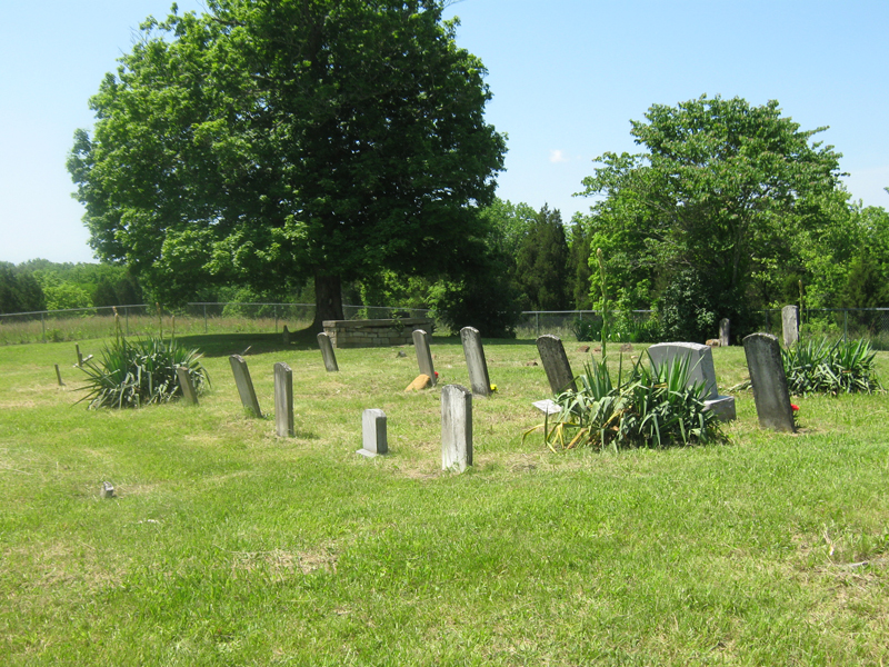
| Memorials | : | 9 |
| Location | : | Fleming County, USA |
| Coordinate | : | 38.2435722, -83.6193466 |
| Description | : | THIS CEMETERY IS ON PRIVATE LAND. In Hillsboro, come to the 4-way stop and turn onto route 158. Go through the village of Ringos Mills (there is a covered bridge over Fox Creek). Stay on route 158 until you see a black topped road (Lower Rock Lick Road). Turn right and go approximately 1 1/2 miles. Go past the Denton Cemetery. Take the next road on the right (Hamilton Lane) and go about 3/4 of a mile. Go past two trailors on the left and the Filson Cemetery will be on your left back in... Read More |
frequently asked questions (FAQ):
-
Where is Filson Burying Ground?
Filson Burying Ground is located at Fleming County ,Kentucky ,USA.
-
Filson Burying Ground cemetery's updated grave count on graveviews.com?
9 memorials
-
Where are the coordinates of the Filson Burying Ground?
Latitude: 38.2435722
Longitude: -83.6193466
Nearby Cemetories:
1. Denton Cemetery
Fleming County, USA
Coordinate: 38.2374992, -83.6081009
2. Emmons Cemetery #1
Hillsboro, Fleming County, USA
Coordinate: 38.2480400, -83.5956500
3. Fairview Cemetery
Grange City, Fleming County, USA
Coordinate: 38.2297000, -83.6439700
4. Fox Cemetery
Fleming County, USA
Coordinate: 38.2531013, -83.6539001
5. Newman Cemetery
Fleming County, USA
Coordinate: 38.2841988, -83.5935974
6. Prince Cemetery
Hillsboro, Fleming County, USA
Coordinate: 38.2618580, -83.5478770
7. Edens Chapel Cemetery
Hillsboro, Fleming County, USA
Coordinate: 38.2698820, -83.6901200
8. Little Mary Baptist Church Cemetery
Hillsboro, Fleming County, USA
Coordinate: 38.2595550, -83.5436410
9. Hillsboro Cemetery
Hillsboro, Fleming County, USA
Coordinate: 38.2942009, -83.6722031
10. Reeves Cemetery
Colfax, Fleming County, USA
Coordinate: 38.1785480, -83.6456730
11. Hurst Cemetery #1
Fleming County, USA
Coordinate: 38.3083000, -83.5777969
12. New Hope Presbyterian Cemetery
Fleming County, USA
Coordinate: 38.2991520, -83.6970400
13. Hedrick's Cemetery
Salt Lick, Bath County, USA
Coordinate: 38.1613803, -83.6408343
14. Mount Vernon Cemetery
Goddard, Fleming County, USA
Coordinate: 38.3255997, -83.5960999
15. Hedricks Cemetery
Bath County, USA
Coordinate: 38.1609990, -83.6400910
16. Plummer Cemetery
Plummers Landing, Fleming County, USA
Coordinate: 38.3181570, -83.5643600
17. Rogers Cemetery
Owingsville, Bath County, USA
Coordinate: 38.1583990, -83.6657290
18. Atchison Cemetery
Bath County, USA
Coordinate: 38.1991997, -83.7241974
19. Yazell-Hamilton Graveyard
Poplar Plains, Fleming County, USA
Coordinate: 38.3374900, -83.6407200
20. Sorrell Homestead Cemetery
Owingsville, Bath County, USA
Coordinate: 38.1520740, -83.6590430
21. Knox Hill Cemetery
Peasticks, Bath County, USA
Coordinate: 38.1581001, -83.6781006
22. Old Virginia Cemetery
Owingsville, Bath County, USA
Coordinate: 38.1721992, -83.7058029
23. Old Crain Graveyard
Fleming County, USA
Coordinate: 38.3352660, -83.6689150
24. Goodpaster Cemetery #2
Bath County, USA
Coordinate: 38.1791992, -83.7300034