
| Memorials | : | 1 |
| Location | : | New Bremen, Lewis County, USA |
| Phone | : | 315-376-6379 |
| Coordinate | : | 43.8398460, -75.4262460 |
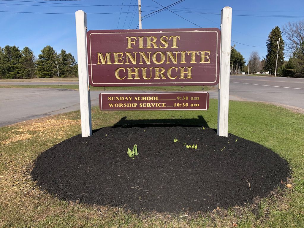
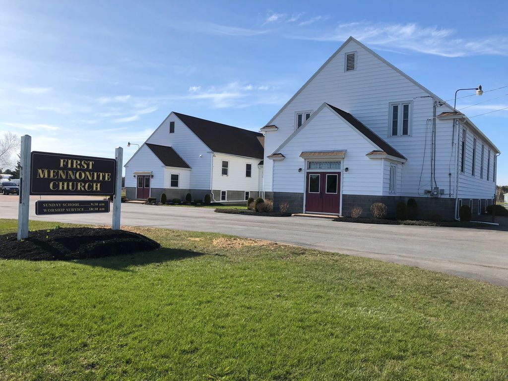
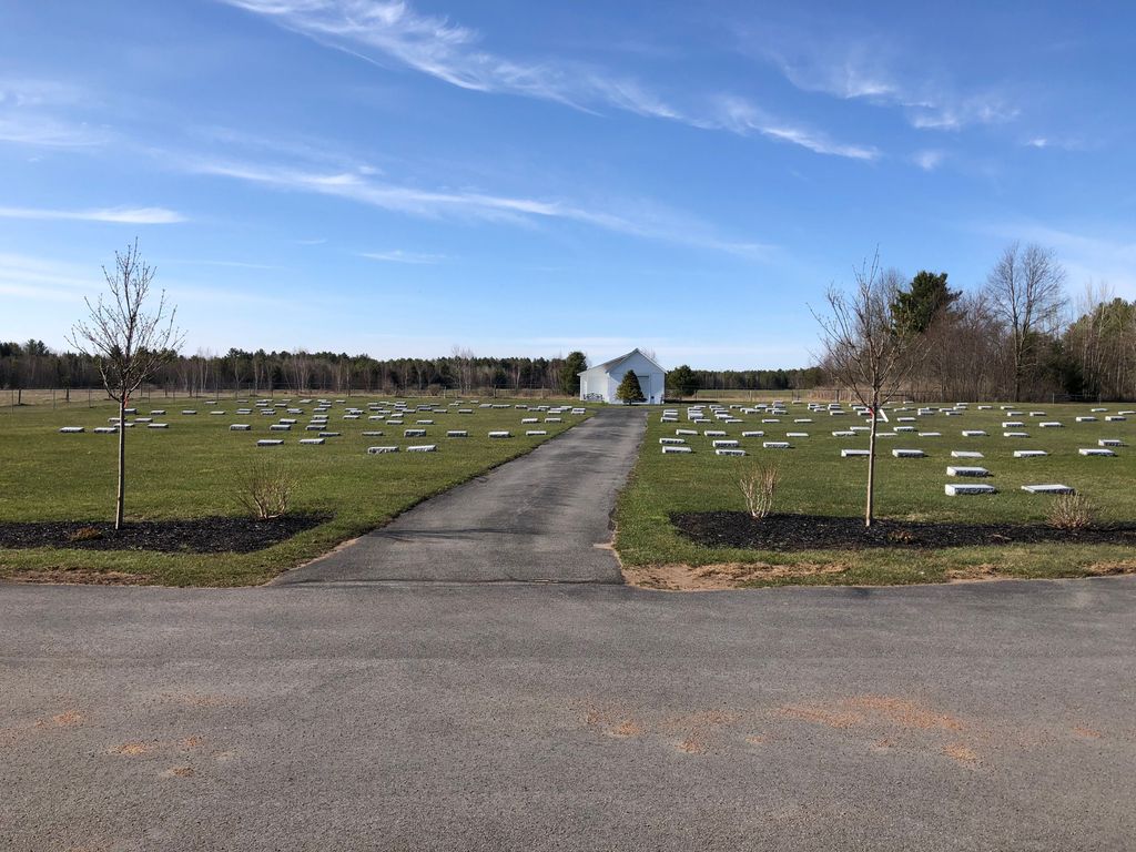
| Description | : | Rte 812, north of New Bremen on west side of Rte 812. The First Mennonite Church in New Bremen was organized on November 9, 1941. In 1942, J. Lawrence Burkholder became the first pastor, and he established the cemetery. The church began with 77 charter members. In 2021, there are 250 members. The First Mennonite Church is an affiliate with the New York Mennonite Conference. The cemetery is used primarily for members and attendees of the First Mennonite Church; however, any person may be buried there if approved by the trustees of the church. All stones in the cemetery are... Read More |
frequently asked questions (FAQ):
-
Where is First Mennonite Church Cemetery?
First Mennonite Church Cemetery is located at 8383 New York 812 New Bremen, Lewis County ,New York , 13367USA.
-
First Mennonite Church Cemetery cemetery's updated grave count on graveviews.com?
1 memorials
-
Where are the coordinates of the First Mennonite Church Cemetery?
Latitude: 43.8398460
Longitude: -75.4262460
Nearby Cemetories:
1. Saint Peters Catholic Cemetery
New Bremen, Lewis County, USA
Coordinate: 43.8388000, -75.4220900
2. New Bremen Rural Cemetery
New Bremen, Lewis County, USA
Coordinate: 43.8376100, -75.4422400
3. Crystal Light Mennonite Church Cemetery
New Bremen, Lewis County, USA
Coordinate: 43.8358530, -75.4416550
4. Croghan Apostolic Christian Cemetery
Croghan, Lewis County, USA
Coordinate: 43.8688090, -75.3914670
5. Seventh-Day Baptists Settlement Cemetery
Watson, Lewis County, USA
Coordinate: 43.8108330, -75.3883330
6. Riverside Cemetery
Beaver Falls, Lewis County, USA
Coordinate: 43.8854170, -75.4271670
7. Beaver Falls New Cemetery
Beaver Falls, Lewis County, USA
Coordinate: 43.8871390, -75.4400280
8. Ebblie Cemetery
Lowville, Lewis County, USA
Coordinate: 43.8078003, -75.4897003
9. Petries Corners Cemetery
Petries Corners, Lewis County, USA
Coordinate: 43.8037100, -75.3626600
10. Basselin Cemetery
Croghan, Lewis County, USA
Coordinate: 43.8944016, -75.3921967
11. Beaches Bridge Cemetery
Watson, Lewis County, USA
Coordinate: 43.7769012, -75.4317017
12. Stowe Square Cemetery
Lowville, Lewis County, USA
Coordinate: 43.8292900, -75.5141100
13. Amish Zehr Cemetery
Croghan, Lewis County, USA
Coordinate: 43.8976600, -75.3864880
14. Wetmore Cemetery
Lewis County, USA
Coordinate: 43.8008003, -75.3544006
15. Hope Mennonite Cemetery
Watson, Lewis County, USA
Coordinate: 43.7750280, -75.4314270
16. Campville Cemetery
Watson, Lewis County, USA
Coordinate: 43.8008400, -75.3541500
17. East Road Cemetery
Lowville, Lewis County, USA
Coordinate: 43.7872400, -75.4805200
18. Spafford's Landing Cemetery
Lowville, Lewis County, USA
Coordinate: 43.7748460, -75.4496560
19. Reed Fairwood Cemetery
Castorland, Lewis County, USA
Coordinate: 43.8514330, -75.5187330
20. Saint Stephens Cemetery
Croghan, Lewis County, USA
Coordinate: 43.9011002, -75.3855972
21. Old Quaker Cemetery
Lowville, Lewis County, USA
Coordinate: 43.7828700, -75.4824000
22. Jackson Street Cemetery
Lowville, Lewis County, USA
Coordinate: 43.7828400, -75.4863300
23. Ferry Road Cemetery
Lowville, Lewis County, USA
Coordinate: 43.7985930, -75.5158620
24. Naumburg Mennonite Cemetery
Castorland, Lewis County, USA
Coordinate: 43.9011240, -75.4912660