
| Memorials | : | 65 |
| Location | : | Holmes County, USA |
| Coordinate | : | 40.4589070, -81.6887460 |
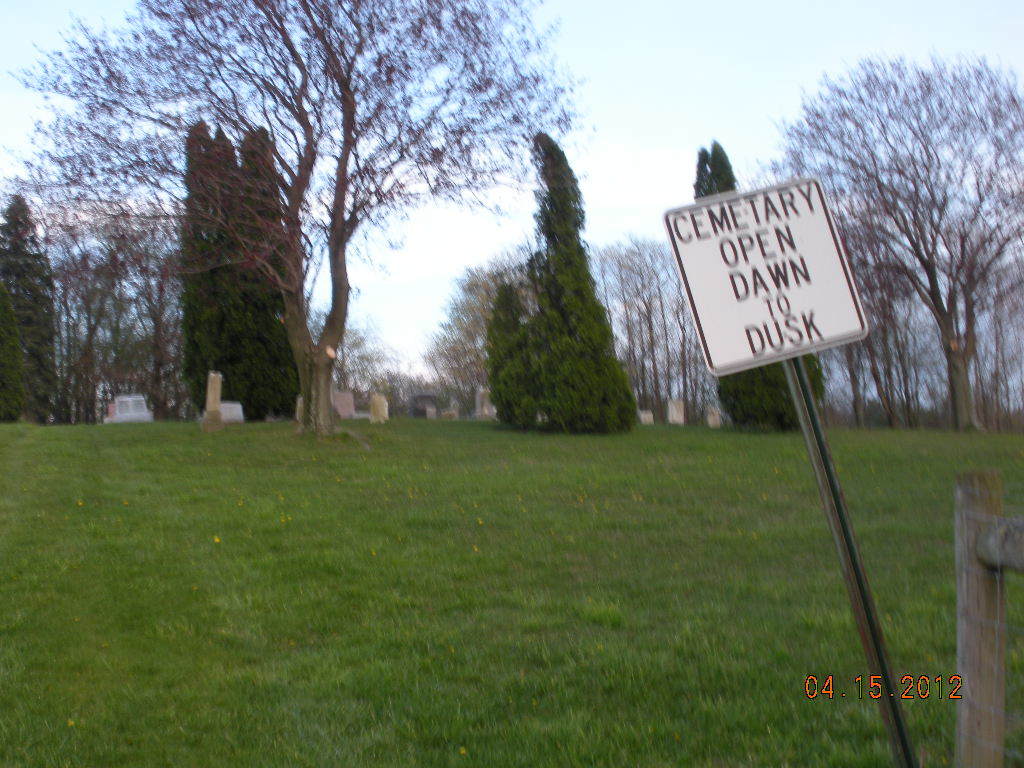
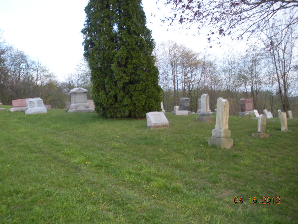
| Description | : | The cemetery is located on the east side of Ohio State Route about 0.1 mile north of Township Road 174. The cemetery is located in Clark Township, Holmes County, Ohio, and is # 5532 (Fisher Cemetery) in “Ohio Cemeteries 1803-2003”, compiled by the Ohio Genealogical Society. The cemetery is registered with the Ohio Division of Real Estate and Professional Licensing (ODRE) as Fisher Cemetery with registration license numbers CGR.0000981734. The U.S. Geological Survey (USGS) Geographic Names Information System (GNIS) feature ID for the cemetery is 1961585 (Fisher Cemetery). |
frequently asked questions (FAQ):
-
Where is Fisher Cemetery?
Fisher Cemetery is located at Ohio State Route 93 Holmes County ,Ohio , 43804USA.
-
Fisher Cemetery cemetery's updated grave count on graveviews.com?
65 memorials
-
Where are the coordinates of the Fisher Cemetery?
Latitude: 40.4589070
Longitude: -81.6887460
Nearby Cemetories:
1. John N Troyer Farm Cemetery
Farmerstown, Holmes County, USA
Coordinate: 40.4632920, -81.6961860
2. Brush Run East Cemetery
Clark Township, Holmes County, USA
Coordinate: 40.4664400, -81.6751300
3. Noah A Troyer Farm Cemetery
Farmerstown, Holmes County, USA
Coordinate: 40.4729580, -81.6877870
4. Berger Cemetery
Holmes County, USA
Coordinate: 40.4491030, -81.7089270
5. Raymond Miller & Albert Hershberger Farms Cemetery
Farmerstown, Holmes County, USA
Coordinate: 40.4706060, -81.6688120
6. Albert Schlabach Farm Cemetery
Charm, Holmes County, USA
Coordinate: 40.4771400, -81.6746270
7. West Lawn Cemetery
Baltic, Tuscarawas County, USA
Coordinate: 40.4428437, -81.7079054
8. Seltonright Cemetery
Baltic, Tuscarawas County, USA
Coordinate: 40.4701004, -81.6586990
9. Baltic Cemetery
Baltic, Tuscarawas County, USA
Coordinate: 40.4370500, -81.7063400
10. Maranatha Church Grounds
Sugarcreek, Tuscarawas County, USA
Coordinate: 40.4811470, -81.6683330
11. Jacobson Mausoleum
Auburn Township, Tuscarawas County, USA
Coordinate: 40.4803341, -81.6644602
12. Reuben Erb Farm Cemetery
Farmerstown, Holmes County, USA
Coordinate: 40.4843320, -81.7141900
13. Levi L Yoder Farm Cemetery
Farmerstown, Holmes County, USA
Coordinate: 40.4907000, -81.6780550
14. Andrew Yoder Farm Cemetery
Farmerstown, Holmes County, USA
Coordinate: 40.4817657, -81.7233124
15. Lloyd Miller Farm Cemetery
Limpytown, Holmes County, USA
Coordinate: 40.4896980, -81.7108670
16. Farmerstown Mennonite Cemetery
Farmerstown, Holmes County, USA
Coordinate: 40.4816060, -81.7271020
17. Moses Erb Farm Cemetery
Farmerstown, Holmes County, USA
Coordinate: 40.4996310, -81.6908280
18. Edward Schmucker Farm Cemetery
Farmerstown, Holmes County, USA
Coordinate: 40.4970280, -81.7105160
19. Farmerstown Cemetery
Holmes County, USA
Coordinate: 40.4883979, -81.7279072
20. Joseph Yoder Farm Cemetery
Farmerstown, Holmes County, USA
Coordinate: 40.4659230, -81.7431810
21. Maranatha Fellowship Church Cemetery
Sugarcreek, Tuscarawas County, USA
Coordinate: 40.4965530, -81.6616730
22. Neff Burial Ground
Ragersville, Tuscarawas County, USA
Coordinate: 40.4501200, -81.6332130
23. Beachy Cemetery
Limpytown, Holmes County, USA
Coordinate: 40.4965370, -81.7174760
24. Ragersville Historical Society Museum
Ragersville, Tuscarawas County, USA
Coordinate: 40.4529500, -81.6299970