
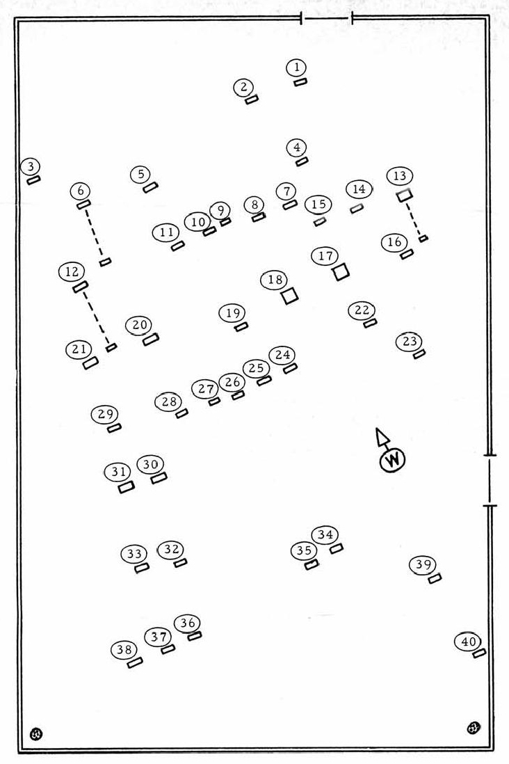
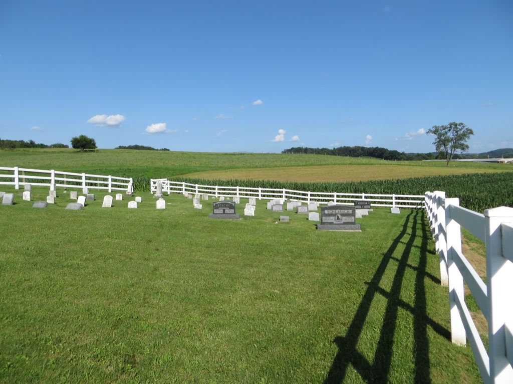
| Memorials | : | 3 |
| Location | : | Farmerstown, Holmes County, USA |
| Coordinate | : | 40.4907000, -81.6780550 |
| Description | : | No official cemetery name, "Troyer Valley" describes the neighborhood. Private farm burial ground. Property owned by Seth Troyer in 1875, later known as the Levi L. Yoder Farm. As recorded in the book "Cemetery directory of the Amish community in eastern Holmes and adjoining counties in Ohio" by Leroy Beachy, (c)1975, 200 pages. This Amish cemetery is located in Clark Township, Holmes County, Ohio, and is # 5573 (Levi L. Yoder Farm Cemetery) in “Ohio Cemeteries 1803-2003”, compiled by the Ohio Genealogical Society. The cemetery is identified as O-36 (Levi L. Yoder Farm Cemetery) in “Cemetery Directory of the Amish Community in Eastern... Read More |
frequently asked questions (FAQ):
-
Where is Levi L Yoder Farm Cemetery?
Levi L Yoder Farm Cemetery is located at 1469 – 1493 County Road 70 Farmerstown, Holmes County ,Ohio , 44681USA.
-
Levi L Yoder Farm Cemetery cemetery's updated grave count on graveviews.com?
3 memorials
-
Where are the coordinates of the Levi L Yoder Farm Cemetery?
Latitude: 40.4907000
Longitude: -81.6780550
Nearby Cemetories:
1. Maranatha Church Grounds
Sugarcreek, Tuscarawas County, USA
Coordinate: 40.4811470, -81.6683330
2. Moses Erb Farm Cemetery
Farmerstown, Holmes County, USA
Coordinate: 40.4996310, -81.6908280
3. Maranatha Fellowship Church Cemetery
Sugarcreek, Tuscarawas County, USA
Coordinate: 40.4965530, -81.6616730
4. Albert Schlabach Farm Cemetery
Charm, Holmes County, USA
Coordinate: 40.4771400, -81.6746270
5. Jacobson Mausoleum
Auburn Township, Tuscarawas County, USA
Coordinate: 40.4803341, -81.6644602
6. Noah A Troyer Farm Cemetery
Farmerstown, Holmes County, USA
Coordinate: 40.4729580, -81.6877870
7. Raymond Miller & Albert Hershberger Farms Cemetery
Farmerstown, Holmes County, USA
Coordinate: 40.4706060, -81.6688120
8. Nelson D. Yoder Cemetery
Sugarcreek, Tuscarawas County, USA
Coordinate: 40.4997580, -81.6525130
9. Brush Run East Cemetery
Clark Township, Holmes County, USA
Coordinate: 40.4664400, -81.6751300
10. Lloyd Miller Farm Cemetery
Limpytown, Holmes County, USA
Coordinate: 40.4896980, -81.7108670
11. Seltonright Cemetery
Baltic, Tuscarawas County, USA
Coordinate: 40.4701004, -81.6586990
12. Edward Schmucker Farm Cemetery
Farmerstown, Holmes County, USA
Coordinate: 40.4970280, -81.7105160
13. Sugar Creek Land Company Cemetery
Farmerstown, Holmes County, USA
Coordinate: 40.5071430, -81.7038970
14. East Lawn Cemetery
Sugarcreek, Tuscarawas County, USA
Coordinate: 40.5086770, -81.6536210
15. Reuben Erb Farm Cemetery
Farmerstown, Holmes County, USA
Coordinate: 40.4843320, -81.7141900
16. Shanesville First Reformed Cemetery
Shanesville, Tuscarawas County, USA
Coordinate: 40.5134000, -81.6540100
17. Henry Zahner Farm Cemetery
Shanesville, Tuscarawas County, USA
Coordinate: 40.5149000, -81.6559000
18. Beachy Cemetery
Limpytown, Holmes County, USA
Coordinate: 40.4965370, -81.7174760
19. John N Troyer Farm Cemetery
Farmerstown, Holmes County, USA
Coordinate: 40.4632920, -81.6961860
20. Fisher Cemetery
Holmes County, USA
Coordinate: 40.4589070, -81.6887460
21. Levi Erb Farm Cemetery
Limpytown, Holmes County, USA
Coordinate: 40.5047110, -81.7198100
22. Erb Cemetery
Farmerstown, Holmes County, USA
Coordinate: 40.5044350, -81.7201710
23. Andrew Yoder Farm Cemetery
Farmerstown, Holmes County, USA
Coordinate: 40.4817657, -81.7233124
24. Farmerstown Cemetery
Holmes County, USA
Coordinate: 40.4883979, -81.7279072