
| Memorials | : | 0 |
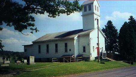
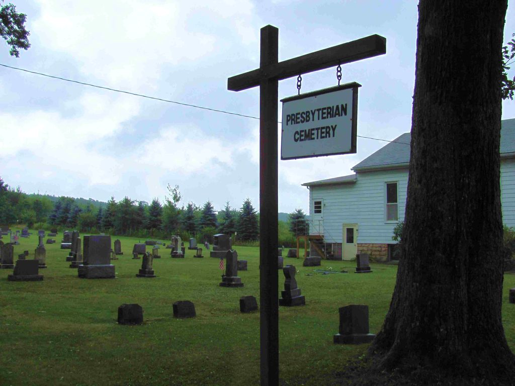
| Location | : | Fisher, Clarion County, USA |
| Coordinate | : | 41.2648000, -79.2413000 |
frequently asked questions (FAQ):
-
Where is Fisher Presbyterian Cemetery?
Fisher Presbyterian Cemetery is located at Fisher, Clarion County ,Pennsylvania ,USA.
-
Fisher Presbyterian Cemetery cemetery's updated grave count on graveviews.com?
0 memorials
-
Where are the coordinates of the Fisher Presbyterian Cemetery?
Latitude: 41.2648000
Longitude: -79.2413000

Nearby Cemetories:
1. Fisher Methodist Cemetery
Fisher, Clarion County, USA
Coordinate: 41.2587000, -79.2445000
2. Scotch Hill Union Cemetery
Scotch Hill, Clarion County, USA
Coordinate: 41.3240000, -79.2651000
3. Kahletown Cemetery
Kahletown, Jefferson County, USA
Coordinate: 41.2720000, -79.1588000
4. Helen Furnace Cemetery
Clarion County, USA
Coordinate: 41.2838000, -79.3210000
5. Cedarview Memorial Park
Strattanville, Clarion County, USA
Coordinate: 41.2193985, -79.3003006
6. Pine Grove Cemetery
Corsica, Jefferson County, USA
Coordinate: 41.2182999, -79.1830978
7. Hominy Ridge Cemetery
Sigel, Jefferson County, USA
Coordinate: 41.3128014, -79.1808014
8. Miola Cemetery
Highland Township, Clarion County, USA
Coordinate: 41.2574997, -79.3367004
9. Cooksburg Cemetery
Forest County, USA
Coordinate: 41.3293991, -79.1980972
10. Asbury Cemetery
Strattanville, Clarion County, USA
Coordinate: 41.1889000, -79.2750015
11. Saint Dominics Cemetery
Sigel, Jefferson County, USA
Coordinate: 41.2619019, -79.1318970
12. Mount Pleasant Independent Cemetery
Corsica, Jefferson County, USA
Coordinate: 41.1806000, -79.2104000
13. Centennial Cemetery
Strattanville, Clarion County, USA
Coordinate: 41.2038330, -79.3256200
14. Strattanville Cemetery
Strattanville, Clarion County, USA
Coordinate: 41.2038926, -79.3258083
15. Mount Pleasant Cemetery
Limestone, Clarion County, USA
Coordinate: 41.1798360, -79.2105830
16. Mount Tabor Cemetery
Sigel, Jefferson County, USA
Coordinate: 41.2655983, -79.1231003
17. Pisgah Cemetery
Corsica, Jefferson County, USA
Coordinate: 41.1789000, -79.2054000
18. Saint Anns Catholic Cemetery
Corsica, Jefferson County, USA
Coordinate: 41.1789000, -79.2033000
19. Haight - Wing Family Cemetery
Jefferson County, USA
Coordinate: 41.3184000, -79.1440000
20. Henderson Family Cemetery
Clarion County, USA
Coordinate: 41.1781250, -79.2772180
21. Maze Cemetery
Hottelville, Forest County, USA
Coordinate: 41.3470947, -79.1846251
22. Daniels Cemetery
Port Barnett, Jefferson County, USA
Coordinate: 41.3183817, -79.1300323
23. Donehey Cemetery
Sigel, Jefferson County, USA
Coordinate: 41.2744950, -79.1093610
24. Independence Cemetery
West Freedom, Clarion County, USA
Coordinate: 41.3300000, -79.3438010