
| Memorials | : | 2 |
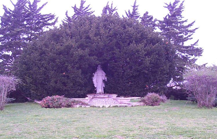
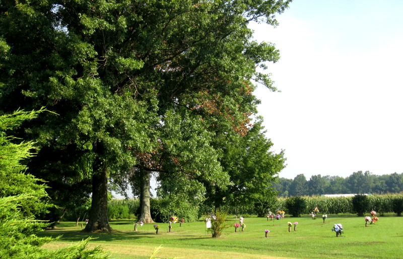
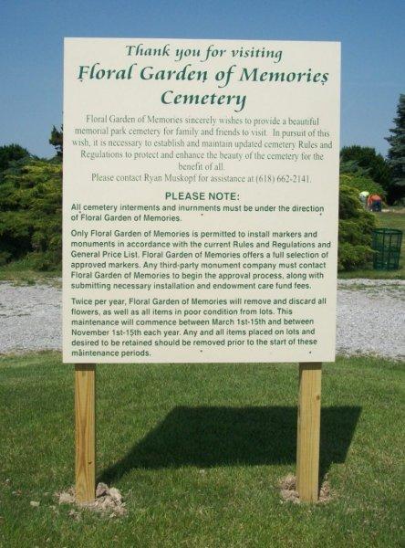
| Location | : | Flora, Clay County, USA |
| Coordinate | : | 38.6885986, -88.5085983 |
| Description | : | The U.S. Geological Survey (USGS) Geographic Names Information System (GNIS) feature ID for the cemetery is 408876 (Garden of Memories Cemetery / Flora Garden of Memories). |
frequently asked questions (FAQ):
-
Where is Floral Garden of Memories Cemetery?
Floral Garden of Memories Cemetery is located at County Road 1000 E and Osage lane Flora, Clay County ,Illinois , 62839USA.
-
Floral Garden of Memories Cemetery cemetery's updated grave count on graveviews.com?
2 memorials
-
Where are the coordinates of the Floral Garden of Memories Cemetery?
Latitude: 38.6885986
Longitude: -88.5085983
Nearby Cemetories:
1. Logan Family Cemetery
Flora, Clay County, USA
Coordinate: 38.6667069, -88.5242105
2. Elmwood Cemetery
Flora, Clay County, USA
Coordinate: 38.6638985, -88.4914017
3. McCawley Cemetery
Clay City, Clay County, USA
Coordinate: 38.6983736, -88.4528198
4. Rusk Cemetery
Flora, Clay County, USA
Coordinate: 38.7113991, -88.4580994
5. Golden Cemetery
Flora, Clay County, USA
Coordinate: 38.7244500, -88.5553800
6. Jenkins Cemetery
Louisville, Clay County, USA
Coordinate: 38.7369003, -88.4847031
7. Saint Stephens Cemetery
Flora, Clay County, USA
Coordinate: 38.6383018, -88.4891968
8. Meisenheimer Cemetery
Clay County, USA
Coordinate: 38.6474991, -88.5550003
9. Bloom Cemetery
Flora, Clay County, USA
Coordinate: 38.6325493, -88.4472733
10. Old Louisville Cemetery
Clay County, USA
Coordinate: 38.7652800, -88.5066700
11. Old Louisville Cemetery
Louisville, Clay County, USA
Coordinate: 38.7667000, -88.5075000
12. Oak Mound Cemetery
Songer Township, Clay County, USA
Coordinate: 38.6777992, -88.6093979
13. Kneff Cemetery
Clay City, Clay County, USA
Coordinate: 38.6469002, -88.4186020
14. Orchard Hill Cemetery
Louisville, Clay County, USA
Coordinate: 38.7764500, -88.5097800
15. Foster Hill Cemetery
Clay City, Clay County, USA
Coordinate: 38.6758800, -88.3961600
16. Smith Cemetery
Wayne County, USA
Coordinate: 38.5978012, -88.5267029
17. Camp Ground Cemetery
Xenia, Clay County, USA
Coordinate: 38.6333008, -88.6081009
18. Toliver Cemetery
Xenia, Clay County, USA
Coordinate: 38.6486015, -88.6260986
19. Speaks Cemetery
Clay County, USA
Coordinate: 38.7780991, -88.5663986
20. Willow Branch Cemetery
Rinard, Wayne County, USA
Coordinate: 38.5844800, -88.5231100
21. Kinnamon Cemetery
Louisville, Clay County, USA
Coordinate: 38.7872009, -88.4586029
22. Pruitt Cemetery
Wayne County, USA
Coordinate: 38.5938988, -88.4464035
23. Christian Home Cemetery
Louisville, Clay County, USA
Coordinate: 38.7883900, -88.5572400
24. Number Four Cemetery
Sailor Springs, Clay County, USA
Coordinate: 38.7428017, -88.3906021