
| Memorials | : | 9 |
| Location | : | Louisville, Clay County, USA |
| Coordinate | : | 38.7764500, -88.5097800 |
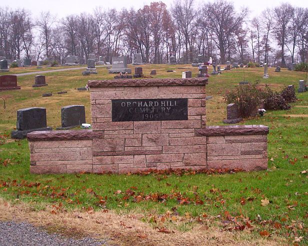
| Description | : | The cemetery is located in Louisville Township on the west side of County Road 1000 E (US 45) about 0.1 miles north of its intersection with Vandalia Road (County Road 1150 N). The U.S. Geological Survey (USGS) Geographic Names Information System (GNIS) feature ID for the cemetery is 1952680 (Orchard Hill Cemetery / Louisville Cemetery). |
frequently asked questions (FAQ):
-
Where is Orchard Hill Cemetery?
Orchard Hill Cemetery is located at County Road 1000 E (US 45) Louisville, Clay County ,Illinois , 62858USA.
-
Orchard Hill Cemetery cemetery's updated grave count on graveviews.com?
8 memorials
-
Where are the coordinates of the Orchard Hill Cemetery?
Latitude: 38.7764500
Longitude: -88.5097800
Nearby Cemetories:
1. Old Louisville Cemetery
Louisville, Clay County, USA
Coordinate: 38.7667000, -88.5075000
2. Old Louisville Cemetery
Clay County, USA
Coordinate: 38.7652800, -88.5066700
3. Red Brush Cemetery
Louisville, Clay County, USA
Coordinate: 38.7969250, -88.5085415
4. Christian Home Cemetery
Louisville, Clay County, USA
Coordinate: 38.7883900, -88.5572400
5. Kinnamon Cemetery
Louisville, Clay County, USA
Coordinate: 38.7872009, -88.4586029
6. Jenkins Cemetery
Louisville, Clay County, USA
Coordinate: 38.7369003, -88.4847031
7. Speaks Cemetery
Clay County, USA
Coordinate: 38.7780991, -88.5663986
8. Tolliver Cemetery
Louisville, Clay County, USA
Coordinate: 38.8217010, -88.5171967
9. Riffle Cemetery
Louisville, Clay County, USA
Coordinate: 38.8061562, -88.5681076
10. Golden Cemetery
Flora, Clay County, USA
Coordinate: 38.7244500, -88.5553800
11. Newton Chapel Cemetery
Louisville, Clay County, USA
Coordinate: 38.8310200, -88.5623100
12. Rusk Cemetery
Flora, Clay County, USA
Coordinate: 38.7113991, -88.4580994
13. Fields Cemetery
Clay County, USA
Coordinate: 38.7747002, -88.4100037
14. Hoosier Prairie Cemetery
Louisville, Clay County, USA
Coordinate: 38.7925460, -88.4111573
15. Floral Garden of Memories Cemetery
Flora, Clay County, USA
Coordinate: 38.6885986, -88.5085983
16. McCawley Cemetery
Clay City, Clay County, USA
Coordinate: 38.6983736, -88.4528198
17. Old Baptist Cemetery
Iola, Clay County, USA
Coordinate: 38.8054695, -88.6248245
18. Lewis Cemetery
Bible Grove Township, Clay County, USA
Coordinate: 38.8514348, -88.4364355
19. Old Union Cemetery
Louisville, Clay County, USA
Coordinate: 38.8708000, -88.5000000
20. Bible Grove Cemetery
Bible Grove, Clay County, USA
Coordinate: 38.8544006, -88.4396973
21. Conly Cemetery
Clay County, USA
Coordinate: 38.8725014, -88.4899979
22. Number Four Cemetery
Sailor Springs, Clay County, USA
Coordinate: 38.7428017, -88.3906021
23. Dillman Cemetery
Sailor Springs, Clay County, USA
Coordinate: 38.7630997, -88.3788986
24. Burge Cemetery
Iola, Clay County, USA
Coordinate: 38.8636017, -88.5813980