
| Memorials | : | 1 |
| Location | : | Enfield, Grafton County, USA |
| Coordinate | : | 43.6173100, -72.1802600 |
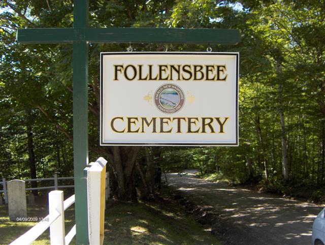
| Description | : | Follansbee Cemetery is also known as Potato Hill Cemetery. Information from: Roberts, George McKenzie, Compiler Vital and cemetery records of the Town of Enfield, Grafton County, New Hampshire, 1957 Follansbee Cemetery is a semi-private cemetery, 102 by 110 feet, on Potato Hill, in the West-Central section of the town, on the South side of the highway, elevation 1380 feet. It is surrounded by a square mesh fence, and contains 61 stones, facing in a westerly direction. |
frequently asked questions (FAQ):
-
Where is Follensbee Cemetery?
Follensbee Cemetery is located at Follensbee Road Enfield, Grafton County ,New Hampshire ,USA.
-
Follensbee Cemetery cemetery's updated grave count on graveviews.com?
1 memorials
-
Where are the coordinates of the Follensbee Cemetery?
Latitude: 43.6173100
Longitude: -72.1802600
Nearby Cemetories:
1. Purmort Cemetery
Enfield, Grafton County, USA
Coordinate: 43.5942000, -72.1750400
2. La Salette Cemetery
Enfield, Grafton County, USA
Coordinate: 43.6213700, -72.1479100
3. Shaker Cemetery
Enfield, Grafton County, USA
Coordinate: 43.6216540, -72.1468630
4. East Lebanon Cemetery
Lebanon, Grafton County, USA
Coordinate: 43.6419920, -72.1534820
5. Lakeview Cemetery
Enfield, Grafton County, USA
Coordinate: 43.6419144, -72.1524734
6. Oak Grove Cemetery
Enfield, Grafton County, USA
Coordinate: 43.6408860, -72.1501450
7. Paddleford Cemetery
Enfield, Grafton County, USA
Coordinate: 43.6418500, -72.1500710
8. Shaker Cemetery
Enfield, Grafton County, USA
Coordinate: 43.6093310, -72.1349760
9. Cole Cemetery
Lebanon, Grafton County, USA
Coordinate: 43.6025500, -72.2224800
10. Jenkins Cemetery
Grafton County, USA
Coordinate: 43.6493670, -72.2067630
11. Methodist Hill Cemetery
East Plainfield, Sullivan County, USA
Coordinate: 43.5807300, -72.2007400
12. Montcalm Cemetery
Enfield Center, Grafton County, USA
Coordinate: 43.6019600, -72.1247600
13. Old Cemetery
Enfield, Grafton County, USA
Coordinate: 43.6238890, -72.1186110
14. East Plainfield Cemetery
East Plainfield, Sullivan County, USA
Coordinate: 43.5755800, -72.2252900
15. Countryside Cemetery
Grafton County, USA
Coordinate: 43.6131927, -72.1065096
16. Country Side Cemetery
Enfield, Grafton County, USA
Coordinate: 43.6147400, -72.1060990
17. School Street Cemetery
Lebanon, Grafton County, USA
Coordinate: 43.6405300, -72.2514000
18. Enfield Center Cemetery
Enfield Center, Grafton County, USA
Coordinate: 43.5918700, -72.1101700
19. Glenwood Cemetery
Lebanon, Grafton County, USA
Coordinate: 43.6352997, -72.2553024
20. Mount Calvary Cemetery
Lebanon, Grafton County, USA
Coordinate: 43.6366997, -72.2585983
21. Lockehaven Cemetery
Enfield, Grafton County, USA
Coordinate: 43.6119440, -72.0977780
22. Town Cemetery
Enfield, Grafton County, USA
Coordinate: 43.6119170, -72.0972360
23. Leavitt Hill Cemetery
Grantham, Sullivan County, USA
Coordinate: 43.5574130, -72.1654530
24. Leavitt Hill Cemetery
North Grantham, Sullivan County, USA
Coordinate: 43.5547200, -72.1638900