
| Memorials | : | 19 |
| Location | : | Enfield, Grafton County, USA |
| Coordinate | : | 43.6216540, -72.1468630 |
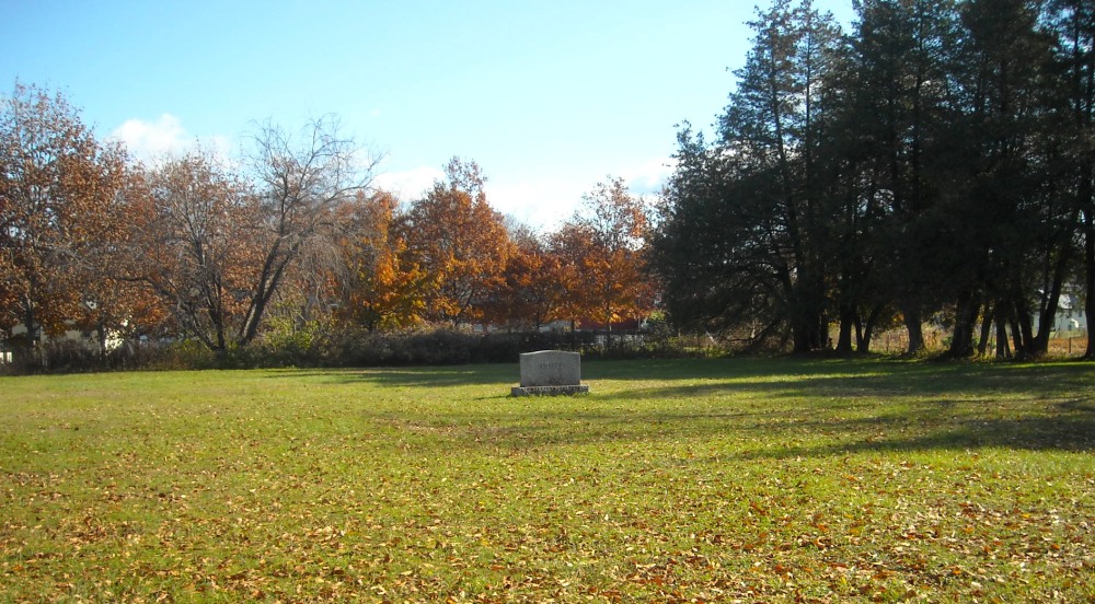
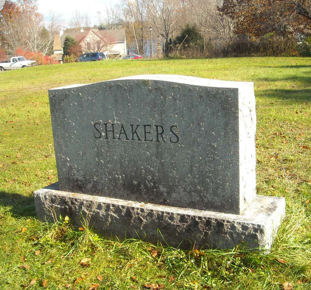
| Description | : | The Church Family Cemetery is the resting place of 330 Shakers. After the Shakers left Enfield in 1923, they asked the new owners, the Missionaries of LaSalette, to remove the individual headstones and replace them with a single stone marked "Shakers." It was felt that one stone expressed the Community's belief in a shared spiritual inheritance in life and death. The entries here are taken from the cemetery plot plan that recorded the information taken from individual stones before they were removed. Additional death records are recorded in The New England historical and genealogical register, Volume 62 By Henry Fitz-Gilbert Waters,... Read More |
frequently asked questions (FAQ):
-
Where is Shaker Cemetery?
Shaker Cemetery is located at Chosen Vale Lane Enfield, Grafton County ,New Hampshire , 03748USA.
-
Shaker Cemetery cemetery's updated grave count on graveviews.com?
19 memorials
-
Where are the coordinates of the Shaker Cemetery?
Latitude: 43.6216540
Longitude: -72.1468630
Nearby Cemetories:
1. La Salette Cemetery
Enfield, Grafton County, USA
Coordinate: 43.6213700, -72.1479100
2. Shaker Cemetery
Enfield, Grafton County, USA
Coordinate: 43.6093310, -72.1349760
3. Oak Grove Cemetery
Enfield, Grafton County, USA
Coordinate: 43.6408860, -72.1501450
4. Paddleford Cemetery
Enfield, Grafton County, USA
Coordinate: 43.6418500, -72.1500710
5. Old Cemetery
Enfield, Grafton County, USA
Coordinate: 43.6238890, -72.1186110
6. Lakeview Cemetery
Enfield, Grafton County, USA
Coordinate: 43.6419144, -72.1524734
7. East Lebanon Cemetery
Lebanon, Grafton County, USA
Coordinate: 43.6419920, -72.1534820
8. Follensbee Cemetery
Enfield, Grafton County, USA
Coordinate: 43.6173100, -72.1802600
9. Montcalm Cemetery
Enfield Center, Grafton County, USA
Coordinate: 43.6019600, -72.1247600
10. Country Side Cemetery
Enfield, Grafton County, USA
Coordinate: 43.6147400, -72.1060990
11. Countryside Cemetery
Grafton County, USA
Coordinate: 43.6131927, -72.1065096
12. Purmort Cemetery
Enfield, Grafton County, USA
Coordinate: 43.5942000, -72.1750400
13. Lockehaven Cemetery
Enfield, Grafton County, USA
Coordinate: 43.6119440, -72.0977780
14. Town Cemetery
Enfield, Grafton County, USA
Coordinate: 43.6119170, -72.0972360
15. Enfield Center Cemetery
Enfield Center, Grafton County, USA
Coordinate: 43.5918700, -72.1101700
16. West Canaan Cemetery
West Canaan, Grafton County, USA
Coordinate: 43.6455700, -72.0911800
17. Scofield Cemetery
Canaan, Grafton County, USA
Coordinate: 43.6319440, -72.0777780
18. Jenkins Cemetery
Grafton County, USA
Coordinate: 43.6493670, -72.2067630
19. Butman Cemetery
Enfield, Grafton County, USA
Coordinate: 43.5952400, -72.0795610
20. Methodist Hill Cemetery
East Plainfield, Sullivan County, USA
Coordinate: 43.5807300, -72.2007400
21. Cole Cemetery
Lebanon, Grafton County, USA
Coordinate: 43.6025500, -72.2224800
22. George Hill Cemetery
Enfield Center, Grafton County, USA
Coordinate: 43.5801400, -72.0906600
23. Leavitt Hill Cemetery
Grantham, Sullivan County, USA
Coordinate: 43.5574130, -72.1654530
24. West Farms Cemetery
Canaan, Grafton County, USA
Coordinate: 43.6869000, -72.1273000