
| Memorials | : | 0 |
| Location | : | Drummond, Chippewa County, USA |
| Coordinate | : | 45.9767820, -83.8688140 |
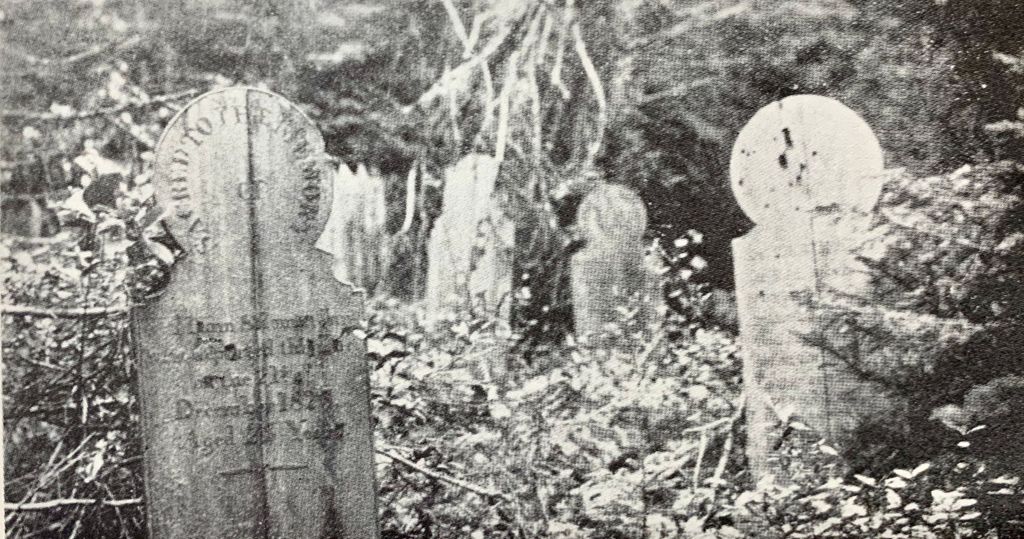
| Description | : | Following the end of the War of 1812, when England agreed to surrender its forts in U.S. to the United States, British soldiers at Mackinac Island relocated to Drummond Island, which their commander bought from the chief of the Chippewa/Ojibwa Indians for approximately $100. In July, 1815 the Union Jack was raised on Drummond's southwest shore and the British established "Fort Collier." They named Drummond Island in honor of Sir Gordon Drummond, their Naval Commander, Chief of Canadian Forces, and Governor General of Canada (who probably never set foot on the island). The British soldiers worked for 13 years there to... Read More |
frequently asked questions (FAQ):
-
Where is Fort Drummond Burial Ground?
Fort Drummond Burial Ground is located at Drummond, Chippewa County ,Michigan ,USA.
-
Fort Drummond Burial Ground cemetery's updated grave count on graveviews.com?
0 memorials
-
Where are the coordinates of the Fort Drummond Burial Ground?
Latitude: 45.9767820
Longitude: -83.8688140
Nearby Cemetories:
1. Riverside Cemetery
De Tour Village, Chippewa County, USA
Coordinate: 45.9833200, -83.9018800
2. Bob Hill Cemetery
De Tour Village, Chippewa County, USA
Coordinate: 45.9805984, -83.9103012
3. Sacred Heart Cemetery
De Tour Village, Chippewa County, USA
Coordinate: 46.0008011, -83.9413986
4. Maple Grove Cemetery
De Tour Village, Chippewa County, USA
Coordinate: 45.9864006, -83.9627991
5. Seaman Family Cemetery
Drummond, Chippewa County, USA
Coordinate: 46.0197790, -83.7458180
6. Drummond Cemetery
Drummond, Chippewa County, USA
Coordinate: 46.0071983, -83.7378006
7. Saint Florence Catholic Cemetery
Drummond, Chippewa County, USA
Coordinate: 46.0094150, -83.7380720
8. Matthews Family Cemetery
Drummond, Chippewa County, USA
Coordinate: 46.0212200, -83.6860400
9. Finnish Cemetery
Drummond, Chippewa County, USA
Coordinate: 45.9721985, -83.6536026
10. Lytle Cemetery
Goetzville, Chippewa County, USA
Coordinate: 46.0285988, -84.0761032
11. Tenby Bay Cemetery
Jocelyn, Algoma District, Canada
Coordinate: 46.1267000, -83.9246090
12. Saint Stanislaus Catholic Cemetery
Goetzville, Chippewa County, USA
Coordinate: 46.0583420, -84.0967407
13. North Raber Cemetery
Raber, Chippewa County, USA
Coordinate: 46.1227989, -84.0927963
14. Mountain Maple Grove Cemetery
Jocelyn, Algoma District, Canada
Coordinate: 46.1906800, -83.9749640
15. Holy Trinity Anglican Cemetery
Jocelyn, Algoma District, Canada
Coordinate: 46.1893570, -84.0271500
16. Saint Boniface Catholic Cemetery
Hilton Beach, Algoma District, Canada
Coordinate: 46.2518340, -83.8799940
17. Grace United Cemetery
Hilton Beach, Algoma District, Canada
Coordinate: 46.2524630, -83.9040880
18. Saint John's Anglican Cemetery
Hilton Beach, Algoma District, Canada
Coordinate: 46.2537500, -83.8982600
19. Stalwart Cemetery
Stalwart, Chippewa County, USA
Coordinate: 46.0932999, -84.2382965
20. Hannah Family Cemetery
Pickford Township, Chippewa County, USA
Coordinate: 46.0825700, -84.2598700
21. St Joseph Township Cemetery
Richards Landing, Algoma District, Canada
Coordinate: 46.2699900, -84.0221800
22. Johnston Family Cemetery
Munuscong, Chippewa County, USA
Coordinate: 46.2494444, -84.1125000
23. Fairview Cemetery
Pickford, Chippewa County, USA
Coordinate: 46.1507988, -84.2585983
24. Neebish Island Presbyterian Church Cemetery
Barbeau, Chippewa County, USA
Coordinate: 46.2560190, -84.1354310