
| Memorials | : | 5 |
| Location | : | Costilla County, USA |
| Coordinate | : | 37.4953200, -105.3951900 |
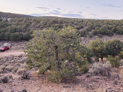
| Description | : | Fort Massachusetts was built on the west bank of Ute (Utah) Creek in the San Luis Valley, Colorado (then part of the New Mexico Territory). Officially established on June 22, 1852, its poorly chosen location in a swampy area caused the fort's operations to be moved six miles south to the newly constructed Fort Garland. Fort Massachusetts was abandoned 24 Jun 1858. |
frequently asked questions (FAQ):
-
Where is Fort Massachusetts Post Cemetery?
Fort Massachusetts Post Cemetery is located at Costilla County ,Colorado ,USA.
-
Fort Massachusetts Post Cemetery cemetery's updated grave count on graveviews.com?
0 memorials
-
Where are the coordinates of the Fort Massachusetts Post Cemetery?
Latitude: 37.4953200
Longitude: -105.3951900
Nearby Cemetories:
1. Brennaman Cemetery
Costilla County, USA
Coordinate: 37.4268990, -105.4274979
2. Myer Cemetery
Costilla County, USA
Coordinate: 37.4352810, -105.4501610
3. Fort Garland Cemetery
Fort Garland, Costilla County, USA
Coordinate: 37.4241982, -105.4272003
4. Fort Garland Post Cemetery
Fort Garland, Costilla County, USA
Coordinate: 37.4239700, -105.4323100
5. Mac Mullan Cemetery
Blanca, Costilla County, USA
Coordinate: 37.4366989, -105.4646988
6. Blanca Trinchera Cemetery
Fort Garland, Costilla County, USA
Coordinate: 37.4302000, -105.4666000
7. Hoffman Cemetery
Fort Garland, Costilla County, USA
Coordinate: 37.3932689, -105.4030617
8. Blanca Cemetery
Blanca, Costilla County, USA
Coordinate: 37.4542000, -105.5264000
9. Flying Tigers Crash Memorial
Alamosa County, USA
Coordinate: 37.6136600, -105.5004480
10. Uracca Pioneer Cemetery
Alamosa County, USA
Coordinate: 37.6021996, -105.5714035
11. Urraca Cemetery
Alamosa County, USA
Coordinate: 37.6898000, -105.5429000
12. Chama Cemetery
Gardner, Huerfano County, USA
Coordinate: 37.7149390, -105.2890730
13. Oak View Cemetery
Huerfano County, USA
Coordinate: 37.5410995, -105.1010971
14. Red Wing Cemetery
Red Wing, Huerfano County, USA
Coordinate: 37.7359886, -105.3088989
15. Gomez Cemetery
Red Wing, Huerfano County, USA
Coordinate: 37.7360000, -105.3050000
16. Gonzales Cemetery
Huerfano County, USA
Coordinate: 37.7341995, -105.2593994
17. Yellowstone Creek Cemetery
Farisita, Huerfano County, USA
Coordinate: 37.6714000, -105.1106000
18. Apostolic Church Cemetery
San Luis, Costilla County, USA
Coordinate: 37.2015320, -105.4058660
19. Church of God in Christ Cemetery
San Luis, Costilla County, USA
Coordinate: 37.2014980, -105.4048260
20. San Luis Old Catholic Cemetery
San Luis, Costilla County, USA
Coordinate: 37.2014800, -105.4073200
21. San Luis Cemetery
San Luis, Costilla County, USA
Coordinate: 37.2013000, -105.4095000
22. Sanches Cemetery
Huerfano County, USA
Coordinate: 37.6760000, -105.0984000
23. San Pedro Cemetery
San Luis, Costilla County, USA
Coordinate: 37.1893997, -105.3897018
24. San Acacio Old Cemetery
San Acacio, Costilla County, USA
Coordinate: 37.2018000, -105.5079000