
| Memorials | : | 0 |
| Location | : | Fort Steele, Carbon County, USA |
| Coordinate | : | 41.7725250, -106.9469110 |
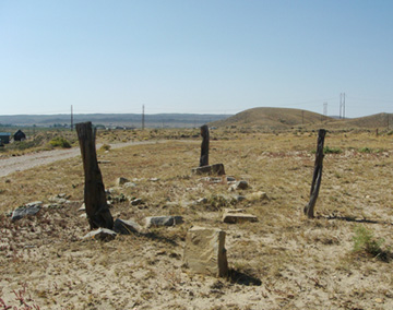
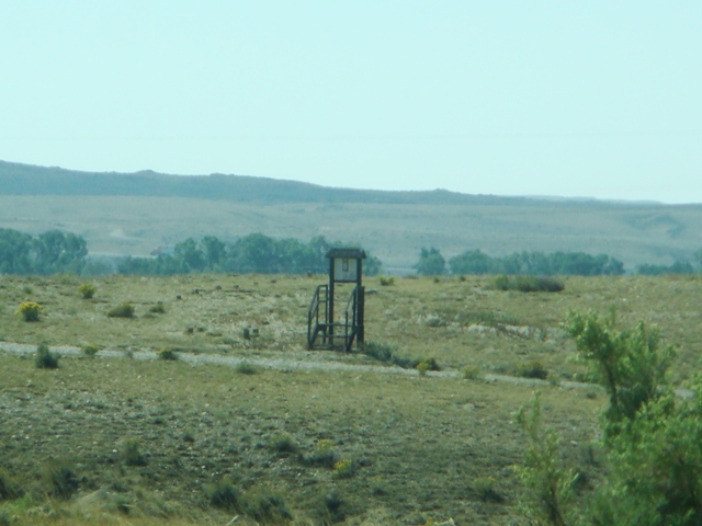
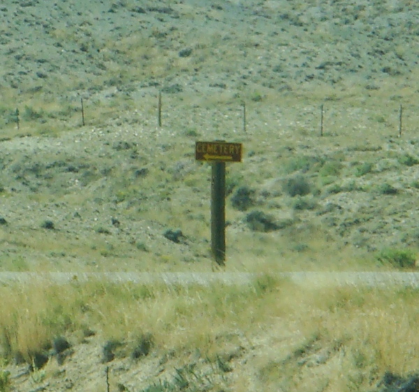
| Description | : | The Fort Steele Cemetery is part of the Fort Fred Steele Historic Site which is about 12 miles east of Rawlins. It's a little over a mile north of the I-80 Fort Steele Rest Area. There are 83 burials listed on a paper document posted on a wooden marker. They were posted by C. Dan Brownell, Superintendent of the Fort Steele Historic Site in 1998. Some of the bodies have been reinterred at the Fort McPherson National Cemetery in Wisconsin in 1892: Graves 1-19, 21-29, 32-35, 40-41, 47-49, 52, 54-55, 59, 65-67, 70-71, 73, 80. The following bodies... Read More |
frequently asked questions (FAQ):
-
Where is Fort Steele Historic Site Cemetery?
Fort Steele Historic Site Cemetery is located at Fort Steele, Carbon County ,Wyoming ,USA.
-
Fort Steele Historic Site Cemetery cemetery's updated grave count on graveviews.com?
0 memorials
-
Where are the coordinates of the Fort Steele Historic Site Cemetery?
Latitude: 41.7725250
Longitude: -106.9469110
Nearby Cemetories:
1. Overland Crossing Cemetery
Carbon County, USA
Coordinate: 41.5732994, -106.9644012
2. Rawlins Cemetery
Rawlins, Carbon County, USA
Coordinate: 41.7976300, -107.2402400
3. Wyoming State Penitentiary Cemetery
Rawlins, Carbon County, USA
Coordinate: 41.7932281, -107.2409210
4. Carbon County Museum
Rawlins, Carbon County, USA
Coordinate: 41.7911400, -107.2468200
5. Hanna Cemetery
Hanna, Carbon County, USA
Coordinate: 41.8575900, -106.5849100
6. Fort Halleck Cemetery
Elk Mountain, Carbon County, USA
Coordinate: 41.6985740, -106.5158570
7. Saratoga Cemetery
Saratoga, Carbon County, USA
Coordinate: 41.4592700, -106.7937600
8. Cadwell Cemetery
Saratoga, Carbon County, USA
Coordinate: 41.4531000, -106.7673000
9. Elk Mountain Cemetery
Elk Mountain, Carbon County, USA
Coordinate: 41.7075005, -106.4289017
10. Carbon Cemetery
Carbon, Carbon County, USA
Coordinate: 41.8519980, -106.3778740
11. Mountain View Cemetery
Riverside, Carbon County, USA
Coordinate: 41.2261009, -106.7403030
12. Encampment Cemetery
Encampment, Carbon County, USA
Coordinate: 41.2155991, -106.7977982
13. Trails End Cemetery
Medicine Bow, Carbon County, USA
Coordinate: 41.8925300, -106.1972800
14. Battle Cemetery
Encampment, Carbon County, USA
Coordinate: 41.1613998, -106.9788971
15. Platt Cemetery
Carbon County, USA
Coordinate: 41.1749992, -106.6172028
16. Hopkins Burial Site
Encampment, Carbon County, USA
Coordinate: 41.1681870, -106.5192480
17. Frederick Richard Fulkerson Gravesite
Natrona County, USA
Coordinate: 42.4435800, -107.2068200
18. Pathfinder Cemetery
Natrona County, USA
Coordinate: 42.4798000, -106.8422900
19. Annis Ranch Cemetery
Alcova, Natrona County, USA
Coordinate: 42.4832900, -106.9948600
20. Clement Stuart Bengough Gravesite
Albany County, USA
Coordinate: 41.5100600, -106.0523800
21. Rock River Cemetery
Rock River, Albany County, USA
Coordinate: 41.7371500, -105.9741700
22. Independence Rock Burial Ground
Natrona County, USA
Coordinate: 42.4942440, -107.1322770
23. Averell-Watson Gravesite
Natrona County, USA
Coordinate: 42.5245840, -107.0202020
24. Three Forks Cemetery
Battle Creek, Routt County, USA
Coordinate: 40.9872000, -107.0478000