
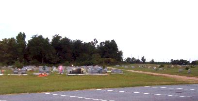
| Memorials | : | 4 |
| Location | : | Roebuck, Spartanburg County, USA |
| Phone | : | (864) 576-5802 |
| Coordinate | : | 34.8646770, -81.9549120 |
frequently asked questions (FAQ):
-
Where is Foster Chapel Baptist Church Cemetery?
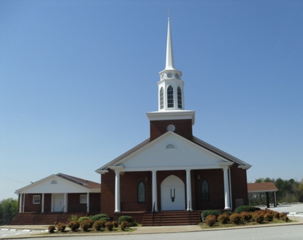
Foster Chapel Baptist Church Cemetery is located at 2800 Highway 215 Roebuck, Spartanburg County ,South Carolina , 29376USA.
-
Foster Chapel Baptist Church Cemetery cemetery's updated grave count on graveviews.com?
4 memorials
-
Where are the coordinates of the Foster Chapel Baptist Church Cemetery?
Latitude: 34.8646770
Longitude: -81.9549120
Nearby Cemetories:
1. Roebuck Presbyterian Church Cemetery
Roebuck, Spartanburg County, USA
Coordinate: 34.8780200, -81.9636120
2. Roebuck Baptist Church Cemetery
Roebuck, Spartanburg County, USA
Coordinate: 34.8814380, -81.9671240
3. Old Walnut Grove Slave Cemetery
Roebuck, Spartanburg County, USA
Coordinate: 34.8418280, -81.9681200
4. Heritage Memorial Gardens
Roebuck, Spartanburg County, USA
Coordinate: 34.8934898, -81.9530869
5. Doar-Lucas Cemetery
Spartanburg County, USA
Coordinate: 34.8358307, -81.9641876
6. Bethlehem Baptist Church Cemetery
Moore, Spartanburg County, USA
Coordinate: 34.8851560, -81.9814130
7. Canaan Baptist Church Cemetery
Spartanburg County, USA
Coordinate: 34.8925620, -81.9326510
8. Spartanburg County Cemetery
Spartanburg, Spartanburg County, USA
Coordinate: 34.8573100, -81.9114240
9. Moore-Barry Family Cemetery
Roebuck, Spartanburg County, USA
Coordinate: 34.8256509, -81.9636295
10. Center Point Presbyterian Church Cemetery
Moore, Spartanburg County, USA
Coordinate: 34.8342380, -81.9943630
11. Harrison Grove Baptist Church Cemetery
Roebuck, Spartanburg County, USA
Coordinate: 34.8216420, -81.9352430
12. Moore's Chapel Baptist Church Cemetery
Moore, Spartanburg County, USA
Coordinate: 34.8287000, -81.9900000
13. Miller-Ott Family Cemetery
Moore, Spartanburg County, USA
Coordinate: 34.8763380, -82.0103750
14. Collins Cemetery
Arkwright, Spartanburg County, USA
Coordinate: 34.9158750, -81.9398220
15. Moore Church of Christ Cemetery
Moore, Spartanburg County, USA
Coordinate: 34.8608017, -82.0211029
16. Allen-Wells Cemetery
Spartanburg, Spartanburg County, USA
Coordinate: 34.8927740, -81.8979610
17. Cathcart Cemetery
Spartanburg County, USA
Coordinate: 34.8083000, -81.9610977
18. Old Hatchett Cemetery
Spartanburg County, USA
Coordinate: 34.8082010, -81.9604220
19. Arkwright Cemetery
Spartanburg, Spartanburg County, USA
Coordinate: 34.9195510, -81.9280370
20. Golightly-Harris Family Cemetery
Pauline, Spartanburg County, USA
Coordinate: 34.8659960, -81.8808600
21. New Hidden Hill Baptist Church
Arkwright, Spartanburg County, USA
Coordinate: 34.9290620, -81.9332350
22. Seay Cemetery
Spartanburg County, USA
Coordinate: 34.9314003, -81.9421997
23. West Family Cemetery
Moore, Spartanburg County, USA
Coordinate: 34.8594818, -82.0374120
24. Barnette Cemetery at Croft State Park
Camp Croft, Spartanburg County, USA
Coordinate: 34.8869900, -81.8748200