
| Memorials | : | 37 |
| Location | : | Roebuck, Spartanburg County, USA |
| Coordinate | : | 34.8418280, -81.9681200 |
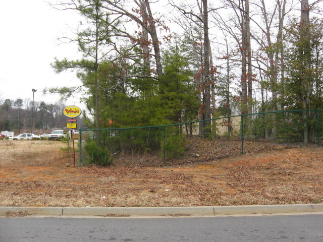
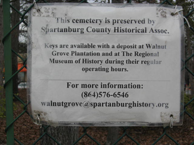
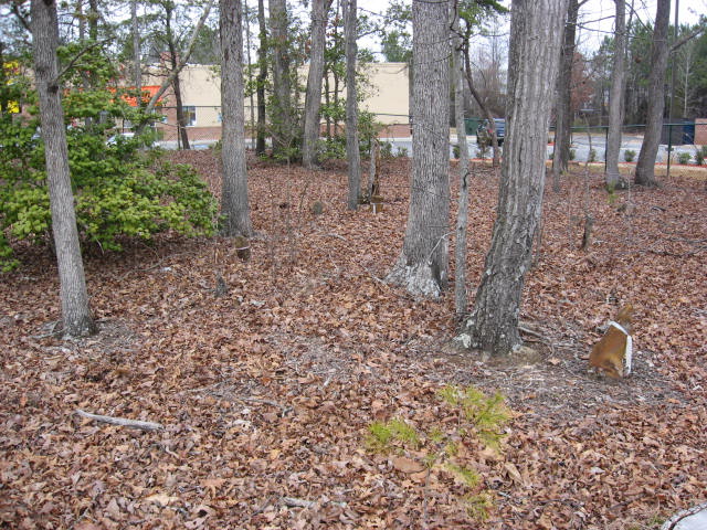
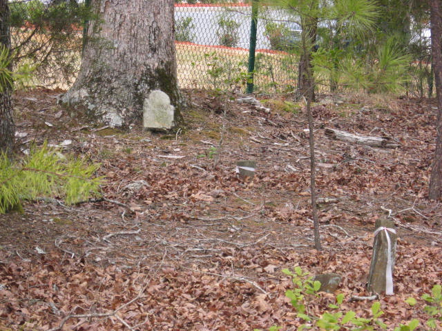
| Description | : | This property was originally part of Walnut Grove Plantation belonging to the Charles Moore (c.1730-1805). The small cemetery is now under the care of the Spartanburg County Historical Society , and is fenced and locked. There are about 30 field stone markers, and a few shaped markers; but only this one is readable. |
frequently asked questions (FAQ):
-
Where is Old Walnut Grove Slave Cemetery?
Old Walnut Grove Slave Cemetery is located at 6163 Hwy 221 (adjacent) Roebuck, Spartanburg County ,South Carolina , 29376USA.
-
Old Walnut Grove Slave Cemetery cemetery's updated grave count on graveviews.com?
0 memorials
-
Where are the coordinates of the Old Walnut Grove Slave Cemetery?
Latitude: 34.8418280
Longitude: -81.9681200
Nearby Cemetories:
1. Doar-Lucas Cemetery
Spartanburg County, USA
Coordinate: 34.8358307, -81.9641876
2. Moore-Barry Family Cemetery
Roebuck, Spartanburg County, USA
Coordinate: 34.8256509, -81.9636295
3. Moore's Chapel Baptist Church Cemetery
Moore, Spartanburg County, USA
Coordinate: 34.8287000, -81.9900000
4. Center Point Presbyterian Church Cemetery
Moore, Spartanburg County, USA
Coordinate: 34.8342380, -81.9943630
5. Foster Chapel Baptist Church Cemetery
Roebuck, Spartanburg County, USA
Coordinate: 34.8646770, -81.9549120
6. Harrison Grove Baptist Church Cemetery
Roebuck, Spartanburg County, USA
Coordinate: 34.8216420, -81.9352430
7. Cathcart Cemetery
Spartanburg County, USA
Coordinate: 34.8083000, -81.9610977
8. Old Hatchett Cemetery
Spartanburg County, USA
Coordinate: 34.8082010, -81.9604220
9. Roebuck Presbyterian Church Cemetery
Roebuck, Spartanburg County, USA
Coordinate: 34.8780200, -81.9636120
10. Roebuck Baptist Church Cemetery
Roebuck, Spartanburg County, USA
Coordinate: 34.8814380, -81.9671240
11. Bethlehem Baptist Church Cemetery
Moore, Spartanburg County, USA
Coordinate: 34.8851560, -81.9814130
12. Moore Church of Christ Cemetery
Moore, Spartanburg County, USA
Coordinate: 34.8608017, -82.0211029
13. Miller-Ott Family Cemetery
Moore, Spartanburg County, USA
Coordinate: 34.8763380, -82.0103750
14. Spartanburg County Cemetery
Spartanburg, Spartanburg County, USA
Coordinate: 34.8573100, -81.9114240
15. Heritage Memorial Gardens
Roebuck, Spartanburg County, USA
Coordinate: 34.8934898, -81.9530869
16. Switzer Mount Zion Baptist Church Cemetery
Switzer, Spartanburg County, USA
Coordinate: 34.8049690, -82.0159610
17. Boiter Family Cemetery
Switzer, Spartanburg County, USA
Coordinate: 34.8266820, -82.0328410
18. Switzer First Baptist Church Cemetery
Moore, Spartanburg County, USA
Coordinate: 34.8014970, -82.0156890
19. Switzer Family Cemetery
Switzer, Spartanburg County, USA
Coordinate: 34.8003710, -82.0163420
20. Concord Methodist Episcopal Church Cemetery
Spartanburg, Spartanburg County, USA
Coordinate: 34.8003740, -82.0164650
21. Canaan Baptist Church Cemetery
Spartanburg County, USA
Coordinate: 34.8925620, -81.9326510
22. West Family Cemetery
Moore, Spartanburg County, USA
Coordinate: 34.8594818, -82.0374120
23. Bethany Wesleyan Church Cemetery
Moore, Spartanburg County, USA
Coordinate: 34.8602250, -82.0427340
24. Poplar Springs Baptist Church Cemetery
Moore, Spartanburg County, USA
Coordinate: 34.8669720, -82.0530410