
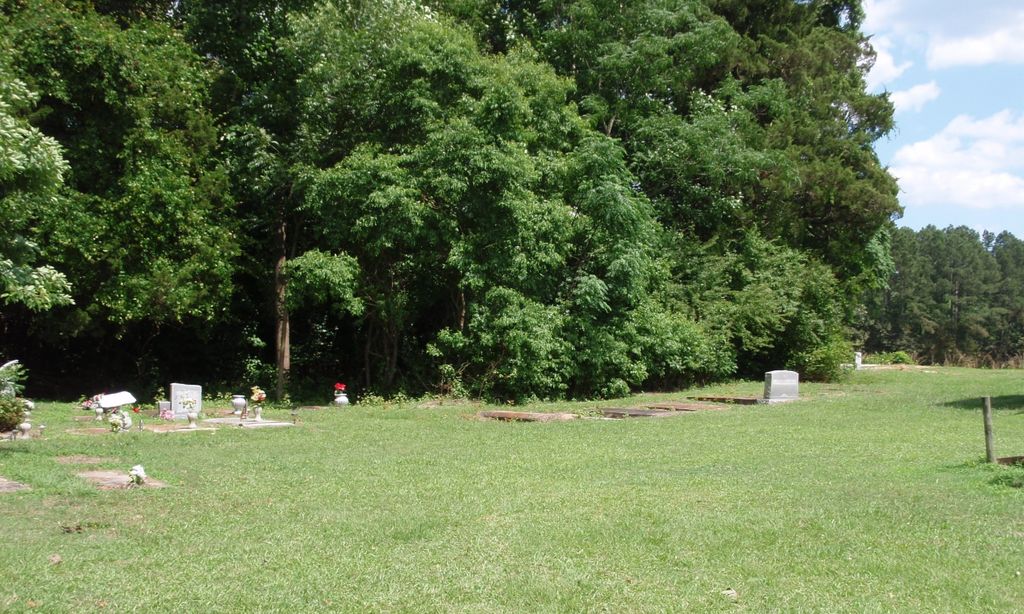
| Memorials | : | 70 |
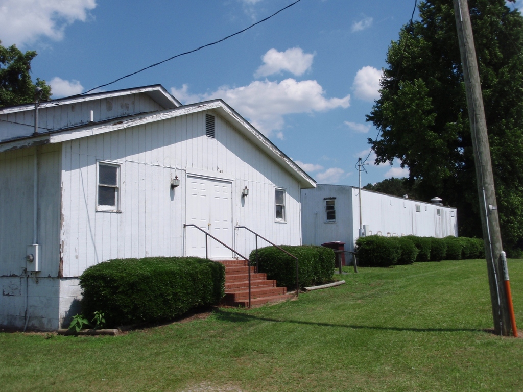
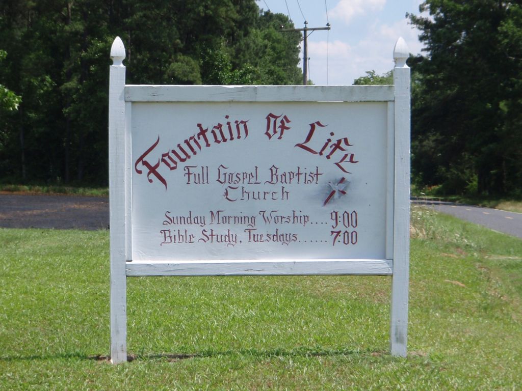
| Location | : | Roper, Washington County, USA |
| Coordinate | : | 35.9190210, -76.6291450 |
| Description | : | May have been previously known as Mount Delane Church Cemetery. |
frequently asked questions (FAQ):
-
Where is Fountain of Life Baptist Church Cemetery?
Fountain of Life Baptist Church Cemetery is located at Roper, Washington County ,North Carolina ,USA.
-
Fountain of Life Baptist Church Cemetery cemetery's updated grave count on graveviews.com?
70 memorials
-
Where are the coordinates of the Fountain of Life Baptist Church Cemetery?
Latitude: 35.9190210
Longitude: -76.6291450
Nearby Cemetories:
1. Joseph W. Blount Cemetery
Roper, Washington County, USA
Coordinate: 35.9175420, -76.6439460
2. Craft Family Cemetery
Roper, Washington County, USA
Coordinate: 35.9049050, -76.6230320
3. Davenport Family Cemetery
Mackeys, Washington County, USA
Coordinate: 35.9305950, -76.6118950
4. Franklin Spruill Cemetery
Mackeys, Washington County, USA
Coordinate: 35.9341100, -76.6109900
5. Bailey Swain Cemetery
Roper, Washington County, USA
Coordinate: 35.9102400, -76.6541110
6. Chesson Memorial Cemetery
Mackeys, Washington County, USA
Coordinate: 35.9173400, -76.6016250
7. Saint Luke Cemetery
Roper, Washington County, USA
Coordinate: 35.8967018, -76.6271973
8. Webb-Downing-Chesson Cemetery
Plymouth, Washington County, USA
Coordinate: 35.9177770, -76.6007480
9. Bethel Church Cemetery
Roper, Washington County, USA
Coordinate: 35.9193470, -76.5991180
10. New Bethel Church Of Christ Cemetery
Roper, Washington County, USA
Coordinate: 35.9162530, -76.5978730
11. Alfred Blount Cemetery
Roper, Washington County, USA
Coordinate: 35.8989020, -76.6095290
12. Saints Delight Church of Christ Cemetery
Plymouth, Washington County, USA
Coordinate: 35.9094150, -76.6589470
13. Norman Cemetery
Roper, Washington County, USA
Coordinate: 35.9214880, -76.5940950
14. Davis Cemetery
Lees Mill Township, Washington County, USA
Coordinate: 35.8975000, -76.6526300
15. Pleasant Grove United Medthodist Church
Pleasant Grove, Washington County, USA
Coordinate: 35.9247900, -76.5913960
16. Davenport Family Plot
Roper, Washington County, USA
Coordinate: 35.8929800, -76.6503300
17. Woodlawn Cemetery
Roper, Washington County, USA
Coordinate: 35.8935400, -76.6552930
18. Marriner-Alexander Family Cemetery
Washington County, USA
Coordinate: 35.9260450, -76.5865220
19. Henry Joseph Williams Cemetery
Roper, Washington County, USA
Coordinate: 35.8866340, -76.6077090
20. Uriah Swanner Cemetery
Roper, Washington County, USA
Coordinate: 35.9301100, -76.5849500
21. First Zion Grove Missionary Baptist Church
Roper, Washington County, USA
Coordinate: 35.9046880, -76.6721360
22. William G. Collins Cemetery
Roper, Washington County, USA
Coordinate: 35.8887210, -76.5987990
23. Christ Holiness Church Cemetery
Roper, Washington County, USA
Coordinate: 35.8807570, -76.6181670
24. Charles B Craddock Cemetery
Roper, Washington County, USA
Coordinate: 35.8988710, -76.5862420