
| Memorials | : | 0 |
| Location | : | Hart County, USA |
| Coordinate | : | 37.2030500, -86.0401800 |
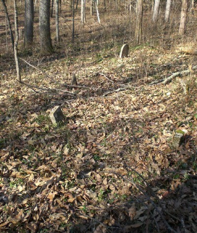
| Description | : | This cemetery is on the east side of the "old" Dennison Ferry Road; (after you turn down the road going toward the river) running from Salts Cave to Grinstead Mill. This cemetery was named by Mammoth Cave National Park. Norman Warnell hiked to this old burial ground and a quick count revealed 41 graves, and he says there is no doubt more. Note: Johnson Cemetery is south of the river from the James Keith Cemetery |
frequently asked questions (FAQ):
-
Where is Franklin Johnson Cemetery?
Franklin Johnson Cemetery is located at Hart County ,Kentucky ,USA.
-
Franklin Johnson Cemetery cemetery's updated grave count on graveviews.com?
0 memorials
-
Where are the coordinates of the Franklin Johnson Cemetery?
Latitude: 37.2030500
Longitude: -86.0401800
Nearby Cemetories:
1. Daniels Cemetery
Mammoth Cave, Edmonson County, USA
Coordinate: 37.2071991, -86.0503006
2. Bransford-Mansfield Cemetery
Mammoth Cave, Edmonson County, USA
Coordinate: 37.1964600, -86.0560900
3. Adwell Cemetery
Edmonson County, USA
Coordinate: 37.1955986, -86.0588989
4. Denison Cemetery
Brownsville, Edmonson County, USA
Coordinate: 37.2240100, -86.0520000
5. Geralds-Fitzgeralds Cemetery
Mammoth Cave, Edmonson County, USA
Coordinate: 37.1940000, -86.0690000
6. Mammoth Cave Baptist Church Cemetery
Mammoth Cave, Edmonson County, USA
Coordinate: 37.1978600, -86.0738800
7. Farmers Cemetery
Hart County, USA
Coordinate: 37.1838989, -86.0139008
8. Cutliff Cemetery
Mammoth Cave, Edmonson County, USA
Coordinate: 37.1926000, -86.0772000
9. Northtown United Baptist Church Cemetery
Horse Cave, Hart County, USA
Coordinate: 37.2165760, -86.0020980
10. Hunter Cemetery
Hart County, USA
Coordinate: 37.1800003, -86.0096970
11. Pleasant Union Cemetery
Mammoth Cave, Edmonson County, USA
Coordinate: 37.1943330, -86.0822230
12. Slemmons-Davis Cemetery
Mammoth Cave, Edmonson County, USA
Coordinate: 37.2230970, -86.0758690
13. Bransford Cemetery
Edmonson County, USA
Coordinate: 37.1997600, -86.0841000
14. Holton Cemetery
Edmonson County, USA
Coordinate: 37.2160988, -86.0888977
15. Wilson Cemetery
Mammoth Cave, Edmonson County, USA
Coordinate: 37.2084000, -86.0931000
16. New Hope Cemetery
Horse Cave, Hart County, USA
Coordinate: 37.1805500, -85.9946290
17. Eaton Cemetery
Mammoth Cave, Edmonson County, USA
Coordinate: 37.1910190, -86.0919820
18. Cox Cemetery #1
Mammoth Cave, Edmonson County, USA
Coordinate: 37.1663600, -86.0695400
19. White Oak Cemetery
Mammoth Cave, Edmonson County, USA
Coordinate: 37.2396690, -86.0696950
20. Keith Cemetery
Edmonson County, USA
Coordinate: 37.2320100, -86.0810100
21. Little Jordan Cemetery
Mammoth Cave, Edmonson County, USA
Coordinate: 37.2332993, -86.0800018
22. Cox Cemetery #2
Barren County, USA
Coordinate: 37.1558800, -86.0551200
23. Little Hope Cemetery
Park City, Barren County, USA
Coordinate: 37.1536280, -86.0564820
24. Pleasant View United Baptist Church Cemetery
Kessinger, Hart County, USA
Coordinate: 37.2171510, -85.9762440