
| Memorials | : | 1 |
| Location | : | Freedhem, Morrison County, USA |
| Coordinate | : | 46.0612907, -94.2087021 |
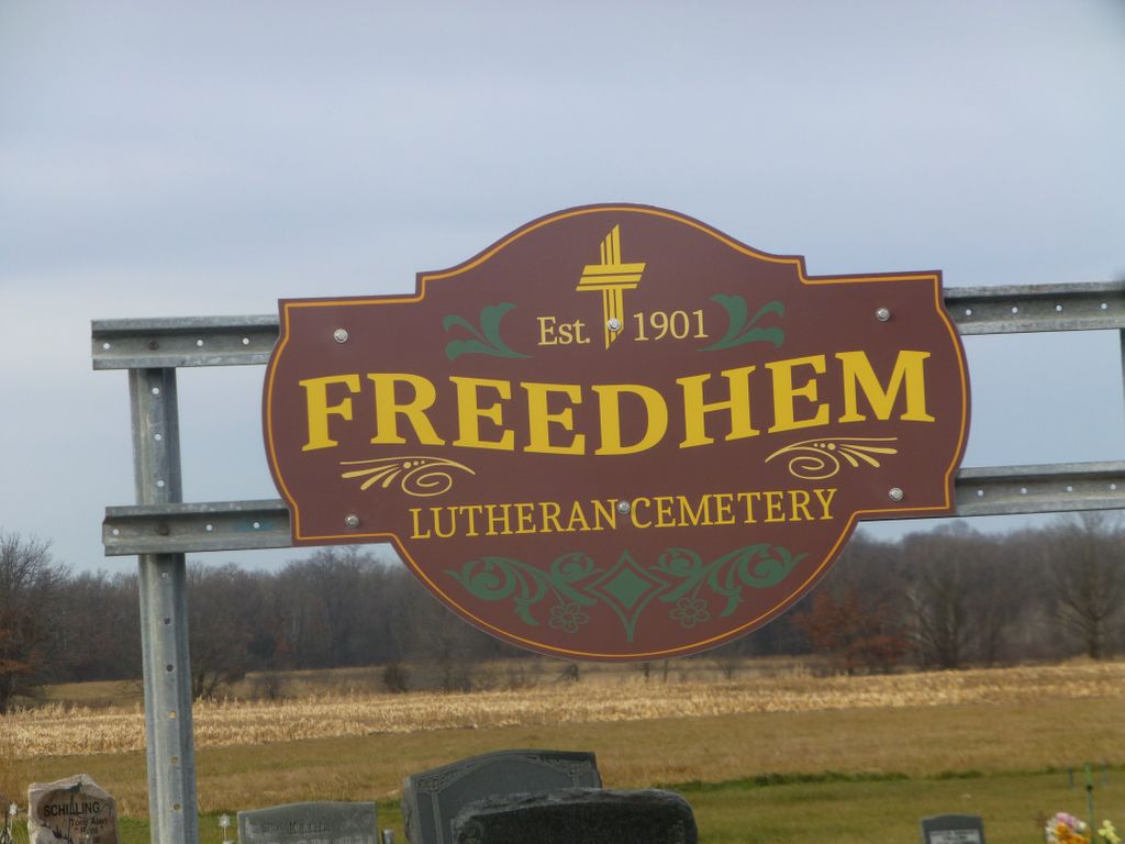
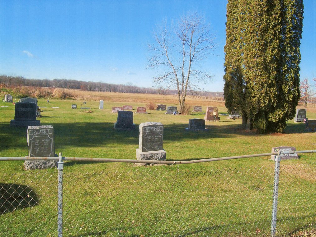
| Description | : | The Freedhem Lutheran Cemetery is located just north of the unincorporated community of Freedhem in Belle Prairie Township, Morrison County, Minnesota. The legal description is T41N-R31W-S2. This cemetery was formerly called the "Swedish Evangelical Lutheran Zion Cemetery" and the "Zion Lutheran Cemetery" plus is sometimes referred to as just the "Freedhem Cemetery." Excerpt from "History of Freedhem" by Mrs. Edwin Swanson dated May 7, 1968: "As more people moved to the little settlement of Freedhem, a need was created for a Lutheran Church in addition to the Evangelical Church already in existence. On April 27th in 1900 a meeting... Read More |
frequently asked questions (FAQ):
-
Where is Freedhem Lutheran Cemetery?
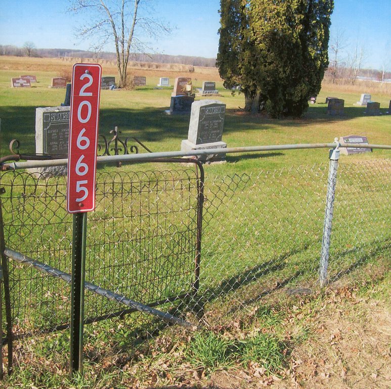
Freedhem Lutheran Cemetery is located at 20665 Jewel Road (County Road 45) Freedhem, Morrison County ,Minnesota , 56345USA.
-
Freedhem Lutheran Cemetery cemetery's updated grave count on graveviews.com?
1 memorials
-
Where are the coordinates of the Freedhem Lutheran Cemetery?
Latitude: 46.0612907
Longitude: -94.2087021
Nearby Cemetories:
1. Freedhem Free Evangelical Cemetery
Freedhem, Morrison County, USA
Coordinate: 46.0559500, -94.2069600
2. Minnesota State Veterans Cemetery
Little Falls, Morrison County, USA
Coordinate: 46.0752296, -94.3305206
3. Hamilton-Farrand Cemetery
Belle Prairie, Morrison County, USA
Coordinate: 46.0357050, -94.3374110
4. Holy Family Church Cemetery
Belle Prairie, Morrison County, USA
Coordinate: 46.0325570, -94.3377920
5. Holy Cross Cemetery
Platte, Morrison County, USA
Coordinate: 46.1042000, -94.0813620
6. Saint Marys Catholic Community Cemetery
Pierz, Morrison County, USA
Coordinate: 46.1093620, -94.0818390
7. Saint Johns Cemetery
Lastrup, Morrison County, USA
Coordinate: 46.0385933, -94.0603943
8. Green Prairie Cemetery
Morrison County, USA
Coordinate: 46.1022400, -94.3527800
9. Saint Josephs Catholic Cemetery
Pierz, Morrison County, USA
Coordinate: 45.9803700, -94.1013700
10. Calvary Cemetery
Little Falls, Morrison County, USA
Coordinate: 45.9914017, -94.3442001
11. Pine Grove Cemetery
Crow Wing County, USA
Coordinate: 46.1713000, -94.2725000
12. Fish Lake Cemetery
Darling, Morrison County, USA
Coordinate: 46.0637900, -94.3893300
13. Holy Cross Church Cemetery
Pierz, Morrison County, USA
Coordinate: 46.1137400, -94.0408200
14. Oakland Cemetery
Little Falls, Morrison County, USA
Coordinate: 45.9650002, -94.3497009
15. Saint Marys Cemetery
Little Falls, Morrison County, USA
Coordinate: 45.9618988, -94.3494034
16. Saint Adelbert's Cemetery
Little Falls, Morrison County, USA
Coordinate: 45.9583015, -94.3480988
17. Franciscan Sisters Convent Cemetery
Little Falls, Morrison County, USA
Coordinate: 45.9629100, -94.3618200
18. Swedish Mission Church Cemetery
Morrison County, USA
Coordinate: 46.0283012, -94.4169006
19. Fort Ripley Cemetery
Fort Ripley, Crow Wing County, USA
Coordinate: 46.1761000, -94.3615700
20. Pine Tree Cemetery
Morrison County, USA
Coordinate: 46.0416985, -93.9781036
21. Saint Mathias Catholic Cemetery
Saint Mathias, Crow Wing County, USA
Coordinate: 46.2200000, -94.2517000
22. Riverside Cemetery
Crow Wing County, USA
Coordinate: 46.2224998, -94.1893997
23. Pine Tree Cemetery
Crow Wing County, USA
Coordinate: 46.2122000, -94.1214000
24. Darling Cemetery
Little Falls, Morrison County, USA
Coordinate: 46.0343000, -94.4430100