
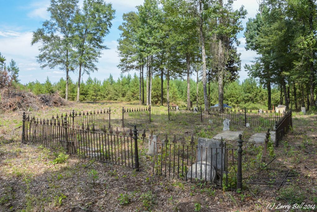
| Memorials | : | 0 |
| Location | : | Barlow Bend, Clarke County, USA |
| Coordinate | : | 31.4564250, -87.6367060 |
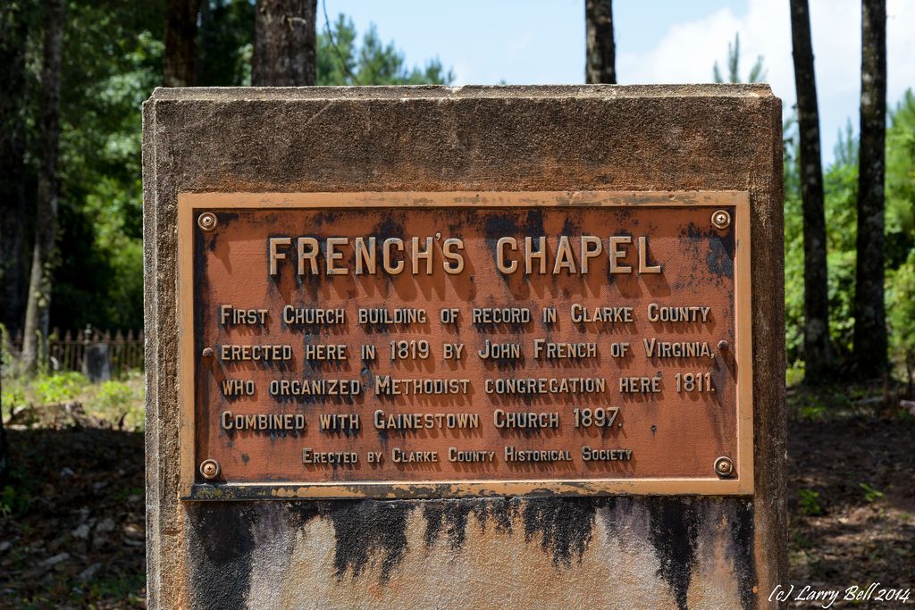
| Description | : | After the Indian wars, settlement increased in the area of Barlows Bend. John French, a Methodist minister from Virginia, settled in this area, approximately five miles upriver from Gainestown, in 1811. In 1819 he built a church called French's Chapel on the public road in the area. Until the Civil War, the settlement near the church was also known as French's Chapel |
frequently asked questions (FAQ):
-
Where is French's Chapel Cemetery?
French's Chapel Cemetery is located at Barlow Bend, Clarke County ,Alabama ,USA.
-
French's Chapel Cemetery cemetery's updated grave count on graveviews.com?
0 memorials
-
Where are the coordinates of the French's Chapel Cemetery?
Latitude: 31.4564250
Longitude: -87.6367060


Nearby Cemetories:
1. Union Chapel Cemetery
Barlow Bend, Clarke County, USA
Coordinate: 31.4599330, -87.6335980
2. Caller Cemetery
Barlow Bend, Clarke County, USA
Coordinate: 31.4921560, -87.6562300
3. Good Hope AME Church Cemetery
Gainestown, Clarke County, USA
Coordinate: 31.4508950, -87.6933170
4. James Landing Cemetery
Barlow Bend, Clarke County, USA
Coordinate: 31.4925003, -87.5982971
5. Norris Cemetery
Gainestown, Clarke County, USA
Coordinate: 31.4425170, -87.6937670
6. Sunflower Baptist Church Cemetery
Jeddo, Monroe County, USA
Coordinate: 31.4060185, -87.5825572
7. George R. Hendree Gravesite
Gainestown Landing, Clarke County, USA
Coordinate: 31.4079000, -87.6982900
8. Rodger Temple A.O.H. Church of God Cemetery
Gainestown, Clarke County, USA
Coordinate: 31.4694090, -87.7257880
9. A.O.H. Church Cemetery
Gainestown, Clarke County, USA
Coordinate: 31.4693990, -87.7258470
10. Scott-English Cemetery
Eliska, Monroe County, USA
Coordinate: 31.3786460, -87.6494410
11. Antioch AME Church Cemetery
Gainestown, Clarke County, USA
Coordinate: 31.4559400, -87.7300890
12. Road Cemetery
Clarke County, USA
Coordinate: 31.4955997, -87.7213974
13. Grove Hill Baptist Cemetery
Uriah, Monroe County, USA
Coordinate: 31.3714580, -87.6474320
14. Slaughter Cemetery
Monroe County, USA
Coordinate: 31.4262100, -87.5418100
15. Shiloh Missionary Baptist Church Cemetery
Frisco City, Monroe County, USA
Coordinate: 31.4209150, -87.5431760
16. Rocky Hill Cemetery
Uriah, Monroe County, USA
Coordinate: 31.3898440, -87.5696690
17. Dunn Cemetery
Uriah, Monroe County, USA
Coordinate: 31.3846040, -87.5769190
18. Morning Star Baptist Church Cemetery
Beatrice, Monroe County, USA
Coordinate: 31.3656940, -87.6198940
19. Evan Austill Burial Ground
Gainestown, Clarke County, USA
Coordinate: 31.5225560, -87.7188330
20. Saint James A.M.E. Church Cemetery
Jackson, Clarke County, USA
Coordinate: 31.4198470, -87.7447990
21. Little Burrah Baptist Church Cemetery
Manila, Clarke County, USA
Coordinate: 31.5161908, -87.7355538
22. New Saint Matthew Baptist Church Cemetery
Jackson, Clarke County, USA
Coordinate: 31.4428800, -87.7570990
23. New Saint Matthew Baptist Cemetery
Clarke County, USA
Coordinate: 31.4428910, -87.7572300
24. Gainestown Methodist Church Cemetery
Clarke County, USA
Coordinate: 31.4906930, -87.7521120