
| Memorials | : | 0 |
| Location | : | Jeddo, Monroe County, USA |
| Coordinate | : | 31.4060185, -87.5825572 |
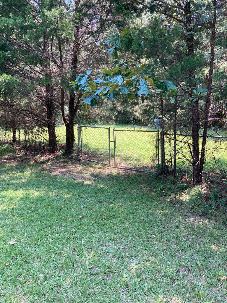
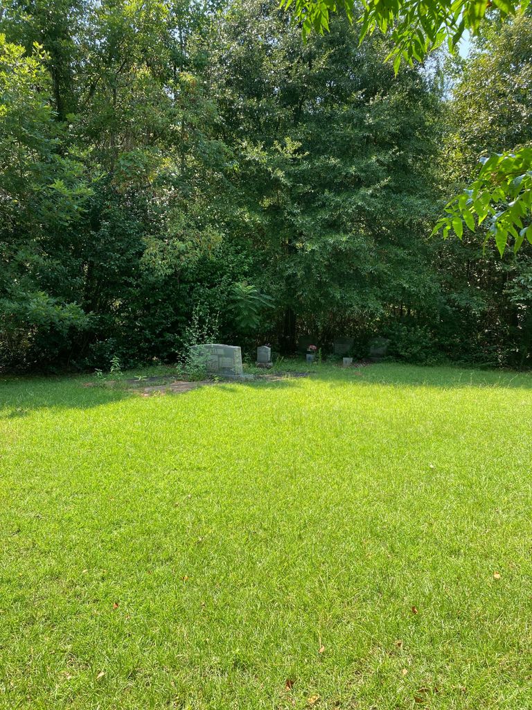
| Description | : | Sunflower Baptist Church was closed in the early 21st century. The land where the structure once sat was sold, but an acre was kept to house a cemetery. The cemetery is fenced in and sits alongside Bailey Creek Road. Sunflower Baptist Church, no longer active; 10 marked and several unmarked graves; first known interment: Walter Martin (1913-1919); Banks, Barnes, Bradley and James are common to this cemetery. |
frequently asked questions (FAQ):
-
Where is Sunflower Baptist Church Cemetery?
Sunflower Baptist Church Cemetery is located at Jeddo, Monroe County ,Alabama ,USA.
-
Sunflower Baptist Church Cemetery cemetery's updated grave count on graveviews.com?
0 memorials
-
Where are the coordinates of the Sunflower Baptist Church Cemetery?
Latitude: 31.4060185
Longitude: -87.5825572
Nearby Cemetories:
1. Rocky Hill Cemetery
Uriah, Monroe County, USA
Coordinate: 31.3898440, -87.5696690
2. Dunn Cemetery
Uriah, Monroe County, USA
Coordinate: 31.3846040, -87.5769190
3. Shiloh Missionary Baptist Church Cemetery
Frisco City, Monroe County, USA
Coordinate: 31.4209150, -87.5431760
4. Slaughter Cemetery
Monroe County, USA
Coordinate: 31.4262100, -87.5418100
5. Morning Star Baptist Church Cemetery
Beatrice, Monroe County, USA
Coordinate: 31.3656940, -87.6198940
6. Scott-English Cemetery
Eliska, Monroe County, USA
Coordinate: 31.3786460, -87.6494410
7. Grove Hill Baptist Cemetery
Uriah, Monroe County, USA
Coordinate: 31.3714580, -87.6474320
8. French's Chapel Cemetery
Barlow Bend, Clarke County, USA
Coordinate: 31.4564250, -87.6367060
9. Union Chapel Cemetery
Barlow Bend, Clarke County, USA
Coordinate: 31.4599330, -87.6335980
10. Pleasant Hill Cemetery
Frisco City, Monroe County, USA
Coordinate: 31.4180370, -87.4954900
11. Macedonia Baptist Church Cemetery
Frisco City, Monroe County, USA
Coordinate: 31.4250180, -87.4940550
12. Qualls Cemetery
Monroe County, USA
Coordinate: 31.3258030, -87.5949920
13. James Landing Cemetery
Barlow Bend, Clarke County, USA
Coordinate: 31.4925003, -87.5982971
14. Polar Bridge Cemetery
Manistee, Monroe County, USA
Coordinate: 31.4452200, -87.4848190
15. Macedonia Church Cemetery
Manistee, Monroe County, USA
Coordinate: 31.4379530, -87.4802680
16. Saint Paul Baptist Church Cemetery
Monroe County, USA
Coordinate: 31.3291600, -87.5181090
17. Poplar Springs Cemetery
Uriah, Monroe County, USA
Coordinate: 31.3322060, -87.5104460
18. George R. Hendree Gravesite
Gainestown Landing, Clarke County, USA
Coordinate: 31.4079000, -87.6982900
19. Eliska Community Cemetery
Eliska, Monroe County, USA
Coordinate: 31.3531250, -87.6809780
20. Mount Pleasant Methodist Church Cemetery
Eliska, Monroe County, USA
Coordinate: 31.3524500, -87.6831400
21. Norris Cemetery
Gainestown, Clarke County, USA
Coordinate: 31.4425170, -87.6937670
22. Weatherford Cemetery
Mineola, Monroe County, USA
Coordinate: 31.3281002, -87.6607971
23. Good Hope AME Church Cemetery
Gainestown, Clarke County, USA
Coordinate: 31.4508950, -87.6933170
24. Caller Cemetery
Barlow Bend, Clarke County, USA
Coordinate: 31.4921560, -87.6562300