
| Memorials | : | 23 |
| Location | : | Basel, Basel-Stadt, Switzerland |
| Coordinate | : | 47.5618166, 7.5855743 |
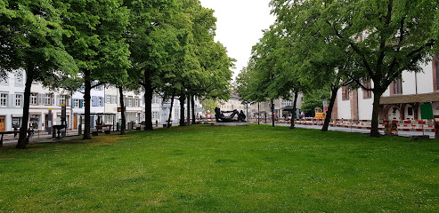
| Description | : | auch bekannt als: Predigerkirche (Christkatholische Kirche) Im 13. Jahrhundert gründeten Dominikaner das Predigerkloster. Die Kirche steht heute noch und gehört der Christkatholischen Kirche. Zum Kloster gehörte auch ein neben der Kirche liegender Friedhof, der seit dem 13. Jahrhundert benutzt wurde. Um 1440 wurde auf der Innenseite der Friedhofsmauer ein Fresko des Totentanzes gemalt (wohl von Konrad Witz und dessen Malerschule). 1805 wurde diese Mauer und Teile des Friedhofs von Basler Bewohnern zerstört. Entlang der Kirchenmauer wurde dann ein neues Gräberfeld eingerichtet. 1845 wurden dann auch diese Gräber durch die Erweiterung der Lottergasse (heutige Spitalstrasse) aufgehoben. Ob und wohin die sterblichen Überreste umgebettet... Read More |
frequently asked questions (FAQ):
-
Where is Friedhof am Totentanz?
Friedhof am Totentanz is located at Spitalstrasse Basel, Basel-Stadt ,Basel-Stadt , 4056Switzerland.
-
Friedhof am Totentanz cemetery's updated grave count on graveviews.com?
1 memorials
-
Where are the coordinates of the Friedhof am Totentanz?
Latitude: 47.5618166
Longitude: 7.5855743
Nearby Cemetories:
1. Basler Münster
Basel, Basel-Stadt, Switzerland
Coordinate: 47.5566670, 7.5922220
2. Leonhardskirche
Basel, Basel-Stadt, Switzerland
Coordinate: 47.5551000, 7.5881900
3. Theodorskirche Basel
Basel, Basel-Stadt, Switzerland
Coordinate: 47.5588228, 7.5976043
4. Johanniterkapelle
Basel, Basel-Stadt, Switzerland
Coordinate: 47.5666670, 7.6000000
5. Sankt Alban-Kirchhof
Basel, Basel-Stadt, Switzerland
Coordinate: 47.5543710, 7.6005430
6. Friedhof der Israelitischen Gemeinde Basel
Basel, Basel-Stadt, Switzerland
Coordinate: 47.5671720, 7.5587700
7. Friedhof Sankt Margarethen Nord
Binningen, Bezirk Arlesheim, Switzerland
Coordinate: 47.5411518, 7.5790710
8. Friedhof Sankt Margarethen Süd
Binningen, Bezirk Arlesheim, Switzerland
Coordinate: 47.5390593, 7.5789665
9. Wolfgottesacker
Basel, Basel-Stadt, Switzerland
Coordinate: 47.5422950, 7.6078610
10. Cimetière de Bourgfelden
Saint-Louis, Departement du Haut-Rhin, France
Coordinate: 47.5742616, 7.5476239
11. Friedhof Birsfelden
Birsfelden, Bezirk Arlesheim, Switzerland
Coordinate: 47.5547380, 7.6279848
12. Friedhof Allschwil
Allschwil, Bezirk Arlesheim, Switzerland
Coordinate: 47.5539733, 7.5369169
13. Friedhof am Hörnli
Riehen, Basel-Stadt, Switzerland
Coordinate: 47.5649500, 7.6401200
14. Cimetière Centre
Saint-Louis, Departement du Haut-Rhin, France
Coordinate: 47.5939100, 7.5541000
15. Friedhof Schönenberg (Bottmingen)
Bottmingen, Bezirk Arlesheim, Switzerland
Coordinate: 47.5204770, 7.5802441
16. Friedhof Weil am Rhein
Weil am Rhein, Landkreis Lörrach, Germany
Coordinate: 47.5983359, 7.6277804
17. Friedhof Grenzach
Grenzach-Wyhlen, Landkreis Lörrach, Germany
Coordinate: 47.5560553, 7.6589719
18. Bettinger Friedhof
Bettingen, Basel-Stadt, Switzerland
Coordinate: 47.5717926, 7.6624535
19. Friedhof Obertüllingen
Lörrach, Landkreis Lörrach, Germany
Coordinate: 47.5989624, 7.6419570
20. Friedhof Münchenstein
Münchenstein, Bezirk Arlesheim, Switzerland
Coordinate: 47.5136401, 7.6219269
21. Gottesacker Riehen
Riehen, Basel-Stadt, Switzerland
Coordinate: 47.5911051, 7.6552329
22. Friedhof Muttenz
Muttenz, Bezirk Arlesheim, Switzerland
Coordinate: 47.5232989, 7.6484997
23. Friedhof Haltingen
Weil am Rhein, Landkreis Lörrach, Germany
Coordinate: 47.6143892, 7.6227533
24. Friedhof Wyhlen
Grenzach-Wyhlen, Landkreis Lörrach, Germany
Coordinate: 47.5499337, 7.6812985