
| Memorials | : | 122 |
| Location | : | Basel, Basel-Stadt, Switzerland |
| Coordinate | : | 47.5543710, 7.6005430 |
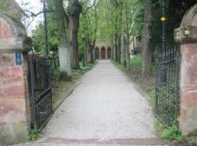
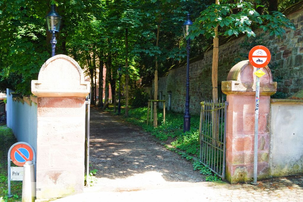
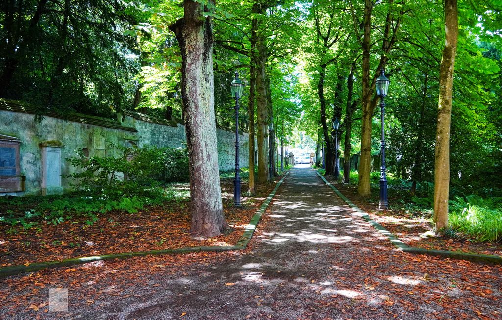
| Description | : | Saint Alban Church Monastery and Cemetery was first established in the early 9th century. The church was expanded in 1083 to be the first monastery in the city of Basil. Today's main structure dates from 1260. It was reconstructed several times rebuilding the design in 1845 by Jakob Stehin. The church was a Roman Catholic Abbey until the Evangelical Reformation in 1529. The last reconstruction was in 1911. The cemetery is located in the front of the church and is the oldest cemetery in Basel. The cemetery is enclosed by a high red-brick wall with a... Read More |
frequently asked questions (FAQ):
-
Where is Sankt Alban-Kirchhof?
Sankt Alban-Kirchhof is located at St. Alban-Rhienueg 64 Basel, Basel-Stadt ,Basel-Stadt ,Switzerland.
-
Sankt Alban-Kirchhof cemetery's updated grave count on graveviews.com?
0 memorials
-
Where are the coordinates of the Sankt Alban-Kirchhof?
Latitude: 47.5543710
Longitude: 7.6005430
Nearby Cemetories:
1. Theodorskirche Basel
Basel, Basel-Stadt, Switzerland
Coordinate: 47.5588228, 7.5976043
2. Basler Münster
Basel, Basel-Stadt, Switzerland
Coordinate: 47.5566670, 7.5922220
3. Leonhardskirche
Basel, Basel-Stadt, Switzerland
Coordinate: 47.5551000, 7.5881900
4. Johanniterkapelle
Basel, Basel-Stadt, Switzerland
Coordinate: 47.5666670, 7.6000000
5. Friedhof am Totentanz
Basel, Basel-Stadt, Switzerland
Coordinate: 47.5618166, 7.5855743
6. Wolfgottesacker
Basel, Basel-Stadt, Switzerland
Coordinate: 47.5422950, 7.6078610
7. Friedhof Birsfelden
Birsfelden, Bezirk Arlesheim, Switzerland
Coordinate: 47.5547380, 7.6279848
8. Friedhof Sankt Margarethen Nord
Binningen, Bezirk Arlesheim, Switzerland
Coordinate: 47.5411518, 7.5790710
9. Friedhof Sankt Margarethen Süd
Binningen, Bezirk Arlesheim, Switzerland
Coordinate: 47.5390593, 7.5789665
10. Friedhof am Hörnli
Riehen, Basel-Stadt, Switzerland
Coordinate: 47.5649500, 7.6401200
11. Friedhof der Israelitischen Gemeinde Basel
Basel, Basel-Stadt, Switzerland
Coordinate: 47.5671720, 7.5587700
12. Friedhof Schönenberg (Bottmingen)
Bottmingen, Bezirk Arlesheim, Switzerland
Coordinate: 47.5204770, 7.5802441
13. Friedhof Grenzach
Grenzach-Wyhlen, Landkreis Lörrach, Germany
Coordinate: 47.5560553, 7.6589719
14. Cimetière de Bourgfelden
Saint-Louis, Departement du Haut-Rhin, France
Coordinate: 47.5742616, 7.5476239
15. Friedhof Allschwil
Allschwil, Bezirk Arlesheim, Switzerland
Coordinate: 47.5539733, 7.5369169
16. Friedhof Münchenstein
Münchenstein, Bezirk Arlesheim, Switzerland
Coordinate: 47.5136401, 7.6219269
17. Friedhof Muttenz
Muttenz, Bezirk Arlesheim, Switzerland
Coordinate: 47.5232989, 7.6484997
18. Bettinger Friedhof
Bettingen, Basel-Stadt, Switzerland
Coordinate: 47.5717926, 7.6624535
19. Friedhof Weil am Rhein
Weil am Rhein, Landkreis Lörrach, Germany
Coordinate: 47.5983359, 7.6277804
20. Cimetière Centre
Saint-Louis, Departement du Haut-Rhin, France
Coordinate: 47.5939100, 7.5541000
21. Gottesacker Riehen
Riehen, Basel-Stadt, Switzerland
Coordinate: 47.5911051, 7.6552329
22. Friedhof Obertüllingen
Lörrach, Landkreis Lörrach, Germany
Coordinate: 47.5989624, 7.6419570
23. Friedhof Wyhlen
Grenzach-Wyhlen, Landkreis Lörrach, Germany
Coordinate: 47.5499337, 7.6812985
24. Friedhof Haltingen
Weil am Rhein, Landkreis Lörrach, Germany
Coordinate: 47.6143892, 7.6227533