
| Memorials | : | 0 |
| Location | : | Landkreis Uckermark, Germany |
| Coordinate | : | 53.1334190, 13.3678320 |
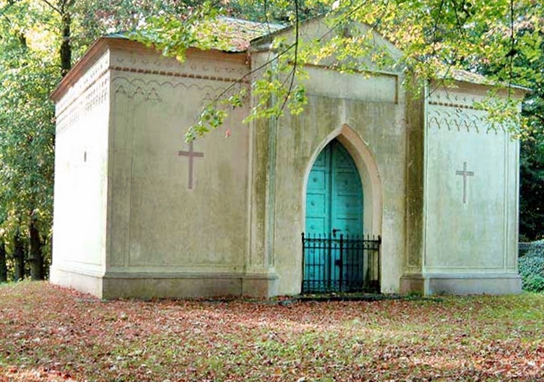
| Description | : | The cemetery in the village of Annenwalde was opened in 1860. There used to be an older cemetery in the village surrounding the church, but that one is long gone. Annenwalde is now part of the city of Templin. _______________________________________________ (Cemetery Administration) Friedhofsverwaltung Bahnhofstr. 3 17268 Templin There are several cemeteries in the city of Templin: ► Waldfriedhof Templin ► Sankt-Georgen-Friedhof Templin ► Jüdischer Friedhof Templin (Jewish Cemetery) ► Friedhof der Evangelischen Kirchengemeinde Templin (Lutheran Cemetery) ► Gemeindefriedhof Vietmannsdorf ► Kirchhof Vietmannsdorf (defunct) ► Friedhof Annenwalde ► Friedhof Gollin ► Kirchhof Gross Dölln ► Neuer Friedhof Gross Dölln ► Friedhof Petznick ► Friedhof Röddelin ► Kirchhof Storkow (closed in 1902) ► Kirchhof Herzfelde ► Neuer Friedhof Herzfelde |
frequently asked questions (FAQ):
-
Where is Friedhof Annenwalde?
Friedhof Annenwalde is located at Village of Annenwalde Landkreis Uckermark ,Brandenburg ,Germany.
-
Friedhof Annenwalde cemetery's updated grave count on graveviews.com?
0 memorials
-
Where are the coordinates of the Friedhof Annenwalde?
Latitude: 53.1334190
Longitude: 13.3678320
Nearby Cemetories:
1. Waldfriedhof Templin
Templin, Landkreis Uckermark, Germany
Coordinate: 53.1188210, 13.4841480
2. Sankt-Georgen-Friedhof Templin
Landkreis Uckermark, Germany
Coordinate: 53.1169380, 13.4978460
3. Gemeindefriedhof Vietmannsdorf
Templin, Landkreis Uckermark, Germany
Coordinate: 53.0481440, 13.5283970
4. Ravensbruck Concentration Camp
Ravensbrück, Landkreis Oberhavel, Germany
Coordinate: 53.1913890, 13.1597220
5. Friedhof Petznick
Templin, Landkreis Uckermark, Germany
Coordinate: 53.1610640, 13.6275470
6. Gollin Friedhof in Templin
Templin, Landkreis Uckermark, Germany
Coordinate: 53.0494920, 13.6043030
7. Neuer Friedhof Gross Dölln
Landkreis Uckermark, Germany
Coordinate: 52.9912890, 13.5218630
8. Schloss Boitzenburg
Lychen, Landkreis Uckermark, Germany
Coordinate: 53.2599000, 13.6078400
9. Friedhof Feldberg
Feldberg, Landkreis Mecklenburgische Seenplatte, Germany
Coordinate: 53.3371178, 13.4253794
10. Friedhof Wüste Kirche
Gerswalde, Landkreis Uckermark, Germany
Coordinate: 53.1456000, 13.7552200
11. Friedhof
Gross Quassow, Landkreis Mecklenburgische Seenplatte, Germany
Coordinate: 53.0000000, 13.0000000
12. Below
Below (Wesenberg), Landkreis Mecklenburgische Seenplatte, Germany
Coordinate: 53.2959816, 13.0173013
13. Neuer Friedhof
Neustrelitz, Landkreis Mecklenburgische Seenplatte, Germany
Coordinate: 53.3719020, 13.0727480
14. Friedhof Rehberg
Rehberg, Landkreis Mecklenburgische Seenplatte, Germany
Coordinate: 53.4427240, 13.4637019
15. Friedhof Friedrichsthal
Oranienburg, Landkreis Oberhavel, Germany
Coordinate: 52.7972732, 13.2800752
16. Friedhof Friedrichsthal
Friedrichsthal, Landkreis Oberhavel, Germany
Coordinate: 52.7966422, 13.2799013
17. Städtischer Friedhof Prenzlau
Prenzlau, Landkreis Uckermark, Germany
Coordinate: 53.3064100, 13.8671260
18. Jüdischer Friedhof Prenzlau
Prenzlau, Landkreis Uckermark, Germany
Coordinate: 53.3136710, 13.8657590
19. Dorfkirche Zehlendorf
Oranienburg, Landkreis Oberhavel, Germany
Coordinate: 52.7839005, 13.3867410
20. Dorfkirche Zehlendorf / Oranienburg
Oranienburg, Landkreis Oberhavel, Germany
Coordinate: 52.7839005, 13.3867410
21. Kirchlicher Friedhof
Ellingen, Landkreis Uckermark, Germany
Coordinate: 53.3483320, 13.8334640
22. Lichterfelde im Barnim
Lichterfelde, Landkreis Barnim, Germany
Coordinate: 52.8692265, 13.7575937
23. Johanniterkirche in Mirow
Mirow, Landkreis Mecklenburgische Seenplatte, Germany
Coordinate: 53.2762947, 12.8104773
24. Campo Santo Radensleben
Neuruppin, Landkreis Ostprignitz-Ruppin, Germany
Coordinate: 52.8829370, 12.9114790