
| Memorials | : | 0 |
| Location | : | Templin, Landkreis Uckermark, Germany |
| Coordinate | : | 53.0481440, 13.5283970 |
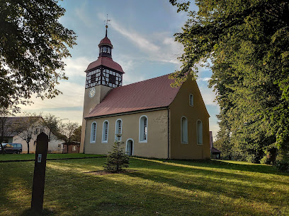
| Description | : | There used to be an older cemetery, located around the village church (Kirchhof Vietmannsdorf), but that one is disappeared and the newer community cemetery (Gemeindefriedhof) was established in the middle of the 20th century. ______________________________________________ (Cemetery Administration) Friedhofsverwaltung Bahnhofstr. 3 17268 Templin There are several cemeteries in the city of Templin: ► Waldfriedhof Templin ► Sankt-Georgen-Friedhof Templin ► Jüdischer Friedhof Templin (Jewish Cemetery) ► Friedhof der Evangelischen Kirchengemeinde Templin (Lutheran Cemetery) ► Gemeindefriedhof Vietmannsdorf ► Kirchhof Vietmannsdorf (defunct) ► Friedhof Annenwalde ► Friedhof Gollin ► Kirchhof Gross Dölln ► Neuer Friedhof Gross Dölln ► Friedhof Petznick ► Friedhof Röddelin ► Kirchhof Storkow (closed in 1902) ► Kirchhof Herzfelde ► Neuer Friedhof Herzfelde |
frequently asked questions (FAQ):
-
Where is Gemeindefriedhof Vietmannsdorf?
Gemeindefriedhof Vietmannsdorf is located at Village of Vietmannsdorf Templin, Landkreis Uckermark ,Brandenburg ,Germany.
-
Gemeindefriedhof Vietmannsdorf cemetery's updated grave count on graveviews.com?
0 memorials
-
Where are the coordinates of the Gemeindefriedhof Vietmannsdorf?
Latitude: 53.0481440
Longitude: 13.5283970
Nearby Cemetories:
1. Gollin Friedhof in Templin
Templin, Landkreis Uckermark, Germany
Coordinate: 53.0494920, 13.6043030
2. Neuer Friedhof Gross Dölln
Landkreis Uckermark, Germany
Coordinate: 52.9912890, 13.5218630
3. Sankt-Georgen-Friedhof Templin
Landkreis Uckermark, Germany
Coordinate: 53.1169380, 13.4978460
4. Waldfriedhof Templin
Templin, Landkreis Uckermark, Germany
Coordinate: 53.1188210, 13.4841480
5. Friedhof Petznick
Templin, Landkreis Uckermark, Germany
Coordinate: 53.1610640, 13.6275470
6. Friedhof Annenwalde
Landkreis Uckermark, Germany
Coordinate: 53.1334190, 13.3678320
7. Friedhof Wüste Kirche
Gerswalde, Landkreis Uckermark, Germany
Coordinate: 53.1456000, 13.7552200
8. Schloss Boitzenburg
Lychen, Landkreis Uckermark, Germany
Coordinate: 53.2599000, 13.6078400
9. Lichterfelde im Barnim
Lichterfelde, Landkreis Barnim, Germany
Coordinate: 52.8692265, 13.7575937
10. Ravensbruck Concentration Camp
Ravensbrück, Landkreis Oberhavel, Germany
Coordinate: 53.1913890, 13.1597220
11. Dorfkirche Zehlendorf
Oranienburg, Landkreis Oberhavel, Germany
Coordinate: 52.7839005, 13.3867410
12. Dorfkirche Zehlendorf / Oranienburg
Oranienburg, Landkreis Oberhavel, Germany
Coordinate: 52.7839005, 13.3867410
13. Jüdischer Friedhof Biesenthal
Biesenthal, Landkreis Barnim, Germany
Coordinate: 52.7657400, 13.6441300
14. Friedhof Friedrichsthal
Oranienburg, Landkreis Oberhavel, Germany
Coordinate: 52.7972732, 13.2800752
15. Friedhof Friedrichsthal
Friedrichsthal, Landkreis Oberhavel, Germany
Coordinate: 52.7966422, 13.2799013
16. Friedhof Biesenthal
Biesenthal, Landkreis Barnim, Germany
Coordinate: 52.7624645, 13.6349141
17. Friedhof Biesenthal
Biesenthal, Landkreis Barnim, Germany
Coordinate: 52.7624468, 13.6353281
18. Friedhof Feldberg
Feldberg, Landkreis Mecklenburgische Seenplatte, Germany
Coordinate: 53.3371178, 13.4253794
19. Friedhof Angermünde
Angermünde, Landkreis Uckermark, Germany
Coordinate: 53.0166986, 14.0213298
20. Friedhof Wandlitz
Wandlitz, Landkreis Barnim, Germany
Coordinate: 52.7470181, 13.4542665
21. Friedhof Tornow
Tornow, Landkreis Barnim, Germany
Coordinate: 52.8177674, 13.8916789
22. Friedhof
Gross Quassow, Landkreis Mecklenburgische Seenplatte, Germany
Coordinate: 53.0000000, 13.0000000
23. Sachsenhausen KZ
Oranienburg, Landkreis Oberhavel, Germany
Coordinate: 52.7658330, 13.2641670
24. Sydow Cemetery
Sydow, Landkreis Barnim, Germany
Coordinate: 52.7383835, 13.7054180