
| Memorials | : | 0 |
| Location | : | Bildechingen, Landkreis Freudenstadt, Germany |
| Website | : | www.horb.de/de/Stadt-Buerger/Rathaus/Buergerservice/Dienstleistungen-von-A-Z/Dienstleistung?view=publish&item=service&am |
| Coordinate | : | 48.4678855, 8.7171678 |
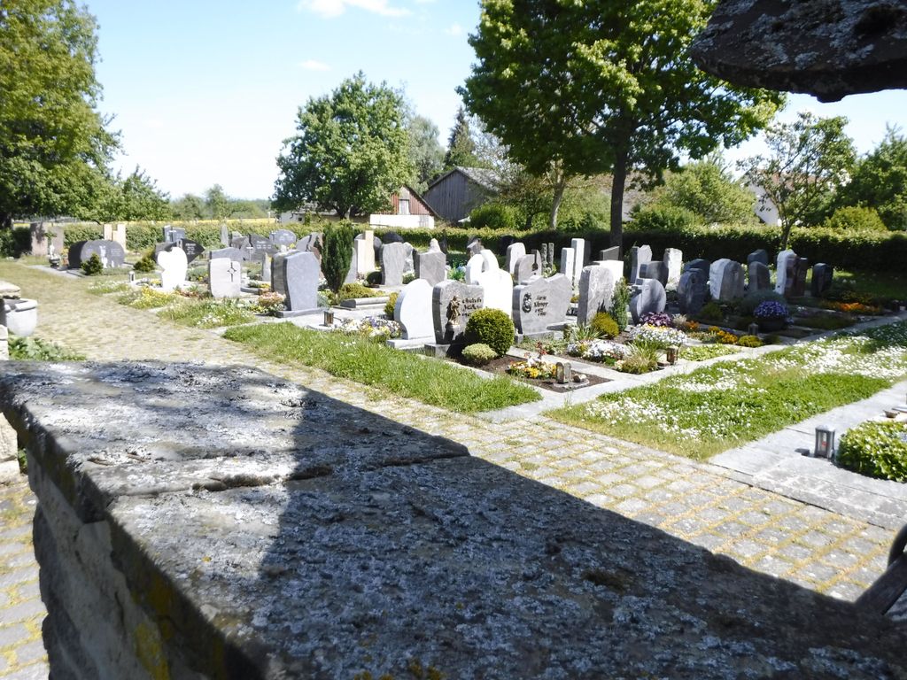
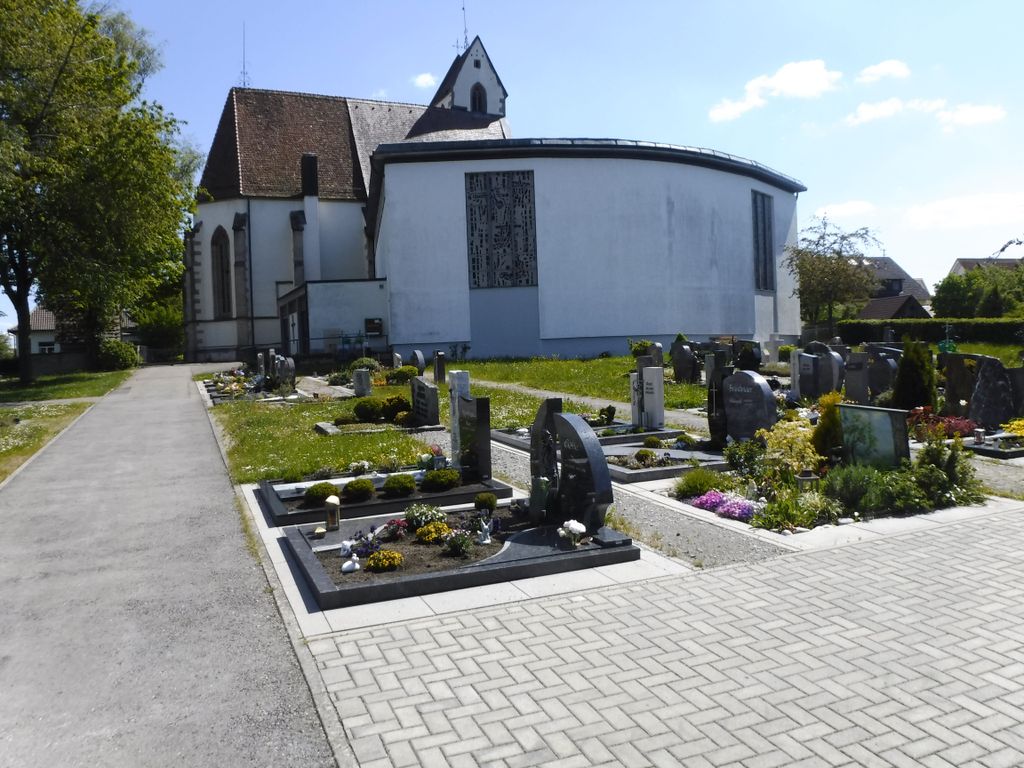
| Description | : | A large cemetery on flat ground overlooked by an ancient church. |
frequently asked questions (FAQ):
-
Where is Friedhof Bildechingen?
Friedhof Bildechingen is located at Kappelstraße 11 Bildechingen, Landkreis Freudenstadt ,Baden-Württemberg , 72160Germany.
-
Friedhof Bildechingen cemetery's updated grave count on graveviews.com?
0 memorials
-
Where are the coordinates of the Friedhof Bildechingen?
Latitude: 48.4678855
Longitude: 8.7171678
Nearby Cemetories:
1. Jüdischer Friedhof Mühlen
Horb am Neckar, Landkreis Freudenstadt, Germany
Coordinate: 48.4490920, 8.7245417
2. Friedhof Eutingen im Gäu
Eutingen, Landkreis Freudenstadt, Germany
Coordinate: 48.4728002, 8.7477544
3. Friedhof Mühlen
Horb am Neckar, Landkreis Freudenstadt, Germany
Coordinate: 48.4539360, 8.7417153
4. Jüdischer Friedhof Horb
Horb am Neckar, Landkreis Freudenstadt, Germany
Coordinate: 48.4457628, 8.7098727
5. Friedhof Horb
Horb am Neckar, Landkreis Freudenstadt, Germany
Coordinate: 48.4477181, 8.6963896
6. Friedhof Hochdorf
Hochdorf, Landkreis Calw, Germany
Coordinate: 48.4951960, 8.7291666
7. Friedhof Nordstetten
Horb am Neckar, Landkreis Freudenstadt, Germany
Coordinate: 48.4452780, 8.6911110
8. Friedhof Ahldorf
Ahldorf, Landkreis Freudenstadt, Germany
Coordinate: 48.4473771, 8.7475058
9. Jüdischer Friedhof Nordstetten
Horb am Neckar, Landkreis Freudenstadt, Germany
Coordinate: 48.4304500, 8.7073500
10. Friedhof Talheim
Horb am Neckar, Landkreis Freudenstadt, Germany
Coordinate: 48.4892300, 8.6697300
11. Friedhof Obertalheim
Obertalheim, Landkreis Freudenstadt, Germany
Coordinate: 48.4885579, 8.6624215
12. Friedhof Rohrdorf
Rohrdorf, Landkreis Freudenstadt, Germany
Coordinate: 48.4700000, 8.7812000
13. Friedhof Schietingen
Schietingen, Landkreis Calw, Germany
Coordinate: 48.5090490, 8.6998810
14. Dettensee Jüdischer Friedhof
Dettensee, Landkreis Freudenstadt, Germany
Coordinate: 48.4230546, 8.7286496
15. Friedhof Weitingen
Weitingen, Landkreis Freudenstadt, Germany
Coordinate: 48.4601357, 8.7878519
16. Friedhof Gündringen
Gündringen, Landkreis Calw, Germany
Coordinate: 48.5153060, 8.7070109
17. Friedhof Dettensee
Dettensee, Landkreis Freudenstadt, Germany
Coordinate: 48.4200053, 8.7295245
18. Jüdischer Friedhof Mühringen
Mühringen, Landkreis Freudenstadt, Germany
Coordinate: 48.4290230, 8.7621050
19. Ruhewald Horb
Horb am Neckar, Landkreis Freudenstadt, Germany
Coordinate: 48.4211948, 8.6886005
20. Friedhof Isenburg
Horb am Neckar, Landkreis Freudenstadt, Germany
Coordinate: 48.4229400, 8.6796100
21. Friedhof Ihlingen
Ihlingen, Landkreis Freudenstadt, Germany
Coordinate: 48.4320825, 8.6599926
22. Friedhof Rexingen
Horb am Neckar, Landkreis Freudenstadt, Germany
Coordinate: 48.4363800, 8.6529900
23. Friedhof Altheim
Altheim, Landkreis Freudenstadt, Germany
Coordinate: 48.4739202, 8.6373862
24. Jüdischer Friedhof Rexingen
Rexingen, Landkreis Freudenstadt, Germany
Coordinate: 48.4361870, 8.6503620