
| Memorials | : | 0 |
| Location | : | Enzklösterle, Landkreis Calw, Germany |
| Coordinate | : | 48.6694900, 8.4724800 |
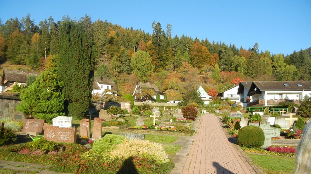
| Description | : | A medium size irregularly shaped cemetery on the sunnyside of the hill, close to the church. A giant Douglas fir tree dating from 1880 is close to the church also. |
frequently asked questions (FAQ):
-
Where is Friedhof Enzklösterle?
Friedhof Enzklösterle is located at Kirchweg Enzklösterle, Landkreis Calw ,Baden-Württemberg , 75337Germany.
-
Friedhof Enzklösterle cemetery's updated grave count on graveviews.com?
0 memorials
-
Where are the coordinates of the Friedhof Enzklösterle?
Latitude: 48.6694900
Longitude: 8.4724800
Nearby Cemetories:
1. Friedhof Mittelenztal
Mittelenztal, Landkreis Calw, Germany
Coordinate: 48.6594910, 8.4655350
2. Friedhof Aichelberg
Aichelberg, Landkreis Calw, Germany
Coordinate: 48.6643266, 8.5215422
3. Friedhof Sprollenhaus
Sprollenhaus, Landkreis Calw, Germany
Coordinate: 48.6975797, 8.5050443
4. Friedhof Hünerberg
Hünerberg, Landkreis Calw, Germany
Coordinate: 48.6745210, 8.5455630
5. Friedhof Aichhalden Oberweiler
Aichhalden, Landkreis Calw, Germany
Coordinate: 48.6412700, 8.5405750
6. Friedhof Meistern
Meistern, Landkreis Calw, Germany
Coordinate: 48.6959570, 8.5480210
7. Friedhof Simmersfeld
Simmersfeld, Landkreis Calw, Germany
Coordinate: 48.6206021, 8.5225566
8. Friedhof Fünfbronn
Fünfbronn, Landkreis Calw, Germany
Coordinate: 48.6113262, 8.4994350
9. Friedhof Eisenbach
Eisenbach, Landkreis Freudenstadt, Germany
Coordinate: 48.6007427, 8.4448525
10. Friedhof Gausbach
Gausbach, Landkreis Rastatt, Germany
Coordinate: 48.6858185, 8.3657220
11. Friedhof Ettmannsweiler
Ettmannsweiler, Landkreis Calw, Germany
Coordinate: 48.6143752, 8.5516850
12. Friedhof Besenfeld
Besenfeld, Landkreis Freudenstadt, Germany
Coordinate: 48.5993433, 8.4270908
13. Friedhof Agenbach
Agenbach, Landkreis Calw, Germany
Coordinate: 48.6926279, 8.5848604
14. Friedhof Forbach
Forbach, Landkreis Rastatt, Germany
Coordinate: 48.6800000, 8.3557400
15. Friedhof Langenbrand
Langenbrand, Landkreis Rastatt, Germany
Coordinate: 48.7075181, 8.3638096
16. Friedhof Reichental
Reichental, Landkreis Rastatt, Germany
Coordinate: 48.7298514, 8.3884400
17. Friedhof Hornberg
Hornberg, Landkreis Calw, Germany
Coordinate: 48.6236882, 8.5767553
18. Friedhof Beuren
Beuren, Landkreis Calw, Germany
Coordinate: 48.5979615, 8.5428946
19. Friedhof Neuweiler
Neuweiler, Landkreis Calw, Germany
Coordinate: 48.6533000, 8.5996700
20. Friedhof Schwarzenberg
Baiersbronn, Landkreis Freudenstadt, Germany
Coordinate: 48.6034529, 8.3894831
21. Friedhof Hochdorf
Hochdorf, Landkreis Freudenstadt, Germany
Coordinate: 48.5865782, 8.5065349
22. Friedhof Gaugenwald Zwerenberg
Zwerenberg, Landkreis Calw, Germany
Coordinate: 48.6352329, 8.5953890
23. Friedhof Au im Murgtal
Au im Murgtal, Landkreis Rastatt, Germany
Coordinate: 48.7184394, 8.3608213
24. Friedhof Göttelfingen
Göttelfingen (Seewald), Landkreis Freudenstadt, Germany
Coordinate: 48.5804406, 8.4752651