| Memorials | : | 0 |
| Location | : | Kaufbeuren, Stadtkreis Kaufbeuren, Germany |
| Coordinate | : | 47.8708740, 10.6449950 |
| Description | : | This is one of six cemeteries managed by the city of Kaufbeuren: - Waldfriedhof Kaufbeuren - Alter Friedhof Kaufbeuren - Friedhof Neugablonz - Friedhof Hirschzell - Parkfriedhof Oberbeuren - Friedhof Oberbeuren Friedhof an der Kirche Please note that the graves in Germany are not perpetual. After a certain period of repose (12-25 years) the graves are being leveled and re-used. There is no toxic embalming being done in Germany, so the coffin and the corpse have decomposed naturally. If the family of the deceased decides to purchase another period the duration can be extended by another 15 years. War Graves are considered memorials and are kept up... Read More |
frequently asked questions (FAQ):
-
Where is Friedhof Hirschzell bei Kaufbeuren?
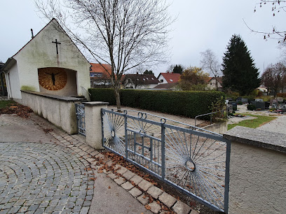
Friedhof Hirschzell bei Kaufbeuren is located at Freibergstrasse Kaufbeuren, Stadtkreis Kaufbeuren ,Bavaria (Bayern) , 87600Germany.
-
Friedhof Hirschzell bei Kaufbeuren cemetery's updated grave count on graveviews.com?
0 memorials
-
Where are the coordinates of the Friedhof Hirschzell bei Kaufbeuren?
Latitude: 47.8708740
Longitude: 10.6449950
Nearby Cemetories:
1. Alter Friedhof Kaufbeuren
Kaufbeuren, Stadtkreis Kaufbeuren, Germany
Coordinate: 47.8751920, 10.6237140
2. Waldfriedhof Kaufbeuren
Kaufbeuren, Stadtkreis Kaufbeuren, Germany
Coordinate: 47.8921620, 10.6421560
3. Friedhof Neugablonz
Kaufbeuren, Stadtkreis Kaufbeuren, Germany
Coordinate: 47.9090930, 10.6385830
4. Friedhof
Untergermaringen, Landkreis Ostallgäu, Germany
Coordinate: 47.9447845, 10.6844284
5. Friedhof Marktoberdorf
Marktoberdorf, Landkreis Ostallgäu, Germany
Coordinate: 47.7811811, 10.6221476
6. Kirche St. Pankratius
Marktoberdorf, Landkreis Ostallgäu, Germany
Coordinate: 47.7773209, 10.6147911
7. Alter Friedhof Geisenried
Geisenried, Landkreis Ostallgäu, Germany
Coordinate: 47.7701164, 10.5614843
8. Friedhof Unterthingau
Unterthingau, Landkreis Ostallgäu, Germany
Coordinate: 47.7717442, 10.5076258
9. Friedhof Bad Wörishofen
Bad Wörishofen, Landkreis Unterallgäu, Germany
Coordinate: 48.0025580, 10.5952500
10. Friedhof Oberthingau
Oberthingau, Landkreis Ostallgäu, Germany
Coordinate: 47.7549800, 10.5186000
11. Friedhof Obergünzburg
Obergunzburg, Landkreis Ostallgäu, Germany
Coordinate: 47.8500360, 10.4204642
12. Friedhof Markt Ronsberg
Ronsberg, Landkreis Ostallgäu, Germany
Coordinate: 47.8946593, 10.4101805
13. Pfarrkirche St. Nikolaus
Unterdiessen, Landkreis Landsberg am Lech, Germany
Coordinate: 47.9771074, 10.8247808
14. Waldfriedhof Schongau
Schongau, Landkreis Weilheim-Schongau, Germany
Coordinate: 47.8098248, 10.8876269
15. Friedhof St. Stephan
Bad Wörishofen, Landkreis Unterallgäu, Germany
Coordinate: 48.0389680, 10.5782970
16. Friedhof St. Leonhard
Bad Wörishofen, Landkreis Unterallgäu, Germany
Coordinate: 48.0406450, 10.5810140
17. City Cemetery
Schongau, Landkreis Weilheim-Schongau, Germany
Coordinate: 47.8145903, 10.8983352
18. Friedhof Erpfting
Erpfting, Landkreis Landsberg am Lech, Germany
Coordinate: 48.0223240, 10.8251160
19. Friedhof Türkheim
Turkheim, Landkreis Unterallgäu, Germany
Coordinate: 48.0654810, 10.6436730
20. Jüdischer Friedhof Igling-Holzhausen
Holzhausen, Landkreis Landsberg am Lech, Germany
Coordinate: 48.0450250, 10.7866400
21. Jüdischer Friedhof Erpfting
Erpfting, Landkreis Landsberg am Lech, Germany
Coordinate: 48.0263260, 10.8445030
22. Stadtpfarrkirche St. Stephan
Mindelheim, Landkreis Unterallgäu, Germany
Coordinate: 48.0476980, 10.4900830
23. Friedhof Haldenwang
Haldenwang, Landkreis Oberallgäu, Germany
Coordinate: 47.8025536, 10.3484542
24. Friedhof Pitzling
Pitzling, Landkreis Landsberg am Lech, Germany
Coordinate: 48.0135360, 10.8822610

