
| Memorials | : | 0 |
| Location | : | Hofstätten, Landkreis Südwestpfalz, Germany |
| Coordinate | : | 49.2814500, 7.8631100 |
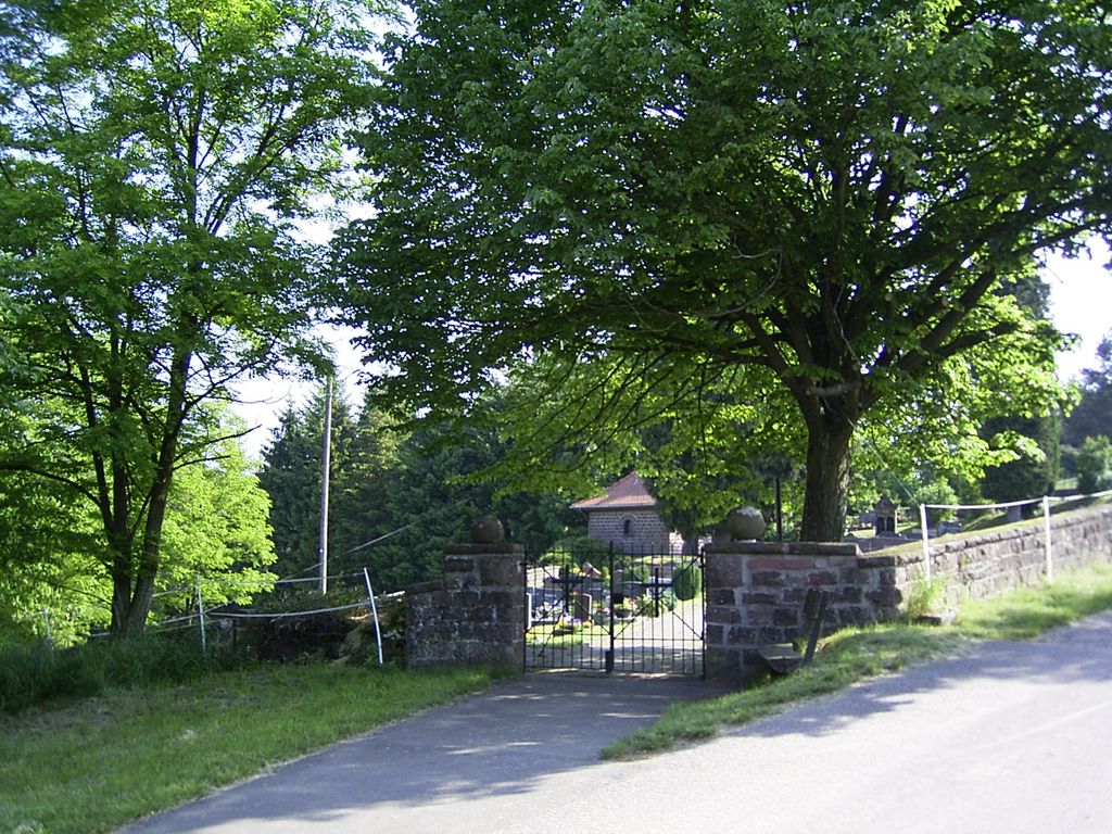
| Description | : | Hofstätten ist ein kleines Dorf mitten im Nationalpark Pfälzer Wald im Bundesland Rheinland-Pfalz und ist heute Teil der Gemeinde Wigartswiesen. Hofstätten liegt nordwestlich der Kleinstadt Annweiler am Trifels. Hofstätten wurde im Mittelalter gegründet und hatte bis 1970 seine eigene Grundschule. Heute hat Hofstätten etwa 150 Einwohner. Das älteste Grabstätte im Hofstättenfriedhof stammt aus dem Jahre 1909. Der Friedhof ist gut erhalten und in sehr gutem Zustand. Die meisten Grabsteine wurden im Jahr 2004 von Andreas Drieß fotografiert. --------------------------------------------- Hofstätten is a small village in the middle of the Pfälzer Wald National Park in the German state of Rheinland-Pfalz and which is today... Read More |
frequently asked questions (FAQ):
-
Where is Friedhof Hofstätten?
Friedhof Hofstätten is located at Friedhofstraße Hofstätten, Landkreis Südwestpfalz ,Rheinland-Pfalz , 76848Germany.
-
Friedhof Hofstätten cemetery's updated grave count on graveviews.com?
0 memorials
-
Where are the coordinates of the Friedhof Hofstätten?
Latitude: 49.2814500
Longitude: 7.8631100
Nearby Cemetories:
1. Friedhof Hermersbergerhof
Wilgartswiesen, Landkreis Südwestpfalz, Germany
Coordinate: 49.2419900, 7.8329400
2. Friedhof Leimen
Leimen, Landkreis Südwestpfalz, Germany
Coordinate: 49.2781610, 7.7780180
3. Ruheforst Südpfälzer Bergland
Wilgartswiesen, Landkreis Südwestpfalz, Germany
Coordinate: 49.2164800, 7.8329100
4. Friedhof Wilgartswiesen
Wilgartswiesen, Landkreis Südwestpfalz, Germany
Coordinate: 49.2074910, 7.8799790
5. Friedhof Wilgartswiesen
Wilgartswiesen, Landkreis Südwestpfalz, Germany
Coordinate: 49.2074910, 7.8799790
6. Rinnthal Cemetery
Rinnthal, Landkreis Südliche Weinstraße, Germany
Coordinate: 49.2194250, 7.9294440
7. Friedhof Eusserthal
Eußerthal, Landkreis Südliche Weinstraße, Germany
Coordinate: 49.2406640, 7.9701760
8. Friedhof Spirkelbach
Spirkelbach, Landkreis Südwestpfalz, Germany
Coordinate: 49.1969950, 7.8886470
9. Friedhof Hauenstein
Hauenstein, Landkreis Südwestpfalz, Germany
Coordinate: 49.1925800, 7.8573900
10. Friedhof Gräfenhausen
Annweiler am Trifels, Landkreis Südliche Weinstraße, Germany
Coordinate: 49.2220830, 7.9719770
11. Friedhof Merzalben
Merzalben, Landkreis Südwestpfalz, Germany
Coordinate: 49.2450000, 7.7301700
12. Friedhof Heltersberg
Heltersberg, Landkreis Südwestpfalz, Germany
Coordinate: 49.3090570, 7.7194480
13. Friedhof Ramberg
Ramberg, Landkreis Südliche Weinstraße, Germany
Coordinate: 49.2576680, 8.0094460
14. Friedhof Annweiler am Trifels
Annweiler am Trifels, Landkreis Südliche Weinstraße, Germany
Coordinate: 49.2049500, 7.9582000
15. Friedhof Wernersberg
Wernersberg, Landkreis Südliche Weinstraße, Germany
Coordinate: 49.1918000, 7.9287280
16. Friedhof Lug
Lug, Landkreis Südwestpfalz, Germany
Coordinate: 49.1846600, 7.8979300
17. Friedhof Queichhambach
Queichhambach, Landkreis Südliche Weinstraße, Germany
Coordinate: 49.2145680, 7.9895030
18. Naturbegräbnisstätte Trifelsruhe
Annweiler am Trifels, Landkreis Südliche Weinstraße, Germany
Coordinate: 49.1911800, 7.9503300
19. Friedhof Hinterweidenthal
Hinterweidenthal, Landkreis Südwestpfalz, Germany
Coordinate: 49.1949560, 7.7577490
20. Friedhof Dimbach
Dimbach, Landkreis Südwestpfalz, Germany
Coordinate: 49.1676900, 7.8951850
21. Neuer Friedhof Münchweiler an der Rodalb
Münchweiler an der Rodalb, Landkreis Südwestpfalz, Germany
Coordinate: 49.2177620, 7.7145300
22. Friedhof Schwanheim
Schwanheim, Landkreis Südwestpfalz, Germany
Coordinate: 49.1655200, 7.8786300
23. Alter Friedhof Münchweiler an der Rodalb
Münchweiler an der Rodalb, Landkreis Südwestpfalz, Germany
Coordinate: 49.2167800, 7.7077700
24. Friedhof Darstein
Darstein, Landkreis Südwestpfalz, Germany
Coordinate: 49.1596200, 7.8823000