
| Memorials | : | 0 |
| Location | : | Wilgartswiesen, Landkreis Südwestpfalz, Germany |
| Coordinate | : | 49.2419900, 7.8329400 |
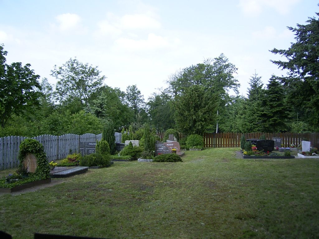
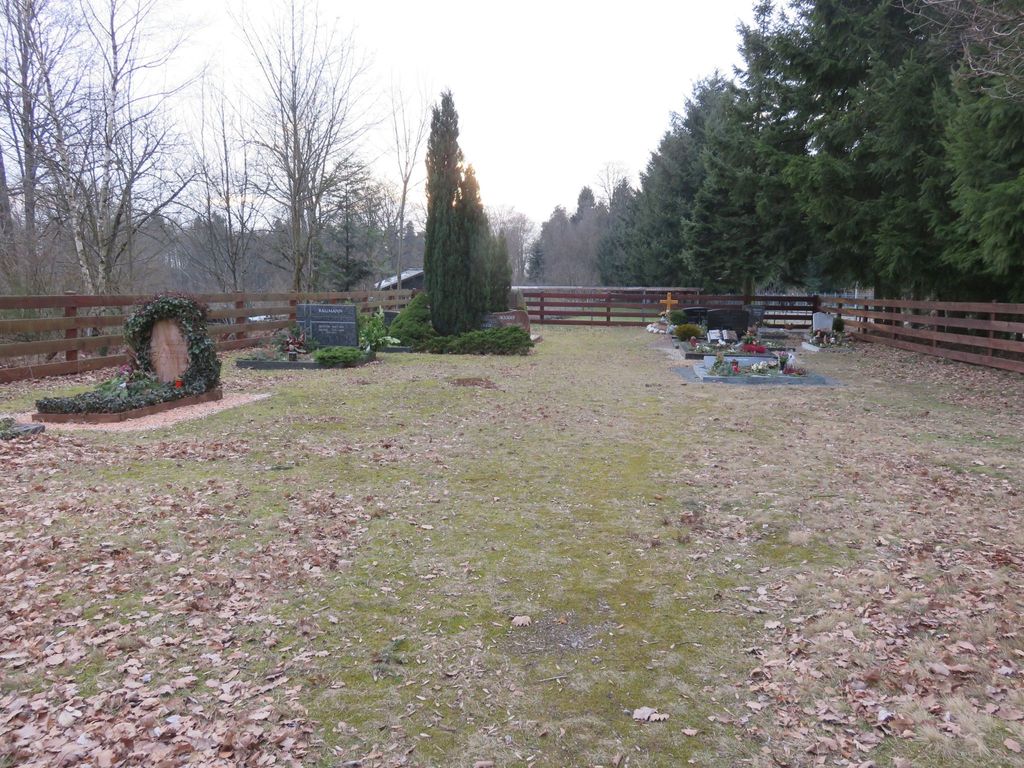
| Description | : | Hermersbergerhof ist das kleinste Dorf in der Gemeinde Wigartswiesen und hat heute nur sehr wenige Einwohner. Es liegt 545 Meter über dem Meeresspiegel und ist damit der höchste bewohnte Punkt im Pfälzer Wald. Die meisten Grabsteine wurden im Jahr 2004 von Andreas Drieß fotografiert. ------------------------------------------------ Hermersbergerhof is the smallest village incorporated in the municipality of Wigartswiesen and today has very few inhabitants. It is 545 metres above sea level and is thus the highest inhabited point in the Palatinate Forest. The cemetery is, as are all German cemeteries, well maintained and in excellent condition. Most photos of the gravestones were taken by Andreas Drieß... Read More |
frequently asked questions (FAQ):
-
Where is Friedhof Hermersbergerhof?
Friedhof Hermersbergerhof is located at Wilgartswiesen, Landkreis Südwestpfalz ,Rheinland-Pfalz , 76848Germany.
-
Friedhof Hermersbergerhof cemetery's updated grave count on graveviews.com?
0 memorials
-
Where are the coordinates of the Friedhof Hermersbergerhof?
Latitude: 49.2419900
Longitude: 7.8329400
Nearby Cemetories:
1. Ruheforst Südpfälzer Bergland
Wilgartswiesen, Landkreis Südwestpfalz, Germany
Coordinate: 49.2164800, 7.8329100
2. Friedhof Hofstätten
Hofstätten, Landkreis Südwestpfalz, Germany
Coordinate: 49.2814500, 7.8631100
3. Friedhof Wilgartswiesen
Wilgartswiesen, Landkreis Südwestpfalz, Germany
Coordinate: 49.2074910, 7.8799790
4. Friedhof Wilgartswiesen
Wilgartswiesen, Landkreis Südwestpfalz, Germany
Coordinate: 49.2074910, 7.8799790
5. Friedhof Leimen
Leimen, Landkreis Südwestpfalz, Germany
Coordinate: 49.2781610, 7.7780180
6. Friedhof Hauenstein
Hauenstein, Landkreis Südwestpfalz, Germany
Coordinate: 49.1925800, 7.8573900
7. Friedhof Spirkelbach
Spirkelbach, Landkreis Südwestpfalz, Germany
Coordinate: 49.1969950, 7.8886470
8. Rinnthal Cemetery
Rinnthal, Landkreis Südliche Weinstraße, Germany
Coordinate: 49.2194250, 7.9294440
9. Friedhof Merzalben
Merzalben, Landkreis Südwestpfalz, Germany
Coordinate: 49.2450000, 7.7301700
10. Friedhof Hinterweidenthal
Hinterweidenthal, Landkreis Südwestpfalz, Germany
Coordinate: 49.1949560, 7.7577490
11. Friedhof Lug
Lug, Landkreis Südwestpfalz, Germany
Coordinate: 49.1846600, 7.8979300
12. Friedhof Wernersberg
Wernersberg, Landkreis Südliche Weinstraße, Germany
Coordinate: 49.1918000, 7.9287280
13. Neuer Friedhof Münchweiler an der Rodalb
Münchweiler an der Rodalb, Landkreis Südwestpfalz, Germany
Coordinate: 49.2177620, 7.7145300
14. Friedhof Schwanheim
Schwanheim, Landkreis Südwestpfalz, Germany
Coordinate: 49.1655200, 7.8786300
15. Friedhof Dimbach
Dimbach, Landkreis Südwestpfalz, Germany
Coordinate: 49.1676900, 7.8951850
16. Alter Friedhof Münchweiler an der Rodalb
Münchweiler an der Rodalb, Landkreis Südwestpfalz, Germany
Coordinate: 49.2167800, 7.7077700
17. Friedhof Erfweiler
Erfweiler, Landkreis Südwestpfalz, Germany
Coordinate: 49.1575300, 7.8085500
18. Friedhof Darstein
Darstein, Landkreis Südwestpfalz, Germany
Coordinate: 49.1596200, 7.8823000
19. Friedhof Eusserthal
Eußerthal, Landkreis Südliche Weinstraße, Germany
Coordinate: 49.2406640, 7.9701760
20. Friedhof Annweiler am Trifels
Annweiler am Trifels, Landkreis Südliche Weinstraße, Germany
Coordinate: 49.2049500, 7.9582000
21. Naturbegräbnisstätte Trifelsruhe
Annweiler am Trifels, Landkreis Südliche Weinstraße, Germany
Coordinate: 49.1911800, 7.9503300
22. Friedhof Gräfenhausen
Annweiler am Trifels, Landkreis Südliche Weinstraße, Germany
Coordinate: 49.2220830, 7.9719770
23. Friedhof Dahn
Dahn, Landkreis Südwestpfalz, Germany
Coordinate: 49.1531000, 7.7799200
24. Friedhof Schindhard
Schindhard, Landkreis Südwestpfalz, Germany
Coordinate: 49.1469200, 7.8198700