
| Memorials | : | 0 |
| Location | : | Lichtenau, Landkreis Ansbach, Germany |
| Coordinate | : | 49.2760440, 10.6847240 |
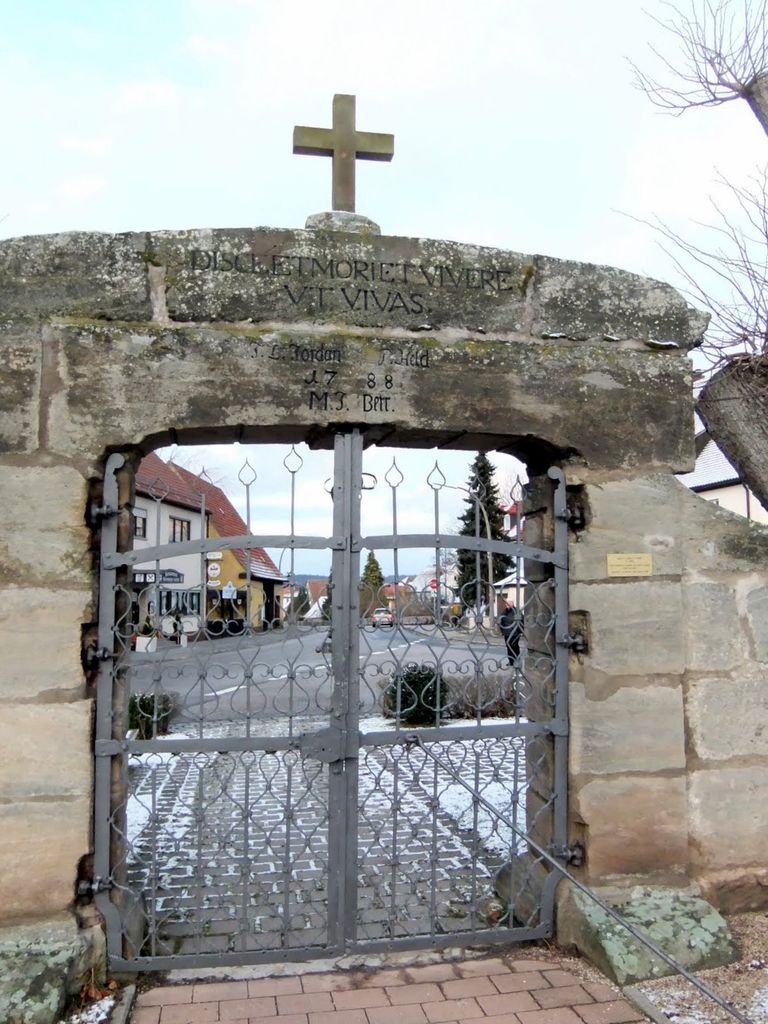
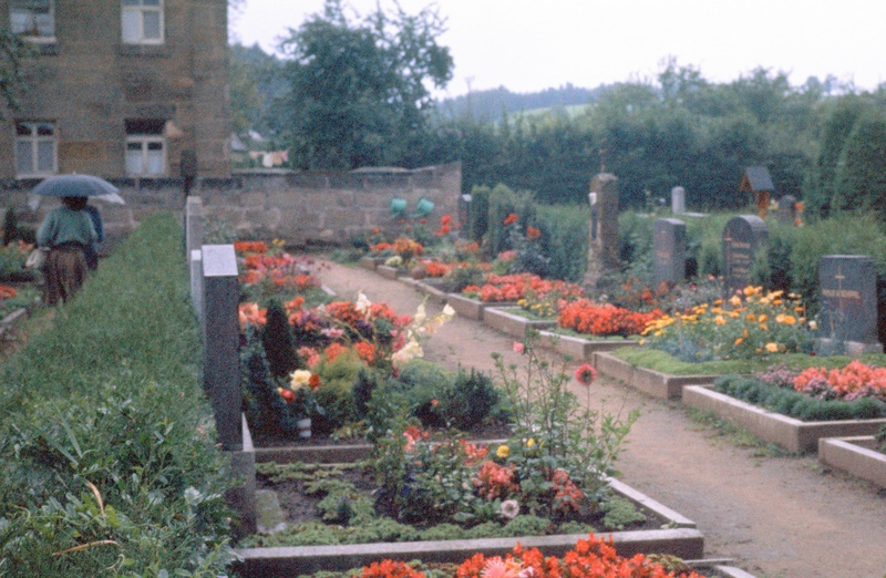
| Description | : | This is the cemetery where the Schwab and Leidel family that did not emigrate are buried. Directions written in 1965 by R.Y. Figge coming from Ansbach "After you come to Lichtenau. Keep on thru the town until you come to a war memorial more or less in front of you, and the road turns to the right. But straight ahead is a little road and a walled in place. Take the road to the right. I think it goes over a bridge, but not sure. It isn't much of a bridge. You come to a... Read More |
frequently asked questions (FAQ):
-
Where is Friedhof Lichtenau bei Ansbach?
Friedhof Lichtenau bei Ansbach is located at Unterrottmannsdorfer Str. 6 Lichtenau, Landkreis Ansbach ,Bavaria (Bayern) , 91586 LichGermany.
-
Friedhof Lichtenau bei Ansbach cemetery's updated grave count on graveviews.com?
0 memorials
-
Where are the coordinates of the Friedhof Lichtenau bei Ansbach?
Latitude: 49.2760440
Longitude: 10.6847240
Nearby Cemetories:
1. Friedhof Lichtenau
Lichtenau, Landkreis Ansbach, Germany
Coordinate: 49.2755090, 10.6843460
2. Friedhof Immeldorf
Immeldorf, Landkreis Ansbach, Germany
Coordinate: 49.2761630, 10.7237590
3. Friedhof Eyb
Eyb, Stadtkreis Ansbach, Germany
Coordinate: 49.2964510, 10.5993710
4. Friedhof Diakonie Neuendettelsau
Neuendettelsau, Landkreis Ansbach, Germany
Coordinate: 49.2895900, 10.7808150
5. Catholic Cemetery
Burgoberbach, Landkreis Ansbach, Germany
Coordinate: 49.2351480, 10.5978580
6. Friedhof Merkendorf
Merkendorf, Landkreis Ansbach, Germany
Coordinate: 49.2060342, 10.7011449
7. Dorffriedhof
Neuendettelsau, Landkreis Ansbach, Germany
Coordinate: 49.2845700, 10.7928000
8. Friedhof Heilig Kreuz
Ansbach, Stadtkreis Ansbach, Germany
Coordinate: 49.2940300, 10.5719700
9. Sankt Gumbertuskirche
Ansbach, Stadtkreis Ansbach, Germany
Coordinate: 49.3027780, 10.5733330
10. Sankt Johanniskirche
Ansbach, Stadtkreis Ansbach, Germany
Coordinate: 49.3034480, 10.5703580
11. Waldfriedhof Ansbach
Ansbach, Stadtkreis Ansbach, Germany
Coordinate: 49.2897143, 10.5480893
12. Kloster Heilsbronn
Heilbronn, Landkreis Ansbach, Germany
Coordinate: 49.3377780, 10.7919440
13. Friedhof Hirschlach
Hirschlach, Landkreis Ansbach, Germany
Coordinate: 49.1797790, 10.6768865
14. Friedhof Bertholdsdorf
Bertholdsdorf, Landkreis Ansbach, Germany
Coordinate: 49.2895137, 10.8736590
15. Friedhof Lehrberg
Lehrberg, Landkreis Ansbach, Germany
Coordinate: 49.3439220, 10.5120000
16. Gedenkstein für die Opfer der Gasexplosion
Lehrberg, Landkreis Ansbach, Germany
Coordinate: 49.3452310, 10.5098440
17. Friedhof Rügland
Rugland, Landkreis Ansbach, Germany
Coordinate: 49.4007652, 10.5924935
18. Friedhof Gräfensteinberg
Grafensteinberg, Landkreis Weißenburg-Gunzenhausen, Germany
Coordinate: 49.1511578, 10.8102554
19. Friedhof Gräfenbuch
Grafenbuch, Landkreis Ansbach, Germany
Coordinate: 49.3731206, 10.4759098
20. Jewish Cemetery of Gunzenhausen
Gunzenhausen, Landkreis Weißenburg-Gunzenhausen, Germany
Coordinate: 49.1140213, 10.7653408
21. Friedhof Wieseth
Wieseth, Landkreis Ansbach, Germany
Coordinate: 49.1613807, 10.4794709
22. Friedhof Aha
Aha, Landkreis Weißenburg-Gunzenhausen, Germany
Coordinate: 49.0974246, 10.7514500
23. Friedhof Spalt
Spalt, Landkreis Roth, Germany
Coordinate: 49.1791817, 10.9256435
24. Friedhof Leutershausen Mittelfranken
Leutershausen, Landkreis Ansbach, Germany
Coordinate: 49.3031320, 10.4037171