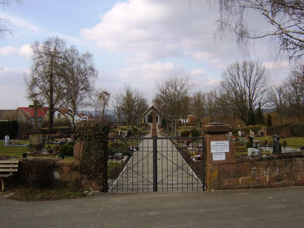
| Memorials | : | 0 |
| Location | : | Kaiserslautern, Stadtkreis Kaiserslautern, Germany |
| Coordinate | : | 49.4734900, 7.7690500 |
| Description | : | Address: Am Obergarten 30 67659 Morlautern is a district of Kaiserslautern, Rheinland-Pfalz and located approximately 5 kilometers North of downtown Kaiserlautern. Bus line 12 - stop "Zum Ellerbach" then 15 minute walk. Cemetery was established in 1841 and expanded in 1996/97. Unlike in America where one purchases a plot and it is theirs for eternity, here the plot is leased for 20 - 30 years and at the end of the lease the family is asked if they wish to renew for another period of time. If they do not renew or there is no family, the monument and all decorations are removed and leased... Read More |
frequently asked questions (FAQ):
-
Where is Friedhof Morlautern?
Friedhof Morlautern is located at Am Obergarten 30 - Zur Geissdell Kaiserslautern, Stadtkreis Kaiserslautern ,Rheinland-Pfalz , 67659Germany.
-
Friedhof Morlautern cemetery's updated grave count on graveviews.com?
0 memorials
-
Where are the coordinates of the Friedhof Morlautern?
Latitude: 49.4734900
Longitude: 7.7690500
Nearby Cemetories:
1. Abteikirche Otterberg
Otterberg, Landkreis Kaiserslautern, Germany
Coordinate: 49.5030600, 7.7737300
2. Friedhof Otterberg
Otterberg, Landkreis Kaiserslautern, Germany
Coordinate: 49.5034300, 7.7751100
3. Hauptfriedhof Kaiserslautern
Kaiserslautern, Stadtkreis Kaiserslautern, Germany
Coordinate: 49.4457000, 7.7987100
4. Jüdischer Friedhof Kaiserslautern
Kaiserslautern, Stadtkreis Kaiserslautern, Germany
Coordinate: 49.4449800, 7.7977130
5. Friedhof Neukirchen
Mehlingen, Landkreis Kaiserslautern, Germany
Coordinate: 49.4889036, 7.8642757
6. Alter Friedfhof Mehlingen
Mehlingen, Landkreis Kaiserslautern, Germany
Coordinate: 49.4959571, 7.8618697
7. Potzbach Friedhofssatzung
Potzbach, Donnersbergkreis, Germany
Coordinate: 49.5406809, 7.8169293
8. Friedhof Enkenbach-Alsenborn
Enkenbach-Alsenborn, Landkreis Kaiserslautern, Germany
Coordinate: 49.4898970, 7.8930520
9. Jüdischer Friedhof Winnweiler
Winnweiler, Donnersbergkreis, Germany
Coordinate: 49.5684890, 7.8436751
10. Winnweiler
Winnweiler, Donnersbergkreis, Germany
Coordinate: 49.5679388, 7.8577504
11. Friedhof Kindsbach
Kindsbach, Landkreis Kaiserslautern, Germany
Coordinate: 49.4167321, 7.6071109
12. Friedhof Schopp
Schopp, Landkreis Kaiserslautern, Germany
Coordinate: 49.3558280, 7.6921490
13. Landstuhl Cemetery
Landstuhl, Landkreis Kaiserslautern, Germany
Coordinate: 49.4132313, 7.5803565
14. St. Andreas-Kirche
Landstuhl, Landkreis Kaiserslautern, Germany
Coordinate: 49.4095100, 7.5701620
15. Friedhof Ramstein
Ramstein-Miesenbach, Landkreis Kaiserslautern, Germany
Coordinate: 49.4473300, 7.5494100
16. Friedhof Dörnbach
Dörnbach, Donnersbergkreis, Germany
Coordinate: 49.6193100, 7.7925500
17. Friedhof Börrstadt
Börrstadt, Donnersbergkreis, Germany
Coordinate: 49.5749100, 7.9346000
18. Friedhof Rudolphskirchen
Rathskirchen, Donnersbergkreis, Germany
Coordinate: 49.6198043, 7.7095683
19. Friedhof Horbach
Horbach, Landkreis Südwestpfalz, Germany
Coordinate: 49.3374990, 7.6586540
20. Ruheforst Pfälzer Wald
Bad Dürkheim, Landkreis Bad Dürkheim, Germany
Coordinate: 49.4478400, 8.0055100
21. Friedhof Rockenhausen
Rockenhausen, Donnersbergkreis, Germany
Coordinate: 49.6343000, 7.8265000
22. Friedhof Heltersberg
Heltersberg, Landkreis Südwestpfalz, Germany
Coordinate: 49.3090570, 7.7194480
23. Obernheim-Kirchenarnbach
Obernheim-Kirchenarnbach, Landkreis Südwestpfalz, Germany
Coordinate: 49.3573500, 7.5776200
24. Friedhof Bisterschied
Bisterschied, Donnersbergkreis, Germany
Coordinate: 49.6479230, 7.7514830

