
| Memorials | : | 0 |
| Location | : | Rathskirchen, Donnersbergkreis, Germany |
| Coordinate | : | 49.6198043, 7.7095683 |
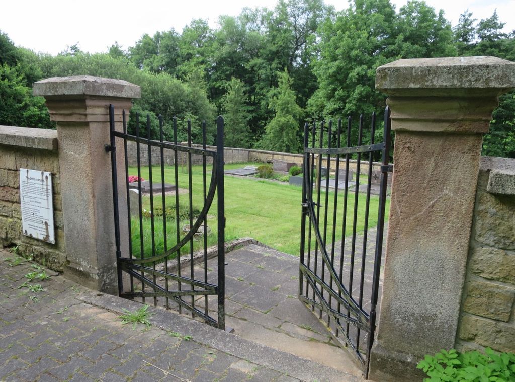
| Description | : | The small cemetery is located just north of Rudolphskirchen on the west side of County Route 386 (Landstrasse 386). It's only 1/3 of an acre in size and owned and run by the city. Formerly independent, since 1969 Rudolphskirchen is a part of Rathskirchen. Please note that the graves in Germany are not perpetual. After a certain period of repose (20-30 years) the graves are being leveled and re-used. There is no toxic embalming being done in Germany, so the coffin and the corpse can decompose naturally. If the family of the deceased decides to purchase another period the duration can... Read More |
frequently asked questions (FAQ):
-
Where is Friedhof Rudolphskirchen?
Friedhof Rudolphskirchen is located at Landstrasse 386 Rathskirchen, Donnersbergkreis ,Rheinland-Pfalz , 67744Germany.
-
Friedhof Rudolphskirchen cemetery's updated grave count on graveviews.com?
0 memorials
-
Where are the coordinates of the Friedhof Rudolphskirchen?
Latitude: 49.6198043
Longitude: 7.7095683
Nearby Cemetories:
1. Friedhof Bisterschied
Bisterschied, Donnersbergkreis, Germany
Coordinate: 49.6479230, 7.7514830
2. Friedhof Dörnbach
Dörnbach, Donnersbergkreis, Germany
Coordinate: 49.6193100, 7.7925500
3. Adenbach Friedhof
Adenbach, Landkreis Kusel, Germany
Coordinate: 49.6657590, 7.6513760
4. Adenbach alter Friedhof
Adenbach, Landkreis Kusel, Germany
Coordinate: 49.6684940, 7.6463450
5. Friedhof Rockenhausen
Rockenhausen, Donnersbergkreis, Germany
Coordinate: 49.6343000, 7.8265000
6. Steingruben
Steingruben, Donnersbergkreis, Germany
Coordinate: 49.6702740, 7.8078770
7. Evangelisch-Reformierte Kirche
Schiersfeld, Donnersbergkreis, Germany
Coordinate: 49.6942920, 7.7638640
8. Schlosskirche Meisenheim
Meisenheim, Landkreis Bad Kreuznach, Germany
Coordinate: 49.7051800, 7.6718080
9. Hausweiler Friedhof
Hausweiler, Landkreis Kusel, Germany
Coordinate: 49.6460360, 7.5604180
10. Jüdischer Friedhof Winnweiler
Winnweiler, Donnersbergkreis, Germany
Coordinate: 49.5684890, 7.8436751
11. Potzbach Friedhofssatzung
Potzbach, Donnersbergkreis, Germany
Coordinate: 49.5406809, 7.8169293
12. Hoferhof Friedhof
Hoferhof, Donnersbergkreis, Germany
Coordinate: 49.6847522, 7.8416047
13. Winnweiler
Winnweiler, Donnersbergkreis, Germany
Coordinate: 49.5679388, 7.8577504
14. Evangelische Kirche
Obermoschel, Donnersbergkreis, Germany
Coordinate: 49.7269440, 7.7727780
15. Friedhof Gerbach - St. Alban
Gerbach, Donnersbergkreis, Germany
Coordinate: 49.6803377, 7.8673649
16. Friedhof Otterberg
Otterberg, Landkreis Kaiserslautern, Germany
Coordinate: 49.5034300, 7.7751100
17. Abteikirche Otterberg
Otterberg, Landkreis Kaiserslautern, Germany
Coordinate: 49.5030600, 7.7737300
18. Kirche Niedermoschel
Niedermoschel, Donnersbergkreis, Germany
Coordinate: 49.7350000, 7.7958330
19. Friedhof Morlautern
Kaiserslautern, Stadtkreis Kaiserslautern, Germany
Coordinate: 49.4734900, 7.7690500
20. Friedhof Börrstadt
Börrstadt, Donnersbergkreis, Germany
Coordinate: 49.5749100, 7.9346000
21. Friedhof Otzweiler
Otzweiler, Landkreis Bad Kreuznach, Germany
Coordinate: 49.7166700, 7.5166700
22. Alter Friedfhof Mehlingen
Mehlingen, Landkreis Kaiserslautern, Germany
Coordinate: 49.4959571, 7.8618697
23. Friedhof Neukirchen
Mehlingen, Landkreis Kaiserslautern, Germany
Coordinate: 49.4889036, 7.8642757
24. Duchroth Cemetery
Duchroth, Landkreis Bad Kreuznach, Germany
Coordinate: 49.7844770, 7.7404600