| Memorials | : | 1 |
| Location | : | Liechtenstein |
| Coordinate | : | 47.1682075, 9.5131535 |
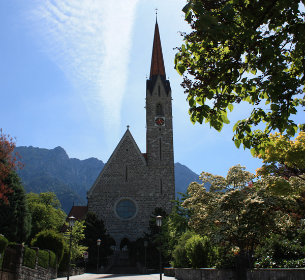
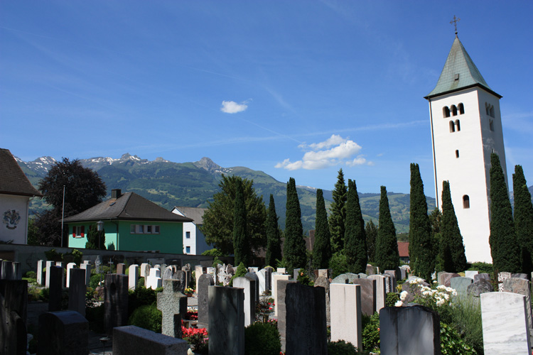
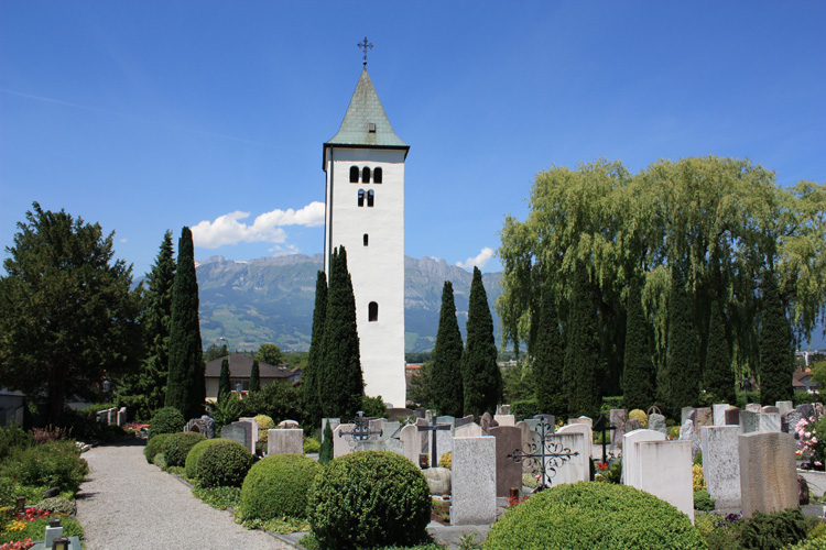
| Description | : | St. Laurentius New Parish Church The parish church in Schaan was rebuilt according to the plans of the Viennese architect Sir Gustav von Neumann on a new construction site toward the south and was consecrated on 5 October 1893. It is a natural stone building in neo-Gothic style, with a three-nave columned interior. It was comprehensively renovated and rebuilt between 1968 and 1978. St. Laurentius Old Parish Church Only the tower remains today, standing free in the western section of the cemetery. Based on its style, it dates from around 1100. There are no indications of the origin of the church, possibly... Read More |
frequently asked questions (FAQ):
-
Where is Friedhof Schaan Duxgass?
Friedhof Schaan Duxgass is located at Reberastraße 14 - Fürst-Johannes-Strasse Schaan , 9494Liechtenstein.
-
Friedhof Schaan Duxgass cemetery's updated grave count on graveviews.com?
1 memorials
-
Where are the coordinates of the Friedhof Schaan Duxgass?
Latitude: 47.1682075
Longitude: 9.5131535
Nearby Cemetories:
1. Friedhof Sevelen
Sevelen, Wahlkreis Werdenberg, Switzerland
Coordinate: 47.1217500, 9.4858000
2. Pfarrkirche St. Joseph
Liechtenstein
Coordinate: 47.1177120, 9.5436680
3. Altar of Capuchin Church
Feldkirch, Feldkirch Bezirk, Austria
Coordinate: 47.2391520, 9.5989370
4. Friedhof Wildhaus
Wildhaus, Wahlkreis Toggenburg, Switzerland
Coordinate: 47.2043300, 9.3512200
5. Friedhof Mels
Mels, Wahlkreis Sarganserland, Switzerland
Coordinate: 47.0467894, 9.4230936
6. Friedhof Flums
Flums, Wahlkreis Sarganserland, Switzerland
Coordinate: 47.0890280, 9.3464120
7. Friedhof Walenstadt
Walenstadt, Wahlkreis Sarganserland, Switzerland
Coordinate: 47.1244998, 9.3178443
8. Friedhof Maienfeld
Maienfeld, Bezirk Landquart, Switzerland
Coordinate: 47.0080690, 9.5320480
9. Friedhof Brand
Brand, Bludenz Bezirk, Austria
Coordinate: 47.1041000, 9.7381600
10. St. Stephan Catholic Church Cemetery
Thuringen, Bludenz Bezirk, Austria
Coordinate: 47.2000008, 9.7666664
11. Friedhof Götzis
Götzis, Feldkirch Bezirk, Austria
Coordinate: 47.3302300, 9.6370300
12. Priory of Saint Gerold
Bludenz Bezirk, Austria
Coordinate: 47.2188380, 9.8172730
13. Friedhof Raggal
Raggal, Bludenz Bezirk, Austria
Coordinate: 47.2104880, 9.8361700
14. Friedhof Hohenems
Hohenems, Dornbirn Bezirk, Austria
Coordinate: 47.3578410, 9.6886800
15. Friedhof Waldstatt
Waldstatt, Bezirk Hinterland, Switzerland
Coordinate: 47.3576703, 9.2887766
16. Katholischer Friedhof Hemberg
Hemberg, Wahlkreis Toggenburg, Switzerland
Coordinate: 47.2979106, 9.1749528
17. Evangelischer Friedhof Hemberg
Hemberg, Wahlkreis Toggenburg, Switzerland
Coordinate: 47.3007881, 9.1759969
18. Friedhof Herisau
Herisau, Bezirk Hinterland, Switzerland
Coordinate: 47.3918090, 9.2871900
19. Dornbirn-Hatlerdorf
Hatlerdorf, Dornbirn Bezirk, Austria
Coordinate: 47.3997554, 9.7375549
20. Friedhof Au
Au, Wahlkreis Rheintal, Switzerland
Coordinate: 47.4346600, 9.6325900
21. Ostfriedhof Sankt Gallen
Sankt Gallen, Wahlkreis St. Gallen, Switzerland
Coordinate: 47.4433330, 9.4052780
22. Zentralfriedhof Rorschach
Rorschach, Wahlkreis Rorschach, Switzerland
Coordinate: 47.4701900, 9.4996300
23. Friedhof Hofegg Gossau SG
Gossau, Wahlkreis St. Gallen, Switzerland
Coordinate: 47.4196484, 9.2652190
24. Pfarrkirche Höchst - St. Johann
Höchst, Bregenz Bezirk, Austria
Coordinate: 47.4601590, 9.6389540


