
| Memorials | : | 7 |
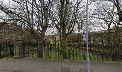
| Location | : | Kildwick, Craven District, England |
| Coordinate | : | 53.8661050, -1.9195670 |
| Description | : | Please also see: Yorkshire Notes and Queries, Volumes 1-2 https://books.google.com/books?id=8PQvAAAAMAAJ&pg=RA3-PA159&lpg=RA3-PA159&dq=friends+burial+ground+calversike&source=bl&ots=_DoRlFFU6O&sig=ACfU3U10UjVN3DQOyUCaicRaUA-1OXYtqQ&hl=en&sa=X&ved=2ahUKEwivp_CSzPrhAhXjRt8KHVEmBrEQ6AEwAHoECAgQAQ#v=onepage&q=friends%20burial%20ground%20calversike&f=false |
frequently asked questions (FAQ):
-
Where is Friends Burial Ground at Calversike Hill?
Friends Burial Ground at Calversike Hill is located at Kildwick, Craven District ,North Yorkshire ,England.
-
Friends Burial Ground at Calversike Hill cemetery's updated grave count on graveviews.com?
7 memorials
-
Where are the coordinates of the Friends Burial Ground at Calversike Hill?
Latitude: 53.8661050
Longitude: -1.9195670
Nearby Cemetories:
1. Keighley Shared Churchyard
Keighley, Metropolitan Borough of Bradford, England
Coordinate: 53.8651000, -1.9095580
2. St. John the Evangelist Churchyard
Ingrow, Metropolitan Borough of Bradford, England
Coordinate: 53.8552100, -1.9163280
3. Utley Cemetery
Keighley, Metropolitan Borough of Bradford, England
Coordinate: 53.8809160, -1.9141230
4. Laycock Wesleyan Methodist Cemetery
Laycock, Metropolitan Borough of Bradford, England
Coordinate: 53.8651200, -1.9527500
5. St Mary the Virgin Churchyard
Riddlesden, Metropolitan Borough of Bradford, England
Coordinate: 53.8801100, -1.8833100
6. Slack Lane Baptist Cemetery
Oakworth, Metropolitan Borough of Bradford, England
Coordinate: 53.8527400, -1.9568800
7. Oakworth Wesleyan Methodist Cemetery
Oakworth, Metropolitan Borough of Bradford, England
Coordinate: 53.8454920, -1.9493540
8. Christ Church Churchyard
Oakworth, Metropolitan Borough of Bradford, England
Coordinate: 53.8459200, -1.9549100
9. Morton Cemetery
Keighley, Metropolitan Borough of Bradford, England
Coordinate: 53.8730450, -1.8688400
10. Oakworth Crematorium
Keighley, Metropolitan Borough of Bradford, England
Coordinate: 53.8499320, -1.9661240
11. Harden Rycroft Primitive Methodist Church
Keighley, Metropolitan Borough of Bradford, England
Coordinate: 53.8385220, -1.8830690
12. St. Stephen Churchyard
Steeton, Metropolitan Borough of Bradford, England
Coordinate: 53.8968600, -1.9499600
13. St Luke Churchyard
East Morton, Metropolitan Borough of Bradford, England
Coordinate: 53.8726100, -1.8538200
14. St. John the Evangelist Churchyard
Cullingworth, Metropolitan Borough of Bradford, England
Coordinate: 53.8282300, -1.8991300
15. West Lane Baptist Chapel
Haworth, Metropolitan Borough of Bradford, England
Coordinate: 53.8324090, -1.9586480
16. St. Michael and All Angels Churchyard
Haworth, Metropolitan Borough of Bradford, England
Coordinate: 53.8311500, -1.9562350
17. Hall Green Baptist Chapel
Haworth, Metropolitan Borough of Bradford, England
Coordinate: 53.8285280, -1.9528130
18. East Morton, Primitive Methodist Chapel
East Morton, Metropolitan Borough of Bradford, England
Coordinate: 53.8755730, -1.8486880
19. Silsden Cemetery
Silsden, Metropolitan Borough of Bradford, England
Coordinate: 53.9106500, -1.9267000
20. Haworth Cemetery
Haworth, Metropolitan Borough of Bradford, England
Coordinate: 53.8301460, -1.9679580
21. Bingley Cemetery
Bingley, Metropolitan Borough of Bradford, England
Coordinate: 53.8534820, -1.8429860
22. All Saints Churchyard
Bingley, Metropolitan Borough of Bradford, England
Coordinate: 53.8516480, -1.8405650
23. St James Churchyard
Silsden, Metropolitan Borough of Bradford, England
Coordinate: 53.9139070, -1.9390650
24. St. Thomas's Churchyard
Sutton-in-Craven, Craven District, England
Coordinate: 53.8937020, -1.9906290