| Memorials | : | 0 |
| Location | : | Royton, Metropolitan Borough of Oldham, England |
| Website | : | www.lan-opc.org.uk/Oldham/Heyside/friends/index.html |
| Coordinate | : | 53.5620200, -2.1039660 |
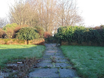
| Description | : | "Until the 1930s, the land at the corner of Turf Lane was the Quaker burial ground for the Oldham area. The first Meeting House built for the purpose was constructed next to the burial ground in 1794. It served Friends from nearby towns like Rochdale and Ashton, until a new Meeting House was built in the centre of Oldham in 1869. Despite the small membership remaining at Heyside the old Meeting House was rebuilt in 1884, however, it was only ever used for the occasional funeral and as a School for local children". https://www.genuki.org.uk/big/eng/LAN/Royton/TurfLaneSocietyofFriends Please see both websites for more on this... Read More |
frequently asked questions (FAQ):
-
Where is Friends Burial Ground at Turf Lane?
Friends Burial Ground at Turf Lane is located at Royton, Metropolitan Borough of Oldham ,Greater Manchester ,England.
-
Friends Burial Ground at Turf Lane cemetery's updated grave count on graveviews.com?
0 memorials
-
Where are the coordinates of the Friends Burial Ground at Turf Lane?
Latitude: 53.5620200
Longitude: -2.1039660
Nearby Cemetories:
1. Holy Trinity Churchyard
Shaw, Metropolitan Borough of Oldham, England
Coordinate: 53.5749940, -2.0991780
2. Saint Paul Churchyard
Royton, Metropolitan Borough of Oldham, England
Coordinate: 53.5653330, -2.1261450
3. Crompton Cemetery
Shaw, Metropolitan Borough of Oldham, England
Coordinate: 53.5799840, -2.1003410
4. Royton Cemetery
Royton, Metropolitan Borough of Oldham, England
Coordinate: 53.5727450, -2.1302850
5. St. Mary Church of England Churchyard
Oldham, Metropolitan Borough of Oldham, England
Coordinate: 53.5428030, -2.1104030
6. Greenacres Cemetery
Oldham, Metropolitan Borough of Oldham, England
Coordinate: 53.5455490, -2.0820510
7. Holy Trinity Churchyard
Waterhead, Metropolitan Borough of Oldham, England
Coordinate: 53.5507100, -2.0738400
8. Greenacres Congregational Church
Oldham, Metropolitan Borough of Oldham, England
Coordinate: 53.5455200, -2.0788100
9. St. John the Baptist Churchyard
Heybridge, Central Coast Council, Australia
Coordinate: 53.5415973, -2.0699727
10. St. John The Baptist Churchyard
Oldham, Metropolitan Borough of Oldham, England
Coordinate: 53.5424690, -2.0680150
11. St Matthew Churchyard
Chadderton, Metropolitan Borough of Oldham, England
Coordinate: 53.5565975, -2.1528452
12. Chadderton Cemetery
Chadderton, Metropolitan Borough of Oldham, England
Coordinate: 53.5464860, -2.1468960
13. St Thomas'
Oldham, Metropolitan Borough of Oldham, England
Coordinate: 53.5366318, -2.0724053
14. Lees Cemetery
Oldham, Metropolitan Borough of Oldham, England
Coordinate: 53.5347540, -2.0739260
15. St. Thomas Churchyard
Newhey, Metropolitan Borough of Rochdale, England
Coordinate: 53.6019166, -2.0958889
16. St. John's Churchyard Thornham
Middleton, Metropolitan Borough of Rochdale, England
Coordinate: 53.5760100, -2.1718300
17. Boarshaw Cemetery and Crematorium
Middleton, Metropolitan Borough of Rochdale, England
Coordinate: 53.5584100, -2.1773100
18. St. Gabriel's Churchyard
Middleton, Metropolitan Borough of Rochdale, England
Coordinate: 53.5446736, -2.1742074
19. Middleton Cemetery and Crematorium
Middleton, Metropolitan Borough of Rochdale, England
Coordinate: 53.5574400, -2.1829200
20. Hollinwood Cemetery
Oldham, Metropolitan Borough of Oldham, England
Coordinate: 53.5178170, -2.1329170
21. St Thomas Churchyard Friarmere
Delph, Metropolitan Borough of Oldham, England
Coordinate: 53.5778800, -2.0285500
22. Delph Independent Chapelyard
Delph, Metropolitan Borough of Oldham, England
Coordinate: 53.5690839, -2.0225845
23. Christ Church Churchyard
Denshaw, Metropolitan Borough of Oldham, England
Coordinate: 53.5918070, -2.0385720
24. Oldham Crematorium
Oldham, Metropolitan Borough of Oldham, England
Coordinate: 53.5156810, -2.1332800

