| Memorials | : | 0 |
| Location | : | Oldham, Metropolitan Borough of Oldham, England |
| Phone | : | 0161 620 5981 |
| Website | : | leesfieldparish.blogspot.com/ |
| Coordinate | : | 53.5366318, -2.0724053 |
| Description | : | In 1844 a small group started to meet at Leesfield House. At the first meeting on March 4th 1844 it was decided to build a church at Leesfield and Mr George Taylor gave the site in lieu of his subscription of £100. This church was St Thomas', Leesfield, and the site was known as 'Bonfire Half Acre' with the chancel of the church being built on 'Mischief Plot'. The design of the church by architect Mr Shellard was perpendicular Gothic, with a hammer beam roof lit by dormer windows and stained open wood tracery, and involved the use of many ancient... Read More |
frequently asked questions (FAQ):
-
Where is St Thomas'?
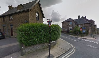
St Thomas' is located at Thomas Street, Lees, Oldham Oldham, Metropolitan Borough of Oldham ,Greater Manchester , OL4 5DAEngland.
-
St Thomas' cemetery's updated grave count on graveviews.com?
0 memorials
-
Where are the coordinates of the St Thomas'?
Latitude: 53.5366318
Longitude: -2.0724053
Nearby Cemetories:
1. Lees Cemetery
Oldham, Metropolitan Borough of Oldham, England
Coordinate: 53.5347540, -2.0739260
2. St. John the Baptist Churchyard
Heybridge, Central Coast Council, Australia
Coordinate: 53.5415973, -2.0699727
3. St. John The Baptist Churchyard
Oldham, Metropolitan Borough of Oldham, England
Coordinate: 53.5424690, -2.0680150
4. Greenacres Congregational Church
Oldham, Metropolitan Borough of Oldham, England
Coordinate: 53.5455200, -2.0788100
5. Greenacres Cemetery
Oldham, Metropolitan Borough of Oldham, England
Coordinate: 53.5455490, -2.0820510
6. Holy Trinity Churchyard
Waterhead, Metropolitan Borough of Oldham, England
Coordinate: 53.5507100, -2.0738400
7. St. Mary Church of England Churchyard
Oldham, Metropolitan Borough of Oldham, England
Coordinate: 53.5428030, -2.1104030
8. St. George Parish Churchyard
Mossley, Metropolitan Borough of Tameside, England
Coordinate: 53.5164000, -2.0486200
9. Friends Burial Ground at Turf Lane
Royton, Metropolitan Borough of Oldham, England
Coordinate: 53.5620200, -2.1039660
10. Hurst Cemetery
Ashton-Under-Lyne, Metropolitan Borough of Tameside, England
Coordinate: 53.5011590, -2.0727370
11. Mossley Cemetery
Mossley, Metropolitan Borough of Tameside, England
Coordinate: 53.5092100, -2.0332700
12. St. John the Evangelist Churchyard
Hurst, Metropolitan Borough of Tameside, England
Coordinate: 53.5001310, -2.0812490
13. Hollinwood Cemetery
Oldham, Metropolitan Borough of Oldham, England
Coordinate: 53.5178170, -2.1329170
14. Holy Trinity Churchyard
Shaw, Metropolitan Borough of Oldham, England
Coordinate: 53.5749940, -2.0991780
15. Oldham Crematorium
Oldham, Metropolitan Borough of Oldham, England
Coordinate: 53.5156810, -2.1332800
16. Saint Paul Churchyard
Royton, Metropolitan Borough of Oldham, England
Coordinate: 53.5653330, -2.1261450
17. Delph Independent Chapelyard
Delph, Metropolitan Borough of Oldham, England
Coordinate: 53.5690839, -2.0225845
18. Chadderton Cemetery
Chadderton, Metropolitan Borough of Oldham, England
Coordinate: 53.5464860, -2.1468960
19. Crompton Cemetery
Shaw, Metropolitan Borough of Oldham, England
Coordinate: 53.5799840, -2.1003410
20. St Thomas Churchyard Friarmere
Delph, Metropolitan Borough of Oldham, England
Coordinate: 53.5778800, -2.0285500
21. Royton Cemetery
Royton, Metropolitan Borough of Oldham, England
Coordinate: 53.5727450, -2.1302850
22. St Georges Cemetery
Stalybridge, Metropolitan Borough of Tameside, England
Coordinate: 53.4873400, -2.0576800
23. St Matthew Churchyard
Chadderton, Metropolitan Borough of Oldham, England
Coordinate: 53.5565975, -2.1528452
24. St. Chad Churchyard
Uppermill, Metropolitan Borough of Oldham, England
Coordinate: 53.5542570, -1.9901190

