
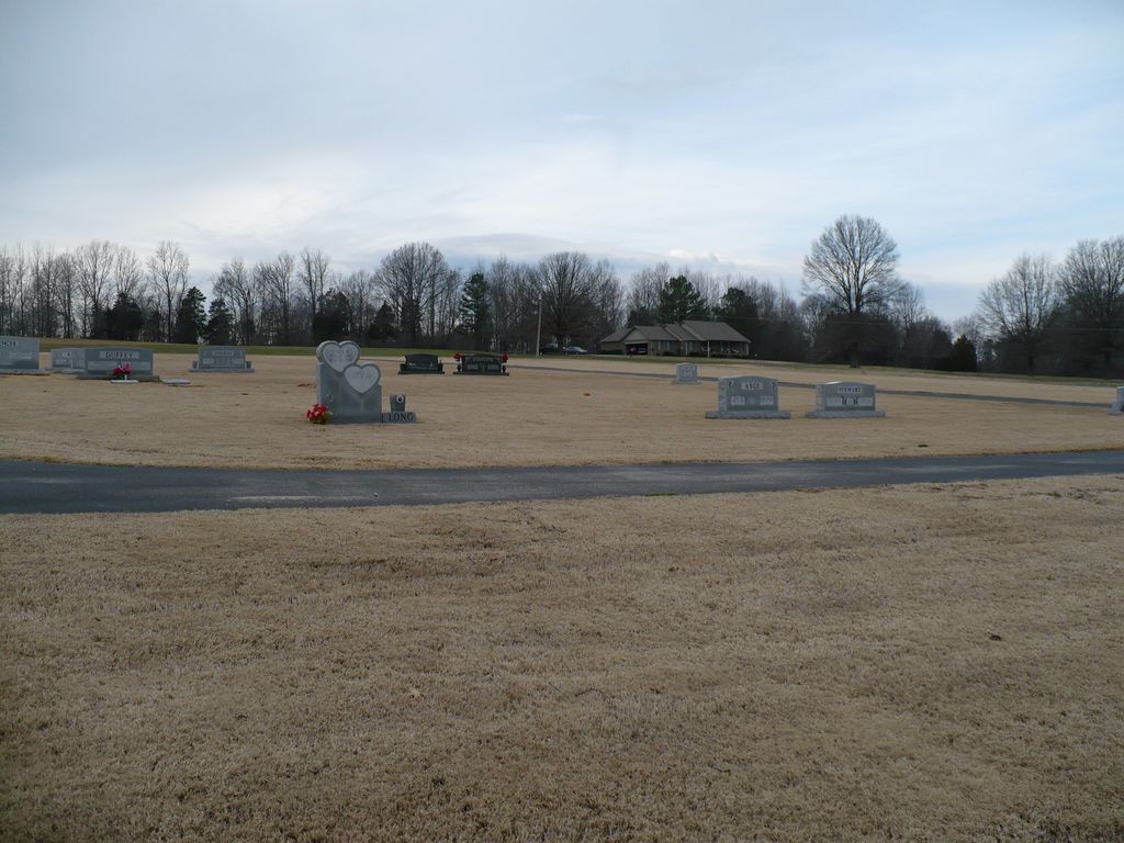
| Memorials | : | 0 |
| Location | : | Madison County, USA |
| Coordinate | : | 35.7714500, -88.7530900 |
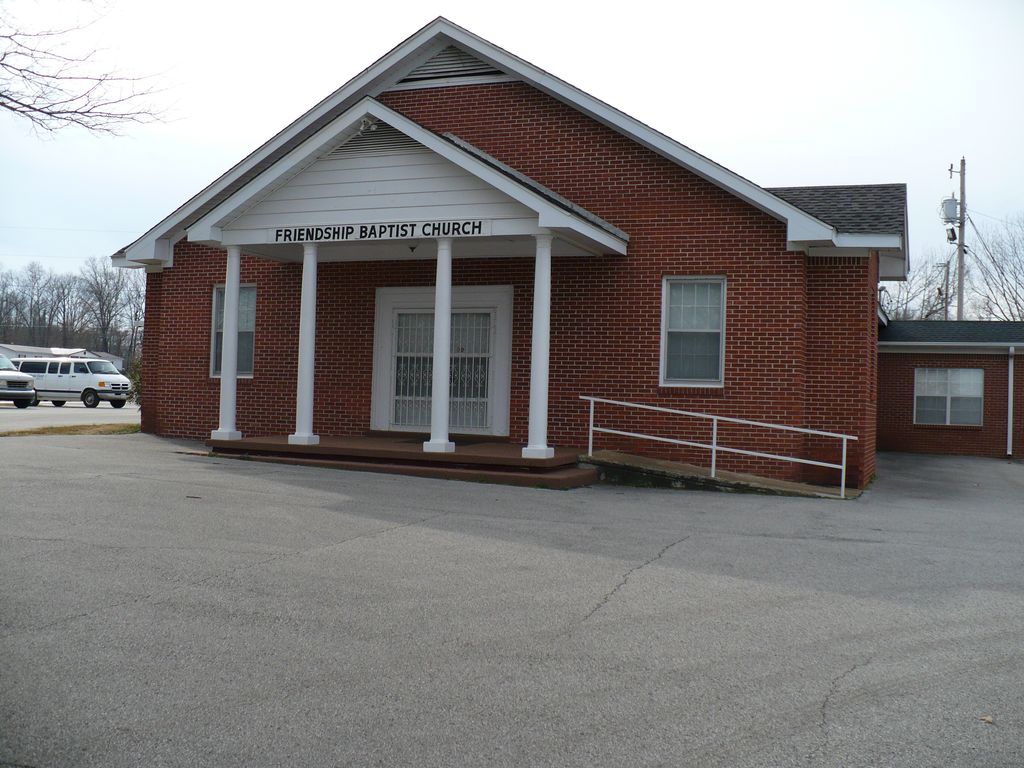
| Description | : | Cemetery is located next to Friendship Baptist Church , 871 Barnes Road , Medina , TN in Madison County, TN. |
frequently asked questions (FAQ):
-
Where is Friendship Baptist Church Cemetery?
Friendship Baptist Church Cemetery is located at Madison County ,Tennessee ,USA.
-
Friendship Baptist Church Cemetery cemetery's updated grave count on graveviews.com?
0 memorials
-
Where are the coordinates of the Friendship Baptist Church Cemetery?
Latitude: 35.7714500
Longitude: -88.7530900

Nearby Cemetories:
1. Davidson Yard Cemetery
Madison County, USA
Coordinate: 35.7542000, -88.7588700
2. Mariah Cemetery
Madison County, USA
Coordinate: 35.7752991, -88.7789001
3. Mount Moriah Cemetery
Madison County, USA
Coordinate: 35.7752390, -88.7790080
4. Hopewell Cemetery
Medina, Gibson County, USA
Coordinate: 35.8036003, -88.7406006
5. Medina Methodist Church Cemetery
Medina, Gibson County, USA
Coordinate: 35.8013930, -88.7781470
6. Hudson's Chapel CME Church Cemetery
Medina, Gibson County, USA
Coordinate: 35.8065100, -88.7686250
7. Hilliard Cemetery
Madison County, USA
Coordinate: 35.7555000, -88.7111000
8. Fellowship Cemetery
Madison County, USA
Coordinate: 35.7477640, -88.7147910
9. Old Carmel Cemetery
Madison County, USA
Coordinate: 35.7476940, -88.7148150
10. Baker Family Cemetery
Madison County, USA
Coordinate: 35.7557190, -88.7985350
11. Herron Cemetery
Medina, Gibson County, USA
Coordinate: 35.8128720, -88.7636090
12. Gaston Cemetery
Spring Creek, Madison County, USA
Coordinate: 35.7738150, -88.6991500
13. Poor House Cemetery
Spring Creek, Madison County, USA
Coordinate: 35.7348520, -88.7229230
14. Madison County Poor House Cemetery
Oakfield, Madison County, USA
Coordinate: 35.7348518, -88.7229233
15. Shelton Family Cemetery
Youngs Crossing, Madison County, USA
Coordinate: 35.7362930, -88.7903670
16. Bakers Chapel Cemetery
Madison County, USA
Coordinate: 35.7667220, -88.8103130
17. Salem C. M. E. Church Cemetery
Jackson, Madison County, USA
Coordinate: 35.7234620, -88.7427080
18. Croom Cemetery
Jackson, Madison County, USA
Coordinate: 35.7228000, -88.7426000
19. Little Family Cemetery
Medina, Gibson County, USA
Coordinate: 35.8205800, -88.7644000
20. Askew-Brown Cemetery
Jackson, Madison County, USA
Coordinate: 35.7229550, -88.7681490
21. Hilliard Cemetery
Spring Creek, Madison County, USA
Coordinate: 35.7708200, -88.6906400
22. Spring Creek Church Cemetery
Spring Creek, Madison County, USA
Coordinate: 35.7696870, -88.6906290
23. Lathams Chapel Cemetery
Medina, Gibson County, USA
Coordinate: 35.8106530, -88.7107940
24. Centerville Cemetery
Medina, Gibson County, USA
Coordinate: 35.8258018, -88.7611008