
| Memorials | : | 9 |
| Location | : | Fordsville, Ohio County, USA |
| Coordinate | : | 37.6417230, -86.7751100 |
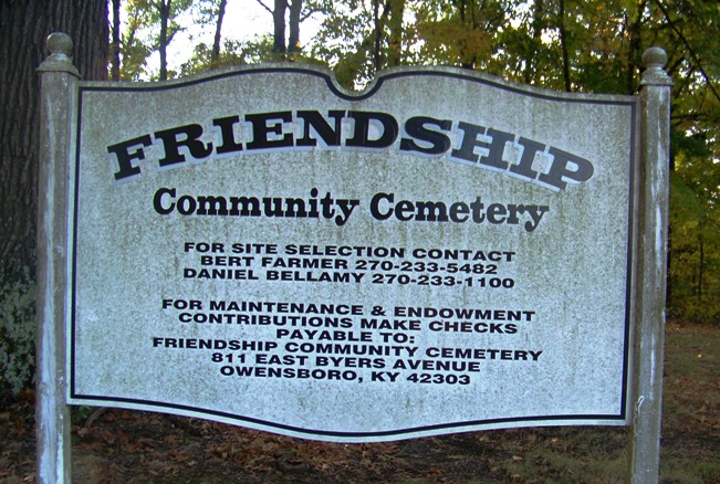
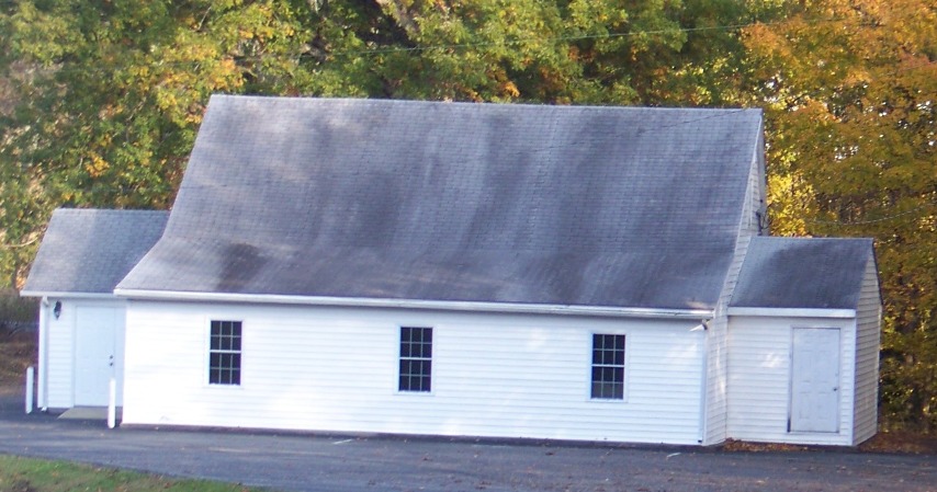
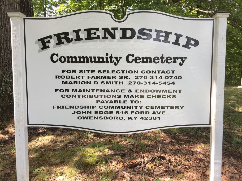
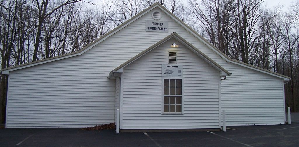
| Description | : | Directions to the cemetery. Take Hwy 54 from Whitesville, Daviess County toward Fordsville, Ohio County. Turn south (right) off Hwy 54 on the Sunnydale Road at the signs for Friendship Chruch and Sugar Grove. The cemetery is on the right across the road from Friendship Church of Christ. Aka Friendship Cemetery or the Friendship Church of Christ Cemetery |
frequently asked questions (FAQ):
-
Where is Friendship Community Cemetery?
Friendship Community Cemetery is located at Fordsville, Ohio County ,Kentucky ,USA.
-
Friendship Community Cemetery cemetery's updated grave count on graveviews.com?
8 memorials
-
Where are the coordinates of the Friendship Community Cemetery?
Latitude: 37.6417230
Longitude: -86.7751100
Nearby Cemetories:
1. McCarty Cemetery
Ohio County, USA
Coordinate: 37.6246986, -86.7714005
2. Kelley Cemetery
Ohio County, USA
Coordinate: 37.6241989, -86.7827988
3. Bellamy Cemetery
Ohio County, USA
Coordinate: 37.6397018, -86.8016968
4. Sugar Grove Baptist Church Cemetery
Fordsville, Ohio County, USA
Coordinate: 37.6169100, -86.7896500
5. Deanefield Cemetery
Deanefield, Ohio County, USA
Coordinate: 37.6611730, -86.8031970
6. Hardin Cemetery
Deanefield, Ohio County, USA
Coordinate: 37.6450000, -86.8133330
7. Hardin Family Cemetery North
Deanefield, Ohio County, USA
Coordinate: 37.6513888, -86.8136110
8. Lewis Owen-John Haynes Cemetery
Fordsville, Ohio County, USA
Coordinate: 37.6727050, -86.7554520
9. Haynesville Cemetery
Ohio County, USA
Coordinate: 37.6797890, -86.7846280
10. Aetnaville Cemetery
Aetnaville, Ohio County, USA
Coordinate: 37.6780464, -86.7946315
11. Fordsville Cemetery
Fordsville, Ohio County, USA
Coordinate: 37.6331900, -86.7220700
12. Magan Community Cemetery
Magan, Ohio County, USA
Coordinate: 37.6010900, -86.8000600
13. Haynes Cemetery #2
Ohio County, USA
Coordinate: 37.6871986, -86.7703018
14. Big Henry Smith Graveyard
Fordsville, Ohio County, USA
Coordinate: 37.5976900, -86.7514600
15. Huff Cemetery
Fordsville, Ohio County, USA
Coordinate: 37.6364580, -86.7132160
16. Ellis Cemetery
Ohio County, USA
Coordinate: 37.6767006, -86.8191986
17. Cobb-Mills Cemetery
Ohio County, USA
Coordinate: 37.6093100, -86.7266590
18. Crow Cemetery
Fordsville, Ohio County, USA
Coordinate: 37.6063140, -86.7279550
19. Hale Cemetery
Fordsville, Ohio County, USA
Coordinate: 37.6024800, -86.7307500
20. Hendrix Cemetery
Ohio County, USA
Coordinate: 37.6557800, -86.8402300
21. Wedding Cemetery
Fordsville, Ohio County, USA
Coordinate: 37.6492004, -86.7080994
22. Howard Family Cemetery
Fordsville, Ohio County, USA
Coordinate: 37.6636900, -86.8398890
23. Cooper Family Cemetery
Fordsville, Ohio County, USA
Coordinate: 37.6349610, -86.7043450
24. Wesley Chapel Cemetery
Fordsville, Ohio County, USA
Coordinate: 37.6765858, -86.7179220