
| Memorials | : | 2 |
| Location | : | Ohio County, USA |
| Coordinate | : | 37.6557800, -86.8402300 |
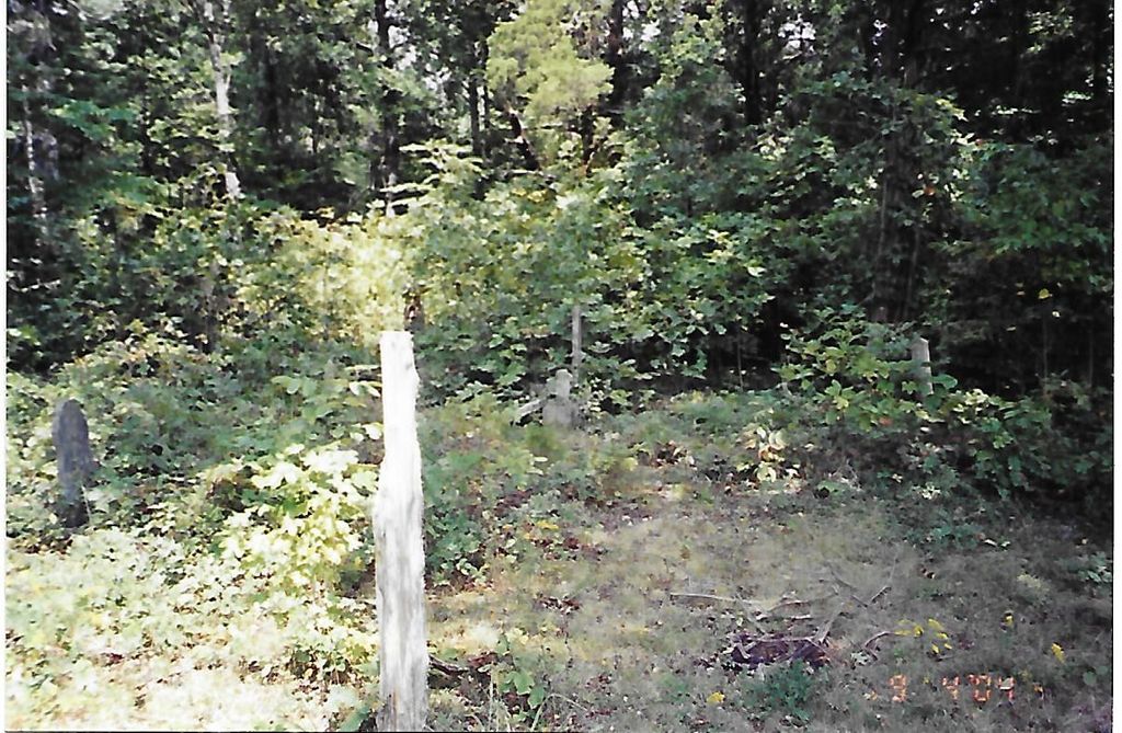
| Description | : | South of HWY 54, from Whitesville turn right onto Collier Road then left and cross Deserter Creek (Daviess-Ohio County line) turn right at next turn. At the fork go right and up the hill to ridge top and follow to a fork, turn left follow to cemetery on the left. (This is a Oil Field Lease Road) Several Unmarked Graves. Info from Ohio County, Kentucky Cemetery Book, taken on January 26, 1974 |
frequently asked questions (FAQ):
-
Where is Hendrix Cemetery?
Hendrix Cemetery is located at Ohio County ,Kentucky ,USA.
-
Hendrix Cemetery cemetery's updated grave count on graveviews.com?
2 memorials
-
Where are the coordinates of the Hendrix Cemetery?
Latitude: 37.6557800
Longitude: -86.8402300
Nearby Cemetories:
1. Howard Family Cemetery
Fordsville, Ohio County, USA
Coordinate: 37.6636900, -86.8398890
2. Hardin Family Cemetery North
Deanefield, Ohio County, USA
Coordinate: 37.6513888, -86.8136110
3. Hardin Cemetery
Deanefield, Ohio County, USA
Coordinate: 37.6450000, -86.8133330
4. Barnetts Knob Cemetery
Whitesville, Daviess County, USA
Coordinate: 37.6753006, -86.8578033
5. Saint Mary of the Woods Cemetery
Whitesville, Daviess County, USA
Coordinate: 37.6605988, -86.8711014
6. Ellis Cemetery
Ohio County, USA
Coordinate: 37.6767006, -86.8191986
7. Cates Cemetery
Whitesville, Daviess County, USA
Coordinate: 37.6819000, -86.8574982
8. Deanefield Cemetery
Deanefield, Ohio County, USA
Coordinate: 37.6611730, -86.8031970
9. Bellamy Cemetery
Ohio County, USA
Coordinate: 37.6397018, -86.8016968
10. Edge Cemetery
Whitesville, Daviess County, USA
Coordinate: 37.6491670, -86.8883330
11. Aetnaville Cemetery
Aetnaville, Ohio County, USA
Coordinate: 37.6780464, -86.7946315
12. Haynesville Cemetery
Ohio County, USA
Coordinate: 37.6797890, -86.7846280
13. Friendship Community Cemetery
Fordsville, Ohio County, USA
Coordinate: 37.6417230, -86.7751100
14. Kelley Cemetery
Ohio County, USA
Coordinate: 37.6241989, -86.7827988
15. Sugar Grove Baptist Church Cemetery
Fordsville, Ohio County, USA
Coordinate: 37.6169100, -86.7896500
16. Passionist Monastery Cemetery
Whitesville, Daviess County, USA
Coordinate: 37.6674350, -86.9092460
17. Antioch Cemetery
Adaburg, Ohio County, USA
Coordinate: 37.5969300, -86.8624600
18. McCarty Cemetery
Ohio County, USA
Coordinate: 37.6246986, -86.7714005
19. Magan Community Cemetery
Magan, Ohio County, USA
Coordinate: 37.6010900, -86.8000600
20. Haynes Cemetery #2
Ohio County, USA
Coordinate: 37.6871986, -86.7703018
21. Adaburg Baptist Church Cemetery
Adaburg, Ohio County, USA
Coordinate: 37.5916800, -86.8524900
22. Panther Creek Baptist Church Cemetery
Whitesville, Daviess County, USA
Coordinate: 37.7180610, -86.8103000
23. Lewis Owen-John Haynes Cemetery
Fordsville, Ohio County, USA
Coordinate: 37.6727050, -86.7554520
24. Ralph Cemetery #2
Magan, Ohio County, USA
Coordinate: 37.5860950, -86.8043520