
| Memorials | : | 2 |
| Location | : | Benton, Holmes County, USA |
| Coordinate | : | 40.6127790, -81.8249750 |
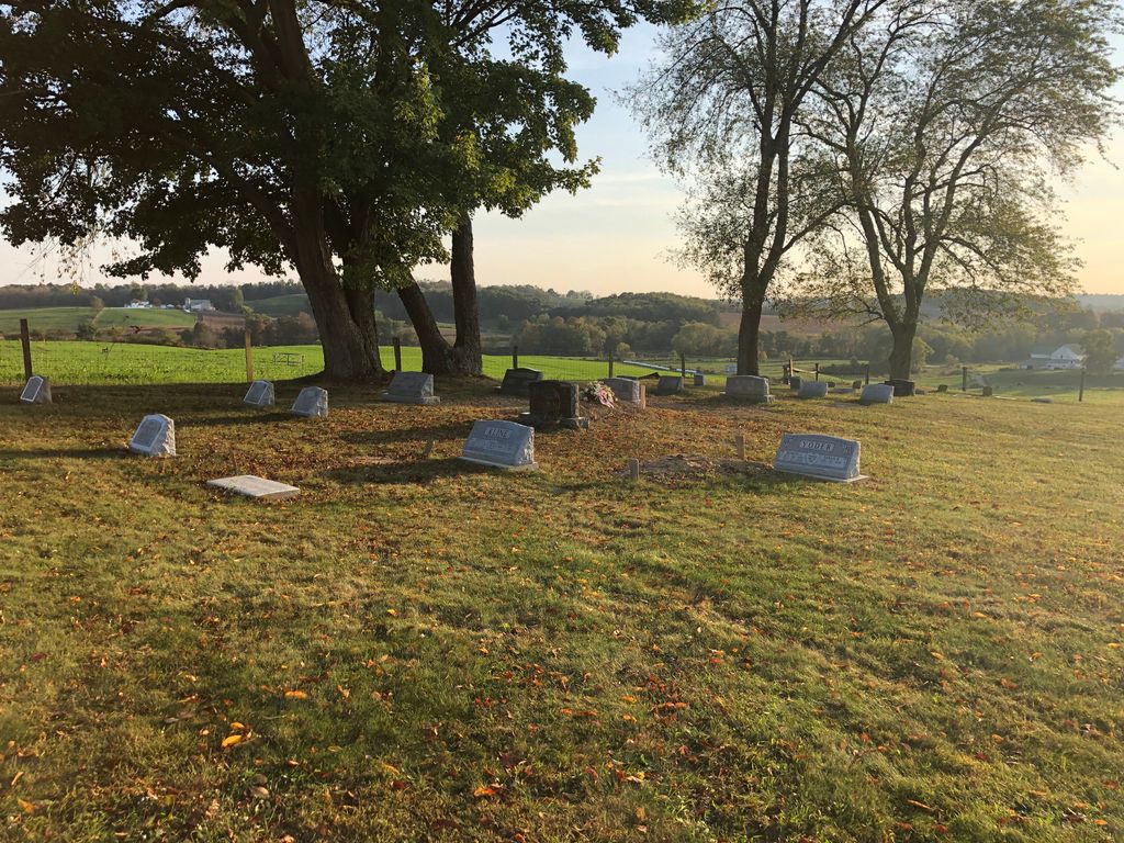
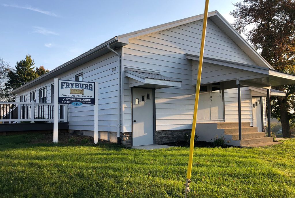
| Description | : | The cemetery is located on the south side of the Fryburg Beachy Fellowship Church on the west side of County Road 201about 280 feet southeast of its intersection with Ohio 241. The cemetery is located in Salt Creek Township, Holmes County, Ohio, and is # 5677 (Fryburg Beachy Church Cemetery) in “Ohio Cemeteries 1803-2003”, compiled by the Ohio Genealogical Society. The cemetery is identified as F-5 (Fryberg Beachy Church Grounds) in “Cemetery Directory of the Amish Community in Eastern Holmes and Adjoining Counties in Ohio" by Leroy Beachy, (c) 1975. |
frequently asked questions (FAQ):
-
Where is Fryburg Beachy Church Cemetery?
Fryburg Beachy Church Cemetery is located at Ohio State Route 241 and County Road 201 Benton, Holmes County ,Ohio , 44654USA.
-
Fryburg Beachy Church Cemetery cemetery's updated grave count on graveviews.com?
2 memorials
-
Where are the coordinates of the Fryburg Beachy Church Cemetery?
Latitude: 40.6127790
Longitude: -81.8249750
Nearby Cemetories:
1. Fryburg Cemetery
Fryburg, Holmes County, USA
Coordinate: 40.6139500, -81.8257240
2. Junior Stutzman Farm Cemetery
Fryburg, Holmes County, USA
Coordinate: 40.6227030, -81.8309190
3. Zion Conservative Mennonite Church Cemetery
Benton, Holmes County, USA
Coordinate: 40.5997440, -81.8372320
4. Arnold Cemetery
Mount Hope, Holmes County, USA
Coordinate: 40.6127777, -81.7997208
5. Drushel Cemetery
Millersburg, Holmes County, USA
Coordinate: 40.6003430, -81.8021060
6. Gospel Haven Church Cemetery
Millersburg, Holmes County, USA
Coordinate: 40.6014380, -81.8500330
7. Wolgamott Cemetery
Holmes County, USA
Coordinate: 40.6341300, -81.8126600
8. Abe J Miller Farm Cemetery
Mount Hope, Holmes County, USA
Coordinate: 40.6179920, -81.7930730
9. Ezra Y Miller Farm Cemetery
Millersburg, Holmes County, USA
Coordinate: 40.6101940, -81.7885540
10. Andy M Keim Farm Cemetery
Mount Hope, Holmes County, USA
Coordinate: 40.6401640, -81.8113370
11. Samuel Hershberger Cemetery
Mount Hope, Holmes County, USA
Coordinate: 40.5959130, -81.8576400
12. Levi Hochstetler Farm Cemetery
Benton, Holmes County, USA
Coordinate: 40.5850182, -81.8442154
13. Noah Troyer Farm Cemetery
Mount Hope, Holmes County, USA
Coordinate: 40.6348950, -81.7954220
14. Hochstetler Cemetery
Mount Hope, Holmes County, USA
Coordinate: 40.6145000, -81.7832000
15. Henry Hersberger Farm Cemetery
Mount Hope, Holmes County, USA
Coordinate: 40.5990270, -81.7869540
16. Daniel J Miller Farm Cemetery #2
Millers Corners, Holmes County, USA
Coordinate: 40.5864760, -81.7976070
17. Albert Miller Farm Cemetery
Berlin, Holmes County, USA
Coordinate: 40.5789800, -81.8218800
18. Canaan Baptist Cemetery
Mount Hope, Holmes County, USA
Coordinate: 40.6461706, -81.8129131
19. Abraham Mast Cemetery
Berlin, Holmes County, USA
Coordinate: 40.5907570, -81.8611370
20. Jacob Mast Farm Cemetery
Mount Hope, Holmes County, USA
Coordinate: 40.6097900, -81.7786620
21. Armstrong Cemetery
Holmes County, USA
Coordinate: 40.6378378, -81.8615273
22. Jonas W Miller Farm Cemetery
Benton, Holmes County, USA
Coordinate: 40.5840640, -81.8588500
23. Daniel J Miller Farm Cemetery
Bunker Hill, Holmes County, USA
Coordinate: 40.5905300, -81.7833390
24. Melvin Miller Farm Cemetery
Bunker Hill, Holmes County, USA
Coordinate: 40.5800420, -81.7944770