
| Memorials | : | 1 |
| Location | : | Millersburg, Holmes County, USA |
| Coordinate | : | 40.6101940, -81.7885540 |
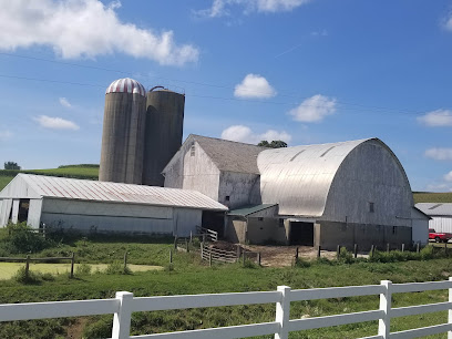
| Description | : | The cemetery is located north of Township Road 628 about 0.6 mile west of its intersection with County Road 77. This Amish cemetery is located in Salt Creek Township, Holmes County, Ohio, and is # 5691 (Ezra Y. Miller Farm Cemetery) in “Ohio Cemeteries 1803-2003”, compiled by the Ohio Genealogical Society. The U.S. Geological Survey (USGS) Geographic Names Information System (GNIS) feature ID for the cemetery is 1961581 (Ezra Y Miller Farm Cemetery). The cemetery is identified as F-11 (Ezra Y. Miller Farm Cemetery) in “Cemetery Directory of the Amish Community in Eastern Holmes and Adjoining Counties in Ohio" by Leroy Beachy, (c)... Read More |
frequently asked questions (FAQ):
-
Where is Ezra Y Miller Farm Cemetery?
Ezra Y Miller Farm Cemetery is located at Township Road 628 Millersburg, Holmes County ,Ohio , 44654USA.
-
Ezra Y Miller Farm Cemetery cemetery's updated grave count on graveviews.com?
1 memorials
-
Where are the coordinates of the Ezra Y Miller Farm Cemetery?
Latitude: 40.6101940
Longitude: -81.7885540
Nearby Cemetories:
1. Hochstetler Cemetery
Mount Hope, Holmes County, USA
Coordinate: 40.6145000, -81.7832000
2. Jacob Mast Farm Cemetery
Mount Hope, Holmes County, USA
Coordinate: 40.6097900, -81.7786620
3. Abe J Miller Farm Cemetery
Mount Hope, Holmes County, USA
Coordinate: 40.6179920, -81.7930730
4. Arnold Cemetery
Mount Hope, Holmes County, USA
Coordinate: 40.6127777, -81.7997208
5. Henry Hersberger Farm Cemetery
Mount Hope, Holmes County, USA
Coordinate: 40.5990270, -81.7869540
6. Drushel Cemetery
Millersburg, Holmes County, USA
Coordinate: 40.6003430, -81.8021060
7. Levi Stutzman Farm Cemetery
Mount Hope, Holmes County, USA
Coordinate: 40.6219870, -81.7712110
8. Daniel J Miller Farm Cemetery
Mount Hope, Holmes County, USA
Coordinate: 40.6042620, -81.7658340
9. Daniel J Miller Farm Cemetery
Bunker Hill, Holmes County, USA
Coordinate: 40.5905300, -81.7833390
10. Raymond J Kline Farm Cemetery #1
Bunker Hill, Holmes County, USA
Coordinate: 40.5901930, -81.7745870
11. Jacob E Miller Farm Cemetery
Bunker Hill, Holmes County, USA
Coordinate: 40.5901500, -81.7745800
12. Daniel J Miller Farm Cemetery #2
Millers Corners, Holmes County, USA
Coordinate: 40.5864760, -81.7976070
13. Noah Troyer Farm Cemetery
Mount Hope, Holmes County, USA
Coordinate: 40.6348950, -81.7954220
14. Raymond J Kline Farm Cemetery #2
Bunker Hill, Holmes County, USA
Coordinate: 40.5865720, -81.7723890
15. Daniel S Hershberger Farm Cemetery
Mount Hope, Holmes County, USA
Coordinate: 40.6300310, -81.7632580
16. Fryburg Beachy Church Cemetery
Benton, Holmes County, USA
Coordinate: 40.6127790, -81.8249750
17. Emanuel Miller Farm Cemetery
Millersburg, Holmes County, USA
Coordinate: 40.5942890, -81.7577250
18. Fryburg Cemetery
Fryburg, Holmes County, USA
Coordinate: 40.6139500, -81.8257240
19. Wolgamott Cemetery
Holmes County, USA
Coordinate: 40.6341300, -81.8126600
20. Melvin Miller Farm Cemetery
Bunker Hill, Holmes County, USA
Coordinate: 40.5800420, -81.7944770
21. Ben M Miller Farm Cemetery
Mount Hope, Holmes County, USA
Coordinate: 40.6335310, -81.7596100
22. Weaver Family Cemetery
Bunker Hill, Holmes County, USA
Coordinate: 40.5823560, -81.7665830
23. Paul Burkholder Farm Cemetery
Bunker Hill, Holmes County, USA
Coordinate: 40.5777140, -81.7926060
24. Melvin J Hershberger Farm Cemetery
Berlin, Holmes County, USA
Coordinate: 40.5760680, -81.7853330