
| Memorials | : | 0 |
| Location | : | Blairsville, Indiana County, USA |
| Coordinate | : | 40.4403580, -79.1130100 |
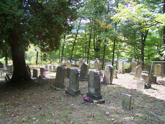
| Description | : | This is an old prototypical, family cemetery, common to Western Pennsylvania. The burials range from the early to mid 1800's to the latest, in 1995, but the majority of them were in the 1800's. This cemetery is located on Bowser Road, West Wheatfield Township, Indiana County, Pennsylvania. It is physically closer to the small villages of Robinson and Bolivar, which are just south of it on Route 259, however, it is, just barely, in the 15717 Zip Code of Blairsville and that is how it is listed, with Findagrave. Driving Directions: From the town of Blairsville, Indiana County, Pennsylvania, at... Read More |
frequently asked questions (FAQ):
-
Where is Gamble Cemetery?
Gamble Cemetery is located at Blairsville, Indiana County ,Pennsylvania , 15717USA.
-
Gamble Cemetery cemetery's updated grave count on graveviews.com?
0 memorials
-
Where are the coordinates of the Gamble Cemetery?
Latitude: 40.4403580
Longitude: -79.1130100

Nearby Cemetories:
1. Germany Lutheran Cemetery
Clyde, Indiana County, USA
Coordinate: 40.4352531, -79.1074829
2. Saint Mary's Cemetery
Indiana County, USA
Coordinate: 40.4343987, -79.1078033
3. Germany United Methodist Church Cemetery
Robinson, Indiana County, USA
Coordinate: 40.4188560, -79.1161660
4. Bethel Cemetery
Clyde, Indiana County, USA
Coordinate: 40.4336014, -79.0686035
5. Bolivar Old Town Cemetery
Bolivar, Westmoreland County, USA
Coordinate: 40.3940000, -79.1540000
6. West View Cemetery
Bolivar, Westmoreland County, USA
Coordinate: 40.3889900, -79.1500600
7. Armagh Old Presbyterian Cemetery
Armagh, Indiana County, USA
Coordinate: 40.4510000, -79.0316000
8. Isabelle Cemetery
Indiana County, USA
Coordinate: 40.3775000, -79.1218000
9. Saint Mary's Church Cemetery
New Florence, Westmoreland County, USA
Coordinate: 40.3817500, -79.0767100
10. Dutch Bethel Evangelical Cemetery
Brush Valley, Indiana County, USA
Coordinate: 40.5019220, -79.0799330
11. Peddicord Cemetery
Luciusboro, Indiana County, USA
Coordinate: 40.5081000, -79.1022000
12. Saint John's Catholic Cemetery
Black Lick, Indiana County, USA
Coordinate: 40.4663920, -79.1959270
13. Legat Cemetery
Westmoreland County, USA
Coordinate: 40.3718987, -79.0950012
14. Armagh Cemetery
Armagh, Indiana County, USA
Coordinate: 40.4528465, -79.0214157
15. Nineveh Cemetery
Indiana County, USA
Coordinate: 40.4208000, -79.0212000
16. Coral Lutheran Cemetery
Indiana, Indiana County, USA
Coordinate: 40.4995000, -79.1776000
17. Saint Francis Cemetery
Graceton, Indiana County, USA
Coordinate: 40.5057000, -79.1723000
18. Tarman Cemetery
Brush Valley Township, Indiana County, USA
Coordinate: 40.4996010, -79.0366900
19. Dias Cemetery
Brush Valley Township, Indiana County, USA
Coordinate: 40.4971900, -79.0327500
20. Matthews Cemetery
Cramer, Indiana County, USA
Coordinate: 40.4316600, -79.0011100
21. Conrad Cemetery
Indiana County, USA
Coordinate: 40.4813995, -79.0130997
22. West Fairfield Cemetery
Fairfield Township, Westmoreland County, USA
Coordinate: 40.3511720, -79.1228810
23. West Fairfield Methodist Episcopal Cemetery
Fairfield Township, Westmoreland County, USA
Coordinate: 40.3495370, -79.1290500
24. Fry Cemetery
Brush Valley, Indiana County, USA
Coordinate: 40.5300940, -79.0829480