
| Memorials | : | 0 |
| Location | : | Black Lick, Indiana County, USA |
| Coordinate | : | 40.4663920, -79.1959270 |
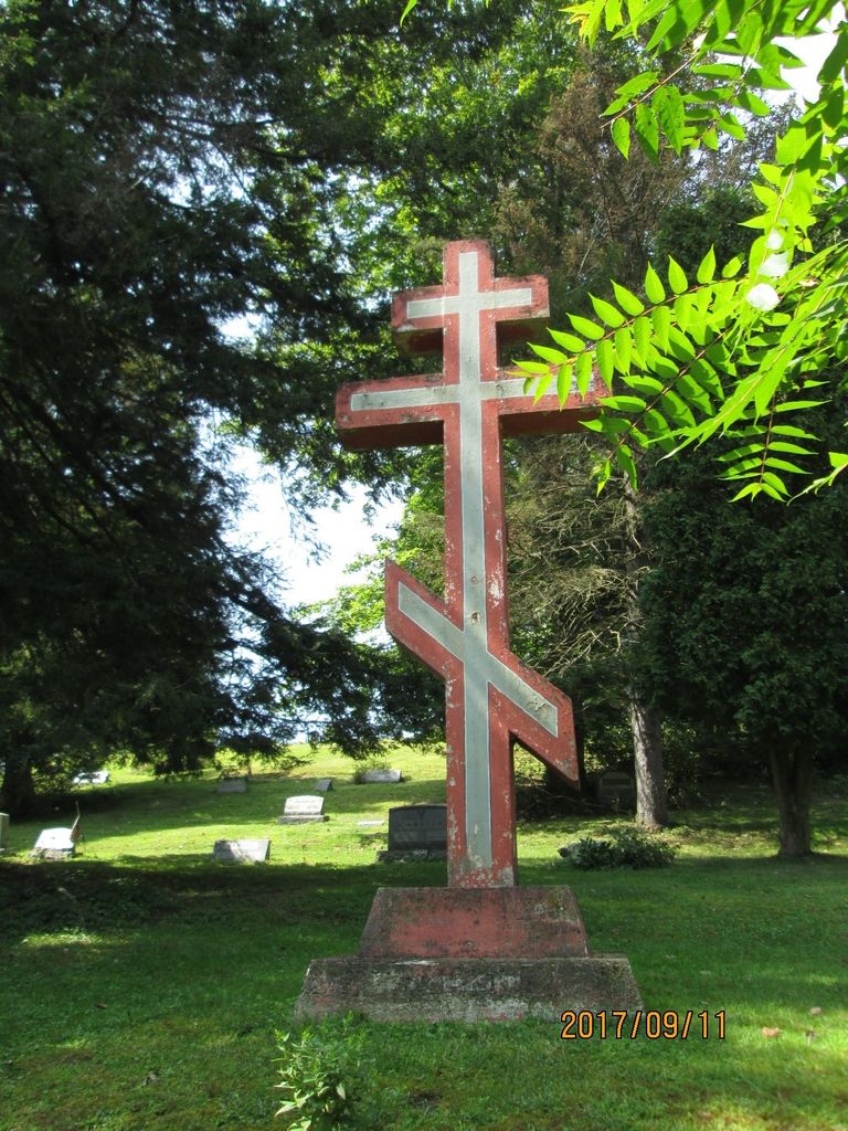
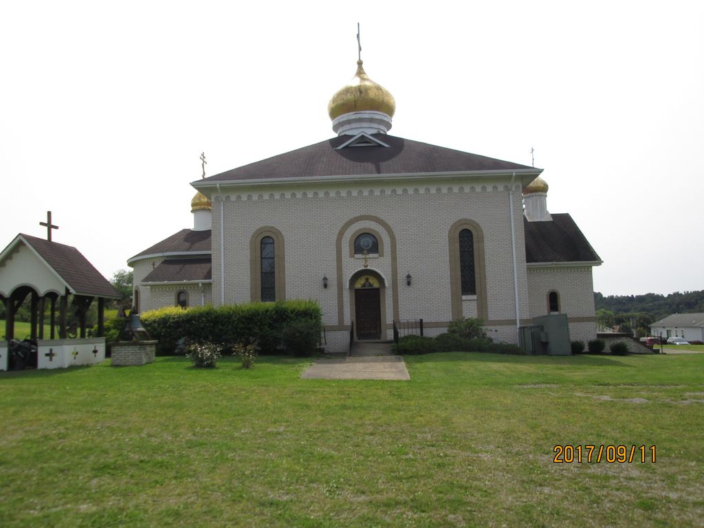
| Description | : | This cemetery may or may not be affiliated with Saint John the Baptist Russian Orthodox Church in Black Lick. St John’s was founded in 1906 as a Greek Catholic parish. The church became officially known as St John the Baptist Greek Catholic Church of Black Lick in 1908. The church was constructed in 1909 with Father Arseny Gavula as the first pastor of St. John's. In 1910 St. John's left their ancestral Greek Catholic Faith and joined the Orthodox Church in America. In 1918 the church cemetery was established in Marshall Heights. Regarding the 3 interments listed: Michael Dornick and his son John's... Read More |
frequently asked questions (FAQ):
-
Where is Saint John's Catholic Cemetery?
Saint John's Catholic Cemetery is located at Marshall Heights Road Black Lick, Indiana County ,Pennsylvania , 15717USA.
-
Saint John's Catholic Cemetery cemetery's updated grave count on graveviews.com?
0 memorials
-
Where are the coordinates of the Saint John's Catholic Cemetery?
Latitude: 40.4663920
Longitude: -79.1959270
Nearby Cemetories:
1. Coral Lutheran Cemetery
Indiana, Indiana County, USA
Coordinate: 40.4995000, -79.1776000
2. Saint Francis Cemetery
Graceton, Indiana County, USA
Coordinate: 40.5057000, -79.1723000
3. Saints Simon and Jude Cemetery
Blairsville, Indiana County, USA
Coordinate: 40.4339470, -79.2512240
4. Blairsville Cemetery
Blairsville, Indiana County, USA
Coordinate: 40.4324989, -79.2536011
5. Kunkle Cemetery
Indiana County, USA
Coordinate: 40.5186005, -79.2228012
6. Hopewell Cemetery
Blairsville, Indiana County, USA
Coordinate: 40.4848000, -79.2667000
7. Old Liberty Street Cemetery
Blairsville, Indiana County, USA
Coordinate: 40.4323910, -79.2672980
8. Gamble Cemetery
Blairsville, Indiana County, USA
Coordinate: 40.4403580, -79.1130100
9. Smathers Cemetery
Center Township, Indiana County, USA
Coordinate: 40.5382996, -79.2031021
10. Germany Lutheran Cemetery
Clyde, Indiana County, USA
Coordinate: 40.4352531, -79.1074829
11. Saint Mary's Cemetery
Indiana County, USA
Coordinate: 40.4343987, -79.1078033
12. Germany United Methodist Church Cemetery
Robinson, Indiana County, USA
Coordinate: 40.4188560, -79.1161660
13. Bolivar Old Town Cemetery
Bolivar, Westmoreland County, USA
Coordinate: 40.3940000, -79.1540000
14. Homer City Cemetery
Homer City, Indiana County, USA
Coordinate: 40.5423000, -79.1640000
15. Peddicord Cemetery
Luciusboro, Indiana County, USA
Coordinate: 40.5081000, -79.1022000
16. West View Cemetery
Bolivar, Westmoreland County, USA
Coordinate: 40.3889900, -79.1500600
17. Bethel Presbyterian Church Cemetery
Indiana, Indiana County, USA
Coordinate: 40.5531000, -79.2417000
18. Fairview McIntire Cemetery
Jacksonville, Indiana County, USA
Coordinate: 40.5402985, -79.2733002
19. Dutch Bethel Evangelical Cemetery
Brush Valley, Indiana County, USA
Coordinate: 40.5019220, -79.0799330
20. Saint Louis Roman Catholic Cemetery
Lucerne Mines, Indiana County, USA
Coordinate: 40.5576000, -79.1570000
21. Jacksonville United Presbyterian Church Cemetery
Indiana County, USA
Coordinate: 40.5423000, -79.2834000
22. Bethel Cemetery
Clyde, Indiana County, USA
Coordinate: 40.4336014, -79.0686035
23. Ebenezer Cemetery
Lewisville, Indiana County, USA
Coordinate: 40.5087000, -79.3203000
24. Livermore Cemetery
Derry, Westmoreland County, USA
Coordinate: 40.4573030, -79.3322640