
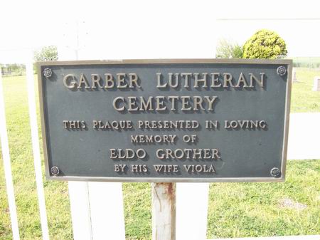
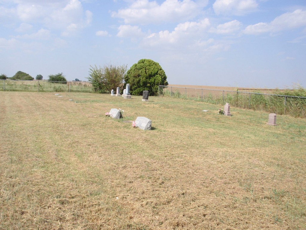
| Memorials | : | 0 |
| Location | : | Garber, Garfield County, USA |
| Coordinate | : | 36.4050160, -97.5954370 |
| Description | : | Located in Lincoln Township, Section 2, Range 22 North, 4 West. Two miles south of Garber on Hiway 74/15, or 1/2 mile north of Hiway 412, then 1/2 mile west on County Road E0420, on the north side of the road. |
frequently asked questions (FAQ):
-
Where is Garber Lutheran Cemetery?
Garber Lutheran Cemetery is located at Garber, Garfield County ,Oklahoma ,USA.
-
Garber Lutheran Cemetery cemetery's updated grave count on graveviews.com?
0 memorials
-
Where are the coordinates of the Garber Lutheran Cemetery?
Latitude: 36.4050160
Longitude: -97.5954370
Nearby Cemetories:
1. Garber Cemetery
Garber, Garfield County, USA
Coordinate: 36.4419200, -97.5686700
2. Saint Johns Lutheran Cemetery
Covington, Garfield County, USA
Coordinate: 36.3391991, -97.5496979
3. Black Bear Cemetery
Garfield County, USA
Coordinate: 36.3763885, -97.5058365
4. Paradise Cemetery
Breckinridge, Garfield County, USA
Coordinate: 36.4336014, -97.7018967
5. Collett Cemetery
Fairmont, Garfield County, USA
Coordinate: 36.3683014, -97.7102966
6. Covington Cemetery
Covington, Garfield County, USA
Coordinate: 36.2966900, -97.5871400
7. Zion Lutheran Cemetery
Fairmont, Garfield County, USA
Coordinate: 36.3749400, -97.7297400
8. Sample Cemetery
Covington, Garfield County, USA
Coordinate: 36.3181000, -97.4788971
9. Breckinridge Lutheran Cemetery
Breckinridge, Garfield County, USA
Coordinate: 36.4632988, -97.7474976
10. Hayward Cemetery
Hayward, Garfield County, USA
Coordinate: 36.2753400, -97.5244100
11. Heitholt Memorial Cemetery
Garfield County, USA
Coordinate: 36.5353012, -97.5156021
12. Polo Cemetery
Noble County, USA
Coordinate: 36.3755989, -97.4163971
13. Douglas Union Cemetery
Douglas, Garfield County, USA
Coordinate: 36.2600365, -97.6592178
14. Chisholm Trail Burial Park
Enid, Garfield County, USA
Coordinate: 36.4632500, -97.7921900
15. Bethel Cemetery
Garfield County, USA
Coordinate: 36.2313995, -97.5867004
16. Billings Union Cemetery
Billings, Noble County, USA
Coordinate: 36.5056000, -97.4163971
17. Bethany Cemetery
Enid, Garfield County, USA
Coordinate: 36.3619003, -97.8097000
18. White Cemetery
Hunter, Garfield County, USA
Coordinate: 36.5788994, -97.6660995
19. Billings Catholic Cemetery
Billings, Noble County, USA
Coordinate: 36.5347700, -97.4348400
20. McGuire Cemetery
Lucien, Noble County, USA
Coordinate: 36.2799988, -97.4255981
21. Enid State School Cemetery
Enid, Garfield County, USA
Coordinate: 36.4326900, -97.8370800
22. Mount Carmel Cemetery
Perry, Noble County, USA
Coordinate: 36.3907500, -97.3362100
23. Pioneer Cemetery
Garfield County, USA
Coordinate: 36.2247400, -97.4609600
24. Mount Vernon Cemetery
Lamont, Grant County, USA
Coordinate: 36.6082993, -97.5167007