
| Memorials | : | 3 |
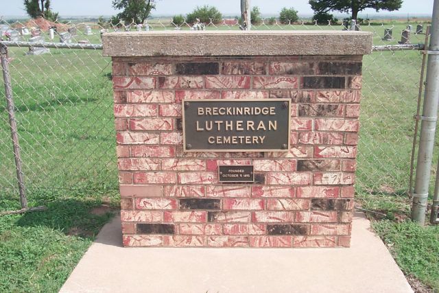
| Location | : | Breckinridge, Garfield County, USA |
| Coordinate | : | 36.4632988, -97.7474976 |
frequently asked questions (FAQ):
-
Where is Breckinridge Lutheran Cemetery?
Breckinridge Lutheran Cemetery is located at Breckinridge, Garfield County ,Oklahoma ,USA.
-
Breckinridge Lutheran Cemetery cemetery's updated grave count on graveviews.com?
3 memorials
-
Where are the coordinates of the Breckinridge Lutheran Cemetery?
Latitude: 36.4632988
Longitude: -97.7474976
Nearby Cemetories:
1. Chisholm Trail Burial Park
Enid, Garfield County, USA
Coordinate: 36.4632500, -97.7921900
2. Paradise Cemetery
Breckinridge, Garfield County, USA
Coordinate: 36.4336014, -97.7018967
3. Enid State School Cemetery
Enid, Garfield County, USA
Coordinate: 36.4326900, -97.8370800
4. Zion Lutheran Cemetery
Fairmont, Garfield County, USA
Coordinate: 36.3749400, -97.7297400
5. Mennonite Brethren Cemetery
Enid, Garfield County, USA
Coordinate: 36.4637900, -97.8605300
6. Memorial Park Cemetery
Enid, Garfield County, USA
Coordinate: 36.4585991, -97.8685989
7. Collett Cemetery
Fairmont, Garfield County, USA
Coordinate: 36.3683014, -97.7102966
8. Kremlin Cemetery
Kremlin, Garfield County, USA
Coordinate: 36.5494003, -97.8131027
9. Bethany Cemetery
Enid, Garfield County, USA
Coordinate: 36.3619003, -97.8097000
10. Calvary Catholic Cemetery
Enid, Garfield County, USA
Coordinate: 36.4200900, -97.8789800
11. Enid Cemetery
Enid, Garfield County, USA
Coordinate: 36.4199295, -97.8803329
12. First United Methodist Church Columbarium
Enid, Garfield County, USA
Coordinate: 36.3976370, -97.8837560
13. Saint Matthews Episcopal Church Columbarium
Enid, Garfield County, USA
Coordinate: 36.3980590, -97.8847090
14. White Cemetery
Hunter, Garfield County, USA
Coordinate: 36.5788994, -97.6660995
15. Garber Lutheran Cemetery
Garber, Garfield County, USA
Coordinate: 36.4050160, -97.5954370
16. Garber Cemetery
Garber, Garfield County, USA
Coordinate: 36.4419200, -97.5686700
17. Banner Hill Cemetery
Garfield County, USA
Coordinate: 36.4627500, -97.9425300
18. Valley Center Cemetery
Pond Creek, Grant County, USA
Coordinate: 36.6081009, -97.8281021
19. Greenwood Cemetery
Pond Creek, Grant County, USA
Coordinate: 36.6366600, -97.7054000
20. Mount Pleasant Cemetery
Salt Fork, Grant County, USA
Coordinate: 36.6217003, -97.6333008
21. Pond Creek Cemetery
Pond Creek, Grant County, USA
Coordinate: 36.6521988, -97.7936020
22. Hackberry Cemetery
Garfield County, USA
Coordinate: 36.2822500, -97.8362700
23. Heitholt Memorial Cemetery
Garfield County, USA
Coordinate: 36.5353012, -97.5156021
24. Saint Johns Lutheran Cemetery
Covington, Garfield County, USA
Coordinate: 36.3391991, -97.5496979